
The Oil Regions of Pennsylvania and Western Virginia
$250.00
Fuelling America’s reconstruction following the Civil War.
1 in stock
Description
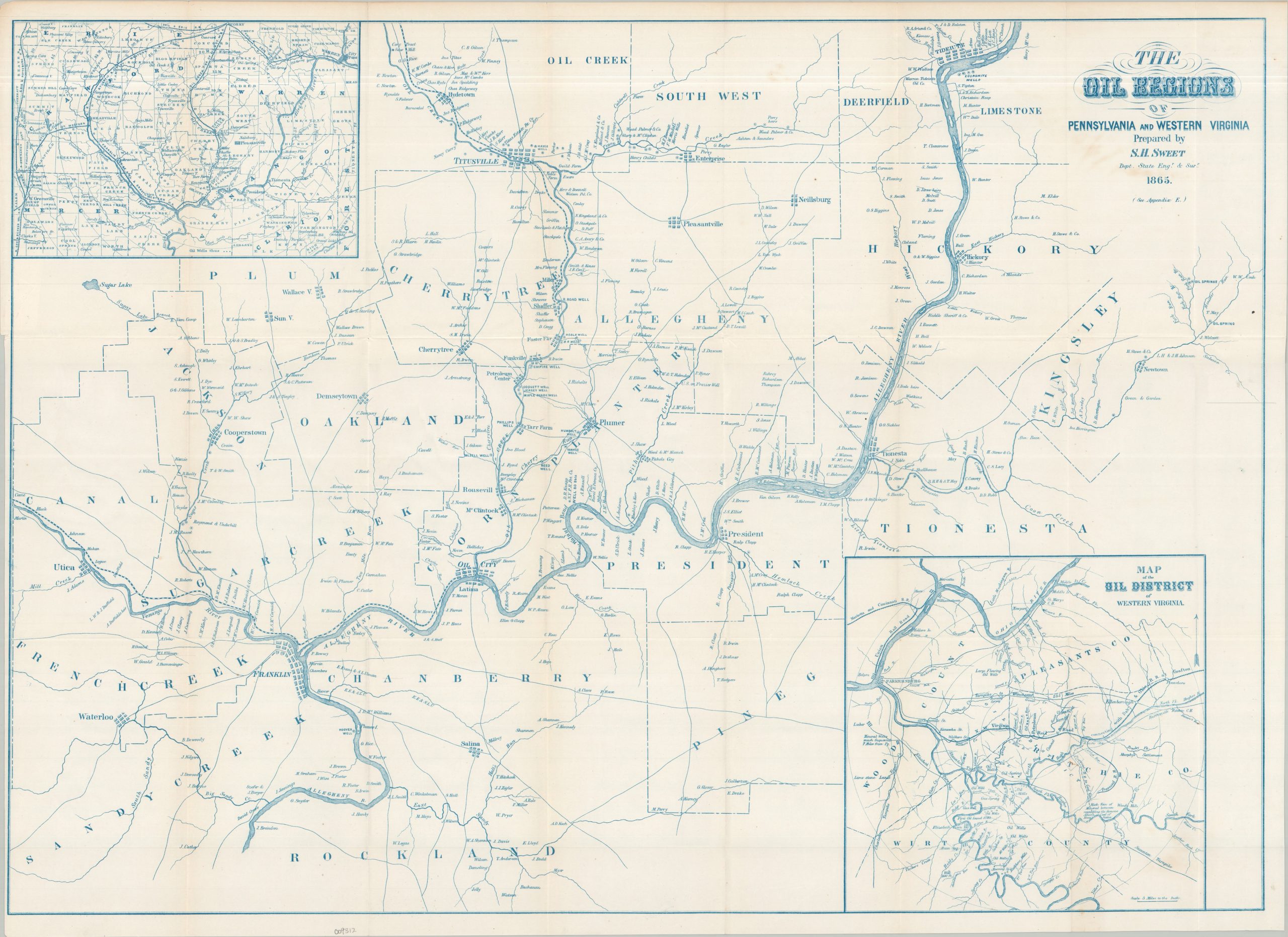
This uncommon 19th-century map focuses on the rapidly developing oil region along the Allegheny River in western Pennsylvania. Boom towns such as Oil City and Titusville, often regarded as the birthplace of the modern American petroleum industry, are among the numerous settlements labeled throughout, connected by a handful of railroad lines and a rudimentary network of wagon roads. Dozens of property owners are identified, providing a detailed record of land ownership in the heart of Pennsylvania’s emerging oil district. The region’s waterways are also carefully depicted and named, reflecting their importance for transportation, industry, and access to the developing oil fields.
An inset in the lower right shows the Oil District of West Virginia, centered east of Parkersburg. A smaller-scale regional map in the upper left provides a broader view of western Pennsylvania, outlining the developing railroad network and locating numerous oil wells, most of which are also represented on the primary map.
The map was prepared by Sylvanus Howe Sweet (1830–1899), Deputy State Engineer and Surveyor of New York. Designated Appendix E, it was published in 1865 as part of a larger report compiled by Sweet concerning the coal and petroleum resources of Pennsylvania. Issued only a few years after the Drake well at Titusville inaugurated the modern petroleum boom, the map provides an unusually detailed contemporary view of one of the earliest major oil-producing regions in the United States.
Map Details
Publication Date: 1865
Author: S.H. Sweet
Sheet Width (in): 31.00
Sheet Height (in): 22.30
Condition: A-
Condition Description: Cyanotyped map on a bright folded sheet. Light foxing around the title block and a narrow left margin. Small holes at fold joints. Very good condition overall.
$250.00
1 in stock