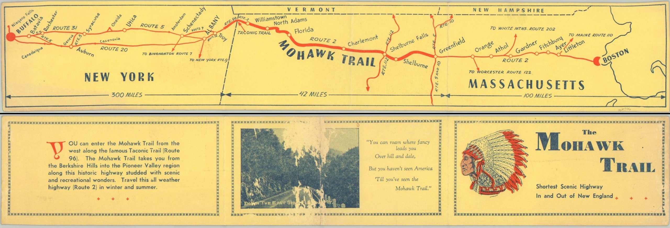
The Mohawk Trail [Title on Verso]
$75.00
Strip map of ‘The Mohawk Trail’.
1 in stock
Description
“You can roam where fancy leads you over hill and dale, but you haven’t seen America ‘Till you’ve seen the Mohawk Trail” [poem, verso]
This neat little folding map highlights the route of ‘The Mohawk Trail’ between Troy, New York and Greenfield, Massachusetts. It’s shown as part of a broader system of paved highways connecting Buffalo to Boston and offering ‘The Shortest Scenic Highway In and Out of New England’, at least according to text on the verso.
The image is heavily obscured, with the 42-mile segment in the center occupying as much space as the 300 miles and 100 miles depicted on either side. The actual origin of the highway began as a Native American trading path, connecting the Hudson and Mohawk River Valleys in New York to the Deerfield and Connecticut River Valleys in Massachusetts. It gradually developed into a tourist attraction following Route 2 and 2A and remains one of the most beautiful drives in Massachusetts today, much of it surrounded by protected forest.
Source: National Park Service
Map Details
Publication Date: c. 1930s?
Author: Anonymous
Sheet Width (in): 17.9
Sheet Height (in): 3
Condition: A-
Condition Description: Creasing along originally issued fold lines and one extraneous line in the center. A bit of offset ink visible on the left side. Abrasion on the verso obscures some text, but does not affect the map. Good to very good overall.
$75.00
1 in stock


