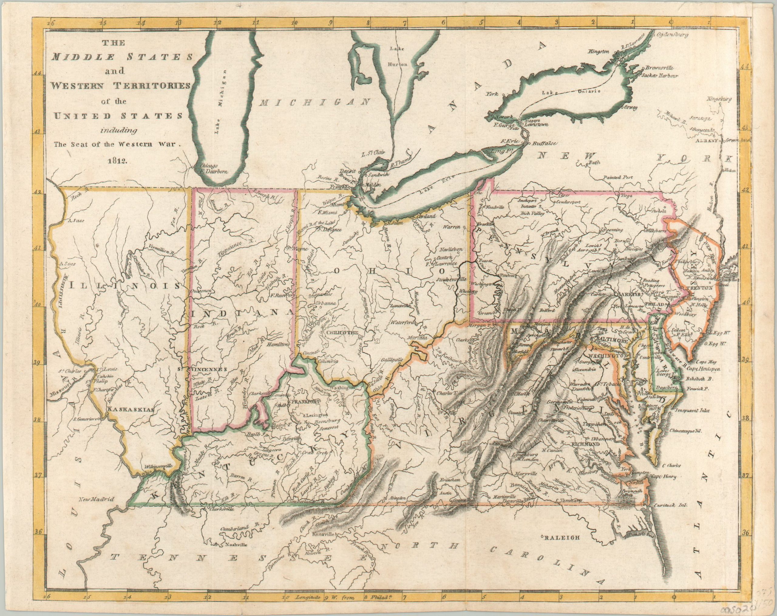
The Middle States and Western Territories of the United States Exhibiting the Seat of the Western War
Interesting map of the northern theater of the War of 1812.
Out of stock
Description
This important early 19th-century map covers a large area across today’s Midwestern and Mid-Atlantic regions. Around the time of publication, it comprised the northern theater of the ongoing conflict with Britain that would later become known as the War of 1812.
The image shows a fascinating outline of the territory between the Chesapeake Bay and the Mississippi River; presenting important fortifications, Native American villages, towns of various sizes (including territorial capitals at Kaskaskia, Chillicothe, and Vincennes), and prominent geographic features. Numerous such locations like Niagara, Frenchtown, and Fort Dearborn would host prominent battles of the war (or massacres, in the case of the last example). Both Indiana and Illinois reflect outdated northern borders that will subsequently be modified to obtain access to Lake Michigan.
The map was designed by the influential American cartographer Matthew Carey and published with Benjamin Warner in Philadelphia as part of the pair’s General Atlas, probably around 1814.
Source: David Rumsey Map Collection
Map Details
Publication Date: c. 1814
Author: Matthew Carey
Sheet Width (in): 10.3
Sheet Height (in): 8.1
Condition: B+
Condition Description: Light soiling visible along the bottom of the sheet and the upper right margin has been professionally refilled with period-correct paper. A bit of faint creasing along originally issued fold lines and the impression is somewhat lightened in the upper right. Good to very good condition, with attractive outline color.
Out of stock