The Kanawha and Michigan Ry Plan Showing Yard Layout of Dickinson, West Virginia
$875.00
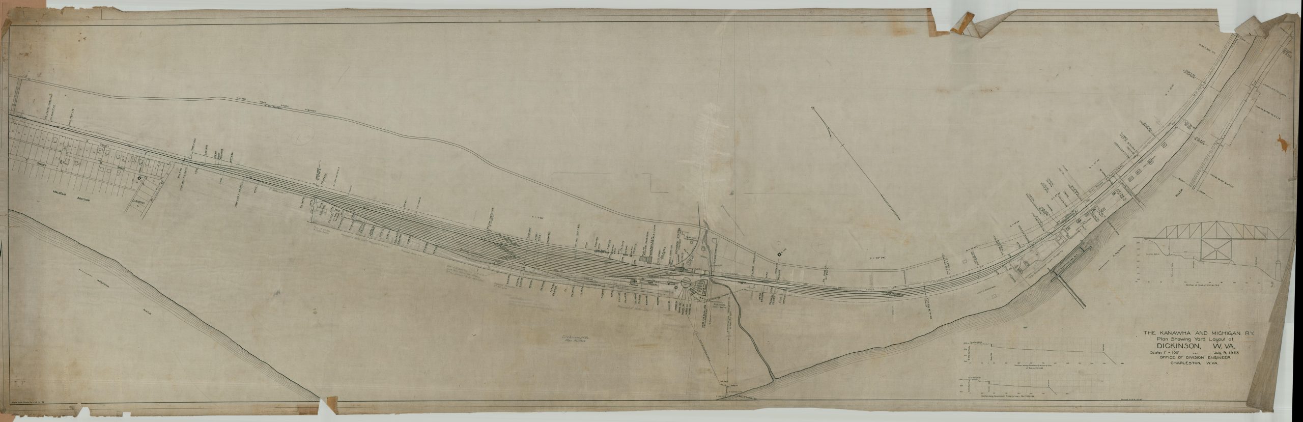
Rare Depression-era plan of the main yard of the Kanawha and Michigan Railroad.
1 in stock
Description
This massive, large-scale plan, almost ten feet long, was originally created in 1923 by the Office of the Division Engineer of the Kanawha and Michigan Railroad (then a subsidiary of the New York Central), with updates reflecting local changes as of 1932. The emphasis is on the primary rail yard and related infrastructure located in the unincorporated community of Dickinson, West Virginia, though the subtext reflects the company-town style of economic subjugation that plagued the region (heavily dependent on the coal industry) in the late 19th and early 20th century.
The map shows the area adjacent to the railway between a residential subdivision (the Malcom Addition) and the Chelyan Bridge, with the Kanawha River meandering along the bottom of the sheet. The Dickinson homestead (the original inhabitants for which the area was named) is labeled across from Dickinson Station, the heart of operations. Nearby are numerous sidetracks, the railroad turntable, worker bunkhouses, a lunch room, and several workshops. An expanding suburban area is depicted to the east, while U.S. Government Lock Property is carefully outlined to the west. The Midland Trail State Highway largely parallels the tracks. An inset diagram shows a cross-section of the steel-truss Chelyan Bridge.
Map Details
Publication Date: 1932
Author: New York Central Office of Division Engineer
Sheet Width (in): 112.00
Sheet Height (in): 33.50
Condition: B
Condition Description: Massive manuscript plan on linen paper, drawn in black ink with penciled annotations. Heavy marginal wear, including numerous closed tears that have toned from old tape (replaced with archival material). Scattered soiling visible in several areas, but the image remains intact and legible.
$875.00
1 in stock