The Evergreen Playground
$425.00
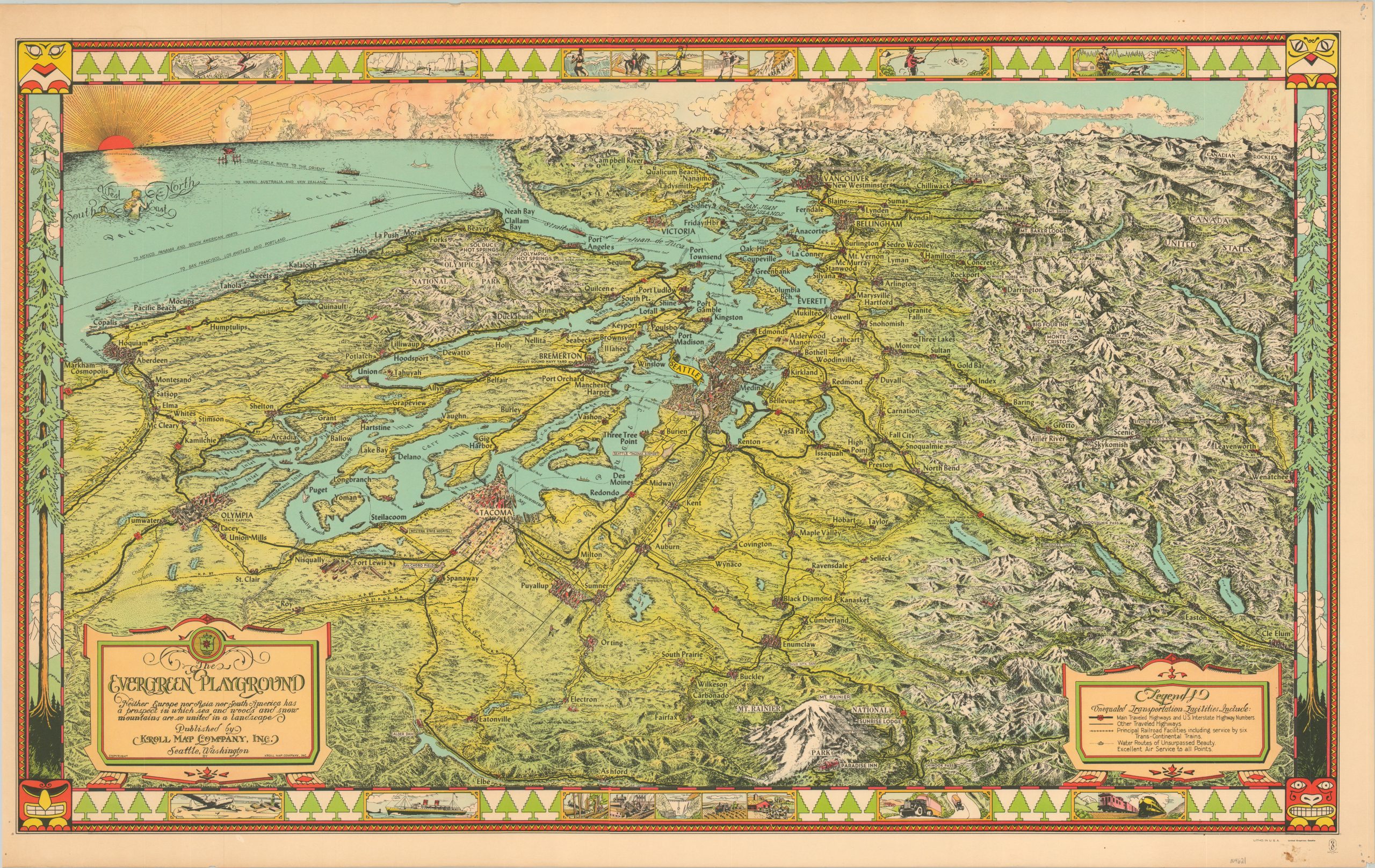
Verdant pictorial overview of the Evergreen Playground in northwest Washington.
1 in stock
Description
This is a spectacular look at the area immediately surrounding Puget Sound, from Vancouver in the north to Mt. Rainier in the south. The image is centered on Seattle, and extensive attention is paid to the depiction of topographic details and the local terrain. The oblique-angle bird’s eye view provides a sweeping perspective of the region, noting the robust network of transportation routes (land and water) connecting towns of all sizes. An attractive decorative border depicts scenes of natural beauty, recreational opportunities, and industrial development.
The image was first drawn around 1930 by Ed Poland of the Kroll Map Company. Headquartered in Seattle, the map was produced to promote tourism and commerce in the area, and advertises “Excellent Air Service,” “Water Routes of Unsurpassed Beauty” and “Service by Trans-Continental Trains.”
This later edition can be dated to around 1945 from the updated border. The earlier edition shows a single-engine plane, while this version displays the massive B-29 Superfortress, which was put into service by the Boeing Corporation (also a Seattle Company) in 1944.
Source: Rumsey Map Center
Map Details
Publication Date: 1945
Author: Kroll Map Company
Sheet Width (in): 33.4
Sheet Height (in): 20.6
Condition: A-
Condition Description: The image is lightly toned and faded, most evident around the outer edges, which also show some minor wear. A small chip is confined to the left margin and there is a bit of soiling in the lower right (again, confined to the margin). Very good overall.
$425.00
1 in stock

