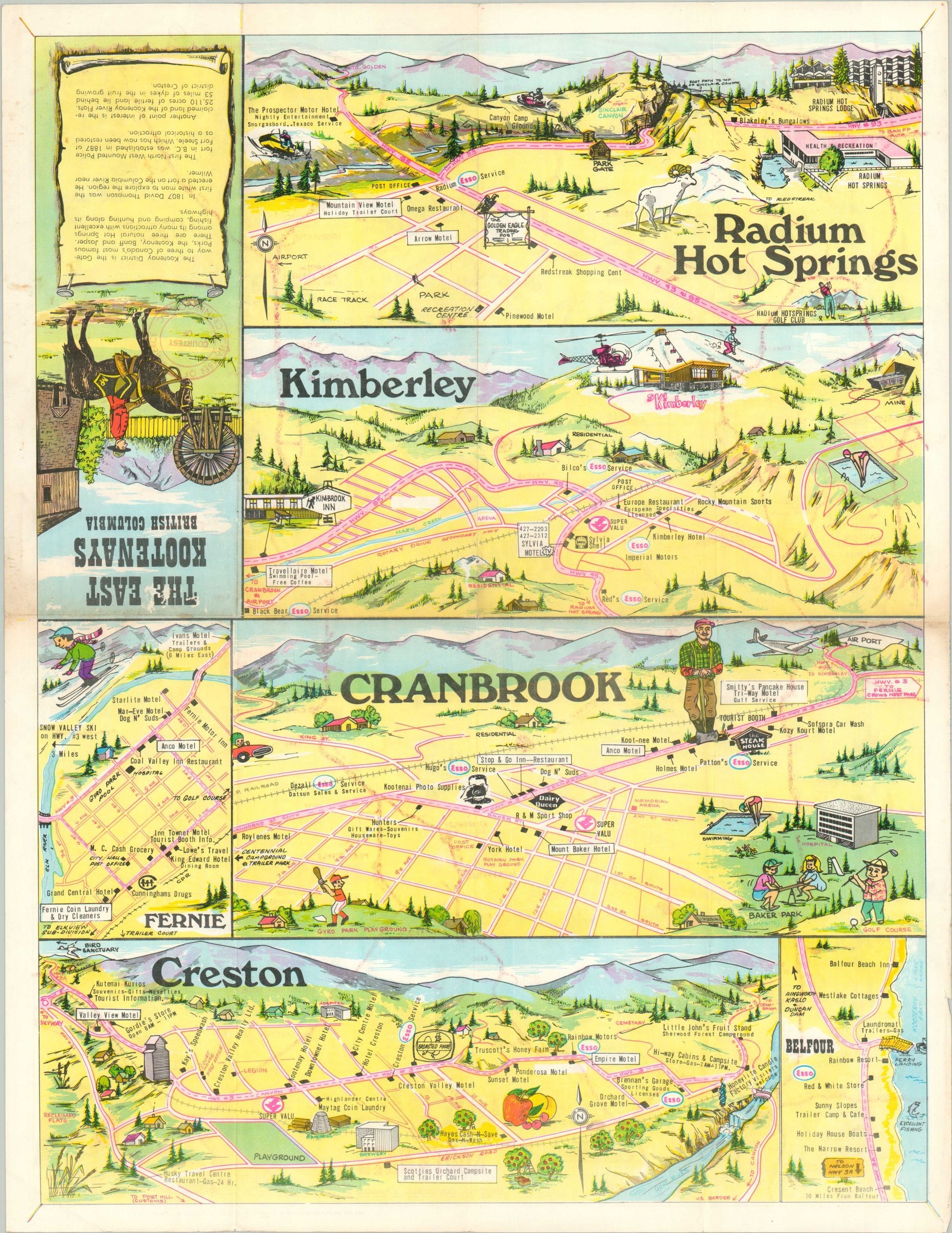
The East Kootenays British Columbia [Title on Verso]
$75.00
“The Gateway to Three of Canda’s Most Famous Parks” – text, verso.
1 in stock
Description
This vibrant traveler’s map shows a stylized overview of the Eastern Kootenays in British Columbia. Originally developed by the mining, logging, and railroading industries, the region became a popular tourist destination in the 20th century.
Motorists were a primary audience during the 1960s – the highways are colored brightly in red and Esso service stations are featured prominently throughout. An inset map in the lower right shows the road connections across western Canada, including the newly constructed Trans-Canada Highway.
Charming vignettes showcase local accommodations, recreational opportunities, geographic features, and abundant wildlife. Other points of interest and businesses are labeled. The verso shows illustrated bird’s eye views of several resort towns in the East Kootenays; Radium Hot Springs, Kimberley, Cranbrook, Creston, Belfour, and Furnie.
Produced and printed in Kamloops, B.C. by Pictorial Advertising, a division of ArtLite. Distributed by the Cranbrook Chamber of Commerce, according to a rubberstamp on the front panel.
Map Details
Publication Date: c. 1965
Author: ArtLite
Sheet Width (in): 17
Sheet Height (in): 22
Condition: B+
Condition Description: Moderate creasing and some light discoloration along originally issued fold lines. Creased corners and a few small edge tears. Good to very good overall.
$75.00
1 in stock


