The Chicago Daily News Official 1921 Auto Trails Map Special Illinois Western Indiana
$495.00
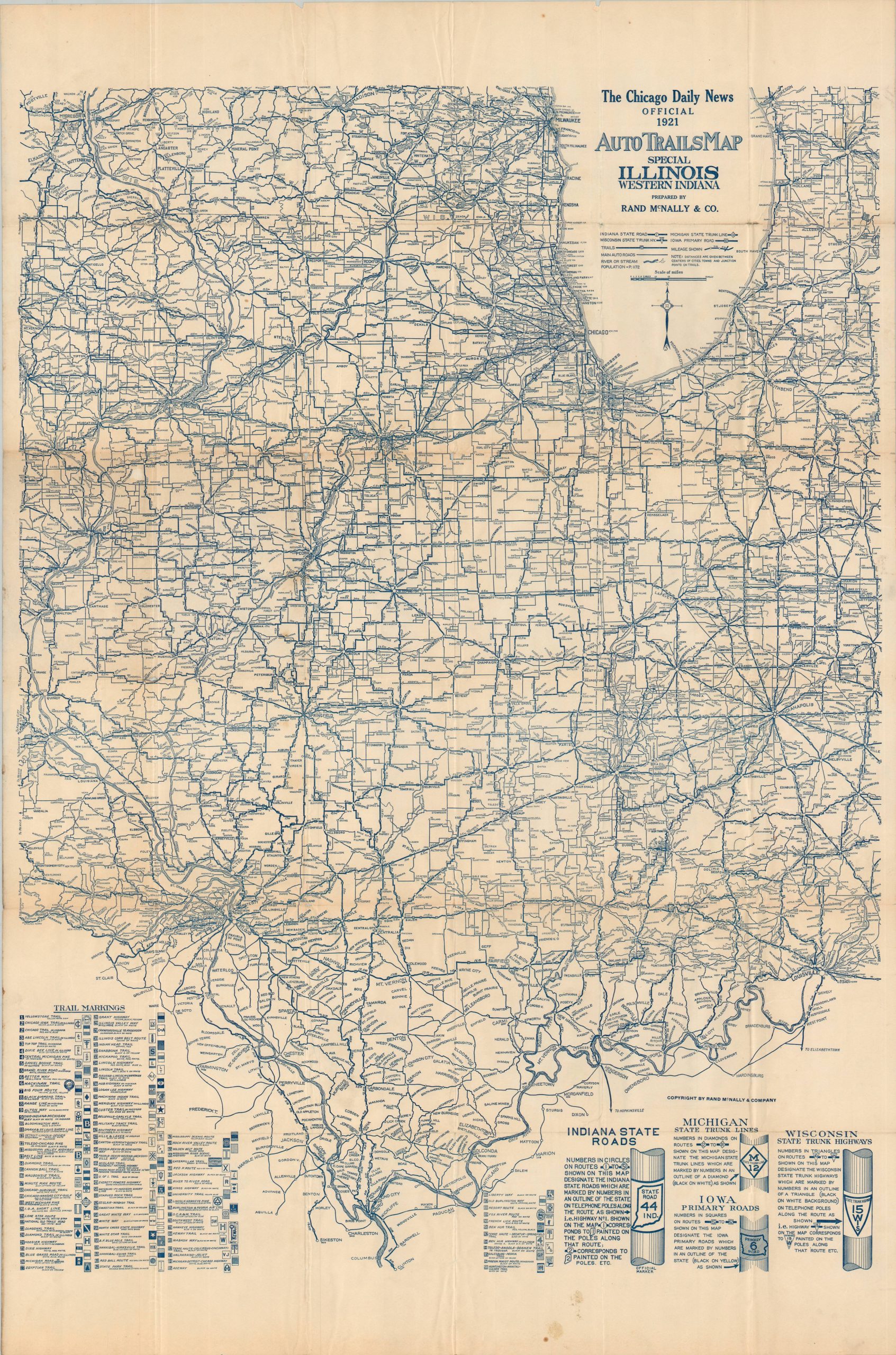
Rare road map highlighting a national shift in route marking.
1 in stock
Description
This large folding road map was prepared by Chicago-based Rand McNally & Company in 1921 for distribution by the Chicago Daily News. The ‘Special’ designation (possibly to cover maximum readership for the paper) includes all of Illinois, much of Indiana, and parts of Michigan, Wisconsin, Missouri, Iowa, and Kentucky. The somewhat convoluted network of blue lines and text is deciphered through the legend below the title.
Numbered highways/state roads/trunk lines are shown for four states, while Illinois is covered by a series of numbered, marked trails. This seems odd, given that the first numbered state bond issue routes were introduced in 1918. For these primary roads, distances between points are noted in most cases. Other ‘Main Auto Roads’ are shown with thinner lines – distances and surface conditions are left to the best estimates of the audience.
A wealth of additional information is provided through captioned illustrations near the bottom of the page. These outline the different signage methodologies used to mark specific routes before the implementation of the United States Numbered Highway System in 1926. The scores of trails listed in the lower left were generally maintained by private organizations, business associations, tourist agencies, etc. One can only imagine how crowded with road signs some of those utility poles must have been!
The map is rare and seldom seen on the market or in institutional collections. As of August 2026, WorldCat notes only one example, with the Rand McNally corporate archive at Chicago’s Newberry Library. A similar piece, sponsored by the Illinois State Automobile Association, can be found at the Illinois State Library.
Sources: OCLC# 919465399, U.S. Department of Transportation, Digital Research Library of Illinois History
Map Details
Publication Date: 1921
Author: Rand McNally
Sheet Width (in): 27.25
Sheet Height (in): 41.75
Condition: B+
Condition Description: Large single-sided map, folded into 30 segments and disbound from original covers (not present). Sharp creasing and moderate wear along folds, including several irregular tears (repaired on verso) and clean splits (with no image loss), some light toning, and wrinkling. Scattered soiling and foxing visible in the upper and lower margins (see scan). Good condition overall. Blank on verso.
$495.00
1 in stock