The Blue Ridge Parkway in Western North Carolina
$165.00
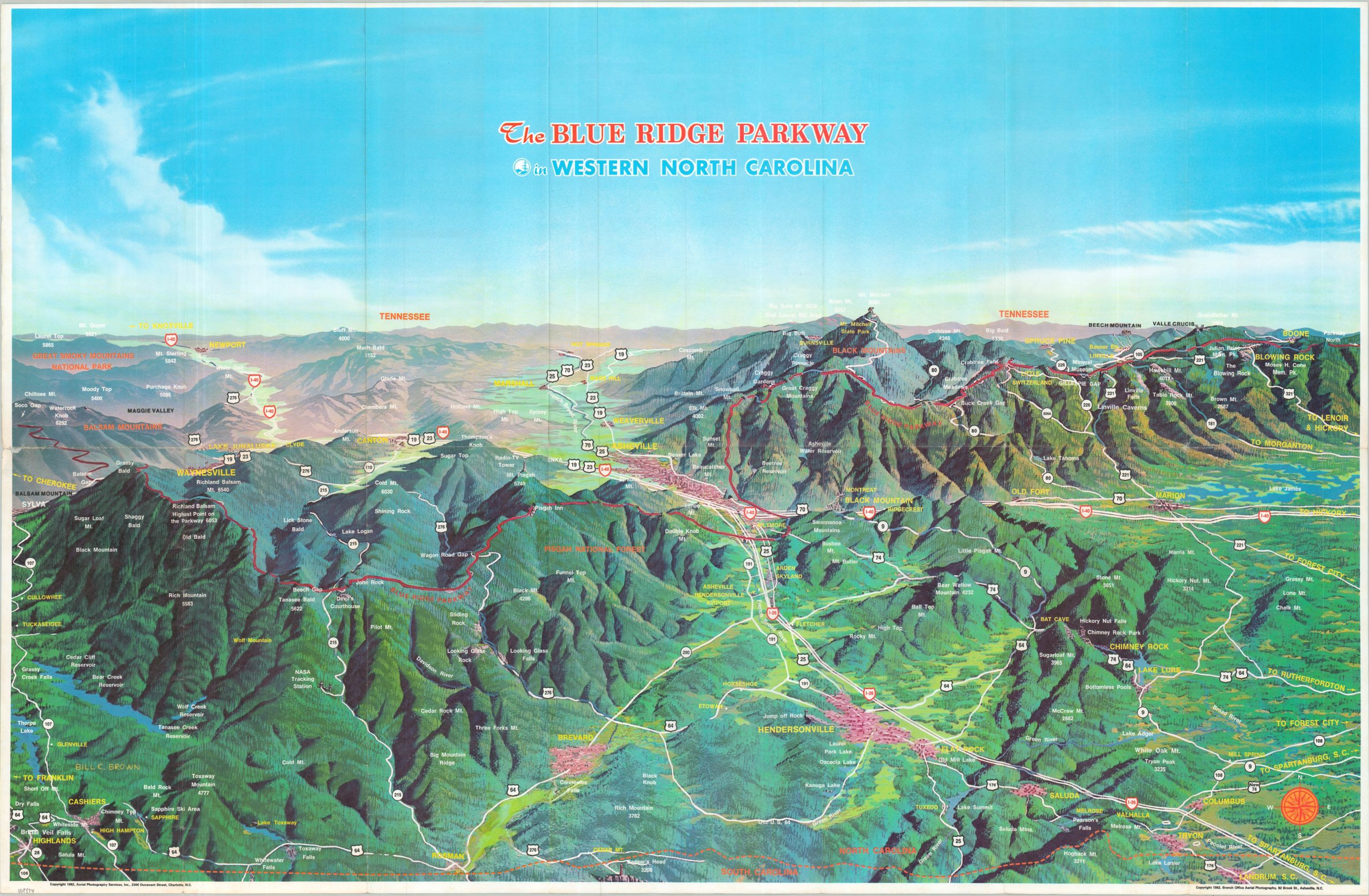
A scenic wonderland in Western North Carolina.
1 in stock
Description
This striking bird’s-eye view of the Blue Ridge Mountains was copyrighted in 1982 by Aerial Photography Services, Inc. Asheville, North Carolina is nestled cozily in the center of the verdant image, which is cross-crossed by I-40 and I-26. Numerous towns, mountain peaks, and locations of interest are labeled throughout.
The scenic Blue Ridge Parkway is highlighted in bright red, running near the crest of the range between Boone and the Great Smoky Mountains National Park. A more practical road map of the entire National Parkway can be found on the verso, along with numerous advertisements for local businesses.
Map Details
Publication Date: 1982
Author: Aerial Photography Services, Inc.
Sheet Width (in): 33.60
Sheet Height (in): 21.90
Condition: A-
Condition Description: Double-sided map brochure with minor wear along original folds. A small 1" tear in the center left has been repaired on the verso. Very good condition overall.
$165.00
1 in stock