Tennessee Valley Region
$165.00
“The work of TVA will never be done until the work of our country is done.” – John F. Kennedy, Jr.
1 in stock
Description
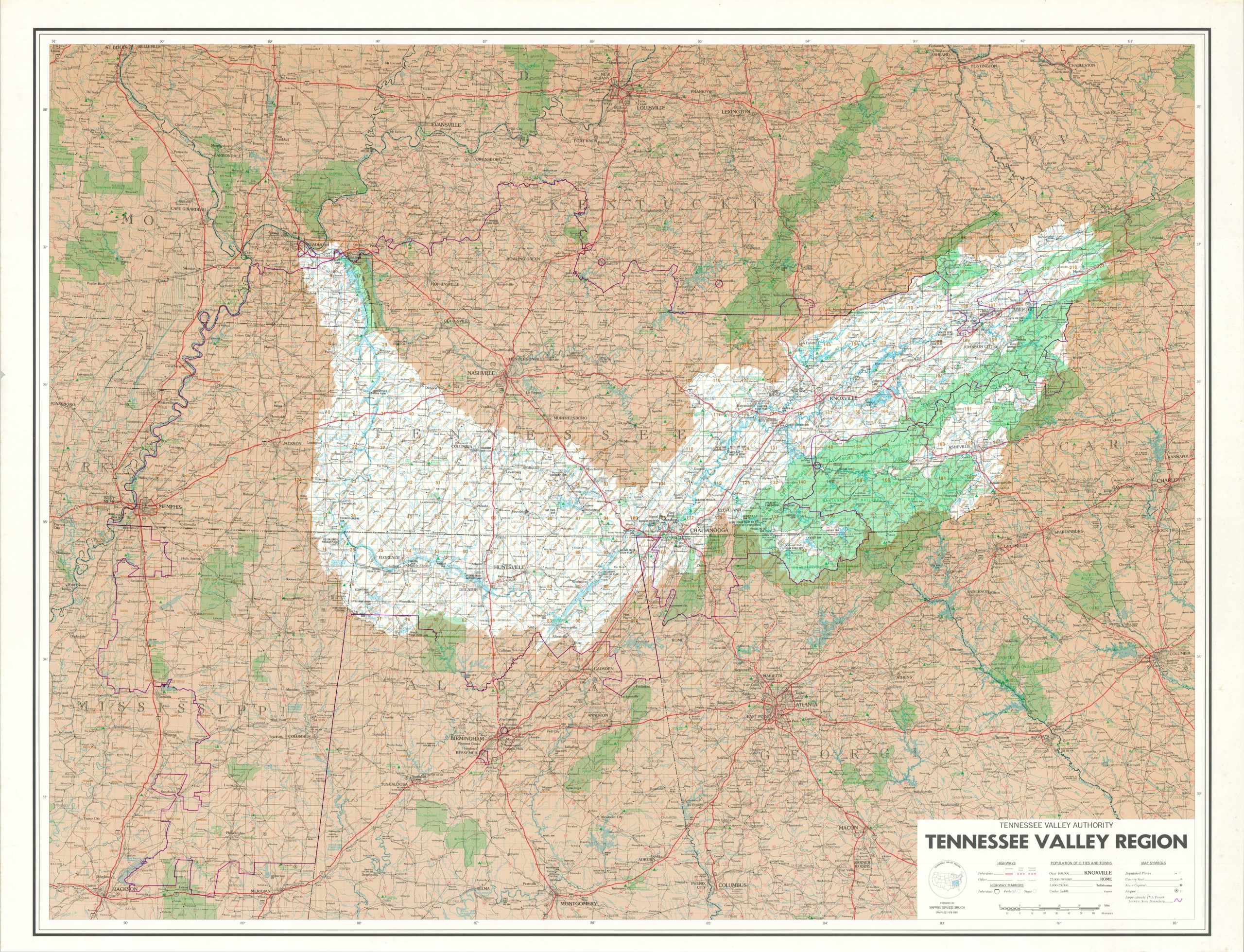
The Tennessee Valley Authority (TVA) was established in 1933 as part of President Franklin D. Roosevelt’s New Deal initiatives in response to the economic challenges of the Great Depression. It was created to address issues like flooding, soil erosion, and the lack of electricity in the Tennessee Valley region, which encompassed parts of seven states in the southeastern United States. The TVA has played a crucial role in transforming the region by building dams, generating hydroelectric power, and supporting economic and environmental development, making it one of the most significant and enduring projects of the New Deal era.
This gigantic map, published in 1981, covers the entirety of the TVA’s geographic authority across the Tennessee Valley region between Memphis and Charlotte. Interstates (completed, under construction and proposed) are shown in bright red lines, while the boundaries of the TVA Power Service areas are noted with a darker shade. Airports, state parks, battle sites, and other locations of interest are also identified across the vast area.
Map Details
Publication Date: 1981
Author: TVA Mapping Service Bureau
Sheet Width (in): 63
Sheet Height (in): 49
Condition: A-
Condition Description: A huge map, printed on treated paper, with moderate wear and soiling confined to the margins and outer edges of the sheet. Very good condition overall.
$165.00
1 in stock