
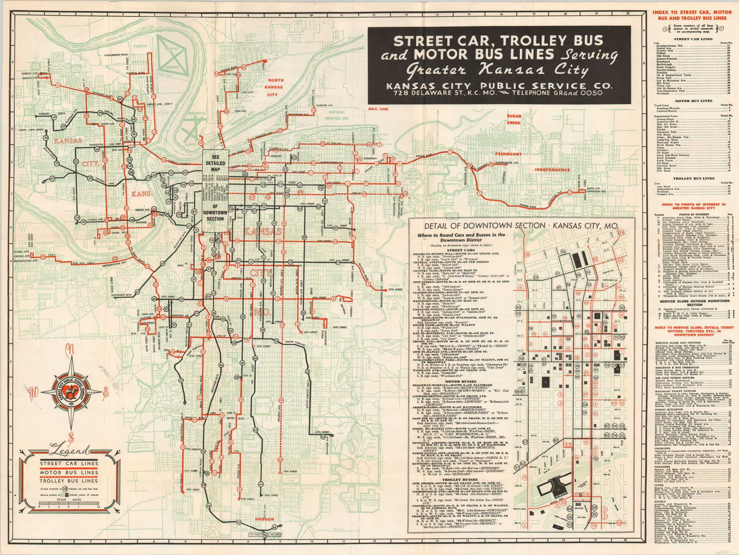
Street Car, Trolley Bus and Motor Bus Lines Serving Greater Kansas City
Transportation map of Kansas City highlighting changing trends in public transit.
Out of stock
Description
This map of Kansas City, Missouri presents the various public transportation options available throughout the city near the end of World War II. Street cars, trolleys, and motor bus lines are all indicated according to the legend in the lower right and numbered within the image.
An inset map shows further details and places of interest across the downtown area, and an index of transportation lines and local attractions can be seen on the right side of the sheet. The verso includes additional information on the transportation options in operation by the publisher, the Kansas City Public Service Company.
Map Details
Publication Date: 1945
Author: Kansas City Public Service Co.
Sheet Width (in): 27.60
Sheet Height (in):
Condition: A
Condition Description: Light creasing along originally issued fold lines and a bit of very faint wear along the outer edges. Near fine.
Out of stock