
St. Simon’s Island Sea Island and Jekyll Island Georgia
A radiant map of Georgia’s Golden Isles.
Out of stock
Description
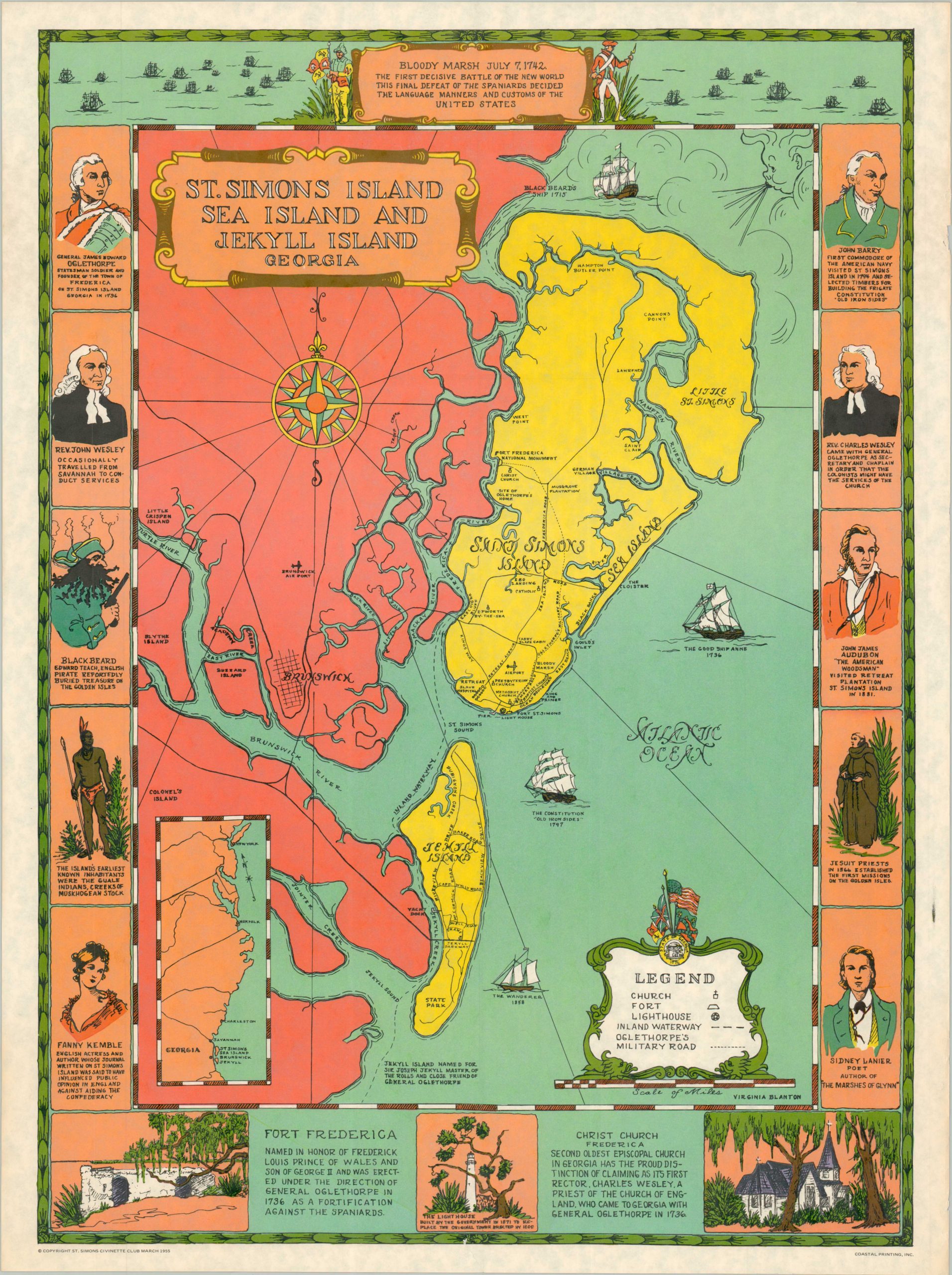
This eye-catching map of southern coastal Georgia presents the area popularly known as the Golden Isles – the town of Brunswick and the nearby barrier islands of Saint Simons, Sea, and Jekyll. The relatively straightforward overview identifies primary transportation routes, geographic features, and a handful of locations of interest. Notable figures related to the area are depicted along either side and include the Guale Indians, Blackbeard, Fanny Kemble, and John James Audubon. Three insets briefly summarize the Battle of Bloody Marsh, Fort Frederica, and Christ Church.
The vibrantly colored image, bursting with civic pride, is attributed to Virginia Blanton (named below the title cartouche). A similar map of the area by Virginia and Jack Blanton, from which this edition draws heavily (or, perhaps, vice-versa), was published by the Brunswick Chamber of Commerce. Copyrighted in 1955 by the St. Simon’s Civinette Club, a local service organization established in 1940 that still hosts events today. Printed by Coastal Printing, Inc.
Map Details
Publication Date: 1955
Author: Virginia Blanton
Sheet Width (in): 18.00
Sheet Height (in): 23.90
Condition: A-
Condition Description: Rich color printed map on a single-sided sheet of sturdy paper. An irregular 1" tear in the lower center, repaired on verso with archival tape. Light marginal wear consistent with age. Very good condition overall.
Out of stock