St. Louis
$85.00
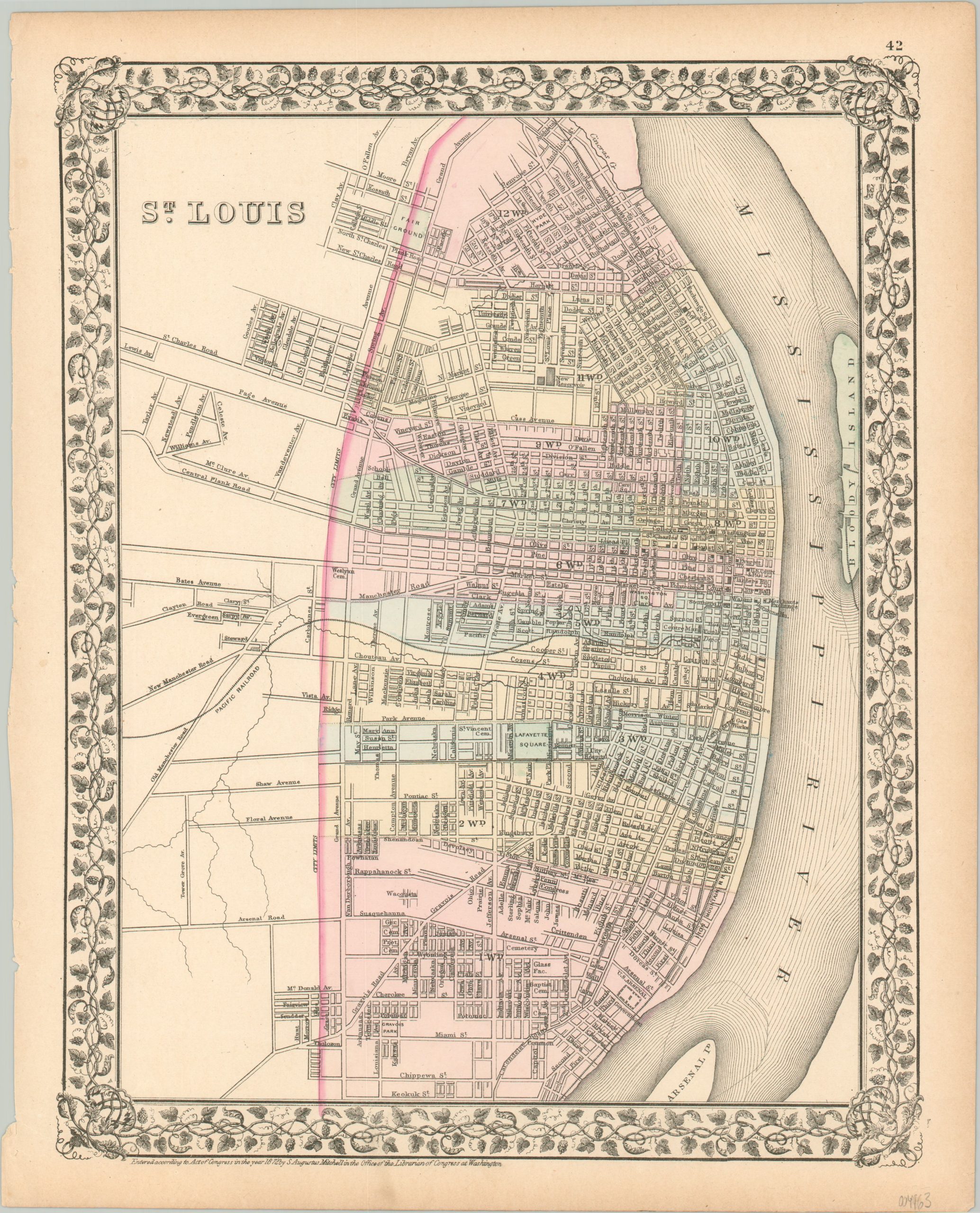
Detailed city plan of St. Louis from the early 1870s.
1 in stock
Description
This attractive map of St. Louis, Missouri was published in Philadelphia by Samuel Augustus Mitchell in 1872. Mitchell was one of the most prominent American mapmakers of the 19th century, and initially got involved with cartography as a school teacher who was frustrated with the quality of available maps. He collaborated with skilled engravers and produced high-quality maps and atlases that contained the most up-to-date information available. Mitchell’s son (of the same name) would take over the business after his death in 1860 and continue the tremendous output.
His attention to detail is evident within the image, which provides an engaging snapshot of ‘Mound City’ about five years after the end of the Civil War. A comprehensive transportation network of horse-drawn streetcar lines, steam-powered cable cars, and standard gauge railways is shown connecting much of the city, but no bridge has yet to cross the Mississippi River.
Numerous important buildings are labeled, such as the Merchant’s Exchange, Planter’s House, City Hall, and Barnum’s Hotel. Also of interest is Bloody Island (far right). Situated in the river, between the authority of Missouri and Illinois, this sandbar island was a popular spot for duelists during the 19th century.
Map Details
Publication Date: 1872
Author: Samuel Augustus Mitchell
Sheet Width (in): 12.4
Sheet Height (in): 15.1
Condition: A-
Condition Description: Trimmed margins show some toning and light spotting, consistent with age and use. Very good overall, with original color.
$85.00
1 in stock

