Southeast Road Map
$225.00
How to escape the chilly Northern winters during the mid-1920s.
1 in stock
Description
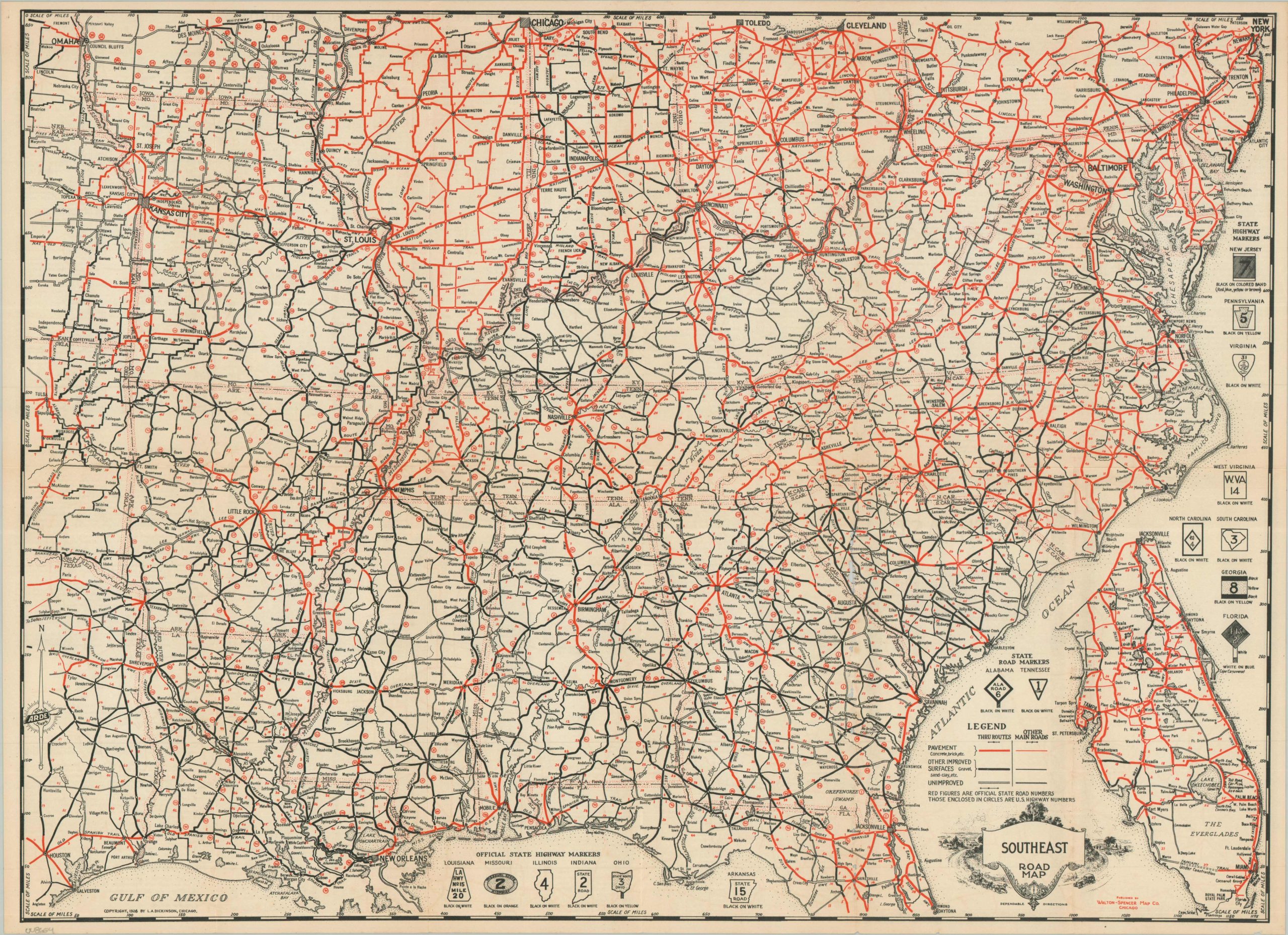
This uncommon map of the southeastern United States captures the regional road network at a transformative moment, on the cusp of the implementation of the National Numbered Highway System. Prior to the new legislation, state highways competed with privately sponsored auto trails, though the latter are omitted entirely from this work. The former are carefully noted within small circles, with the relevant highway markers/signage shown in the negative space. Road quality is also an important element, as bright red lines indicate paved surfaces (concrete, brick, etc.). The evident discrepancy between ‘quality’ roads in the North vs. the South reflects the transportation disparity shared by the railroad during the Civil War era. Text on the verso offers a mileage table, summary of motor laws, and general motor regulations.
The map was copyrighted in 1926 by L.A. Dickinson of Chicago. Published by the Walton-Spencer Map Company (also of Chicago), as part of the ARDE Road Maps (see compass rose in the lower left). A 1925 version by the same firm is listed in WorldCat, but the 1926 example is unrecorded.
Map Details
Publication Date: 1926
Author: L.A. Dickinson
Sheet Width (in): 25.75
Sheet Height (in): 18.75
Condition: B
Condition Description: Double-sided map brochure with moderate wear along original folds, including several small holes in the lower right along a repaired strip (worst damage just north of Augusta). About good condition overall.
$225.00
1 in stock