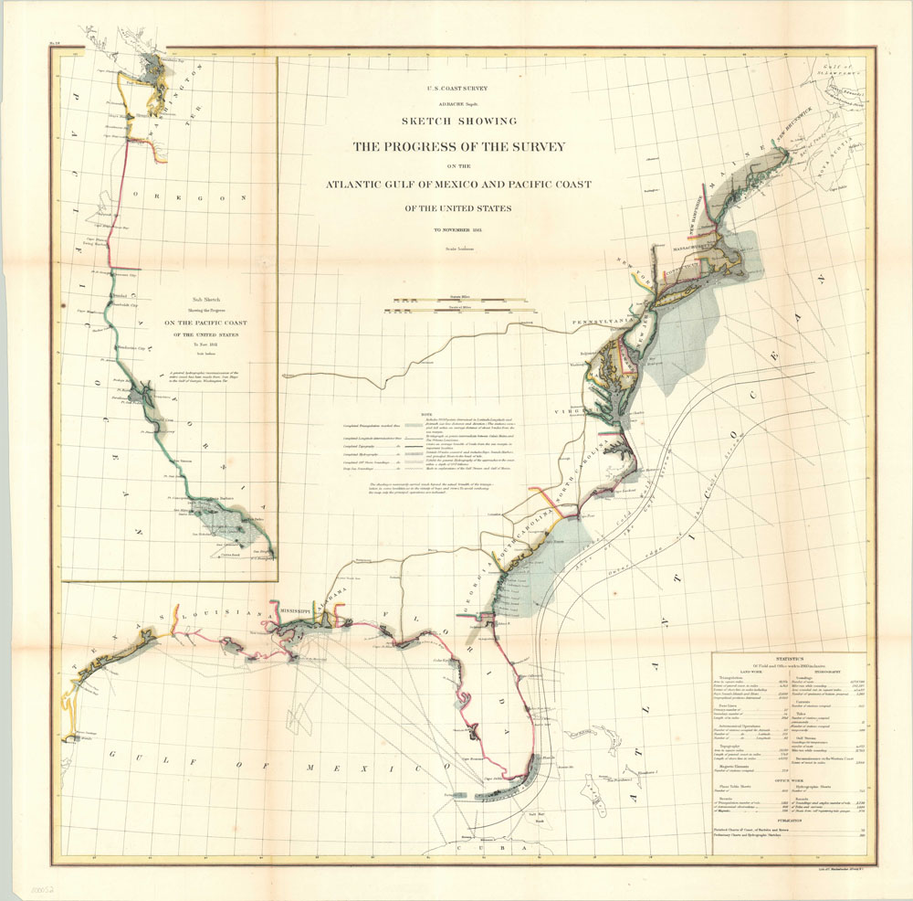
Sketch Showing the Progress of the Survey on the Atlantic Gulf of Mexico and Pacific Coast of the United States
$295.00
Coastal survey chart of the East, West and Gulf coasts published during the American Civil War.
Description
This coastal chart of the United States shows the vast wealth of scientific information collected by the dedicated sailors of the United States Coastal Survey. First proposed in 1807 by Thomas Jefferson, the coast survey is one of the oldest scientific institutions in the United States. This example was produced under the supervision of Alexander Bauche, the second superintendent of the survey and one of its most dedicated proponents.
In addition to showing coastlines of the East, West, and Gulf coasts, the map also depicts the Gulf Stream, navigable bays and harbors, and routes of longitudinal determination. A box in the lower right provides statistics that allude to the incredible amount of work required to complete such a task – over six million sounding casts and upwards of one thousand triangulation measurements! Much of this work was done while on duty with the Union blockade, one of several innovations introduced by Bauche in order to help the Union win the war. He believed “it is certain that accurate maps must form the basis of well-conducted military operations.”
Map Details
Publication Date: 1861
Author: U.S. Coastal Survey
Sheet Width (in): 26
Sheet Height (in): 26
Condition: B+
Condition Description: The map is in good condition, with minor discoloration along folds (as originally issued) and 2" tears along fold lines that have been repaired on verso.
$295.00