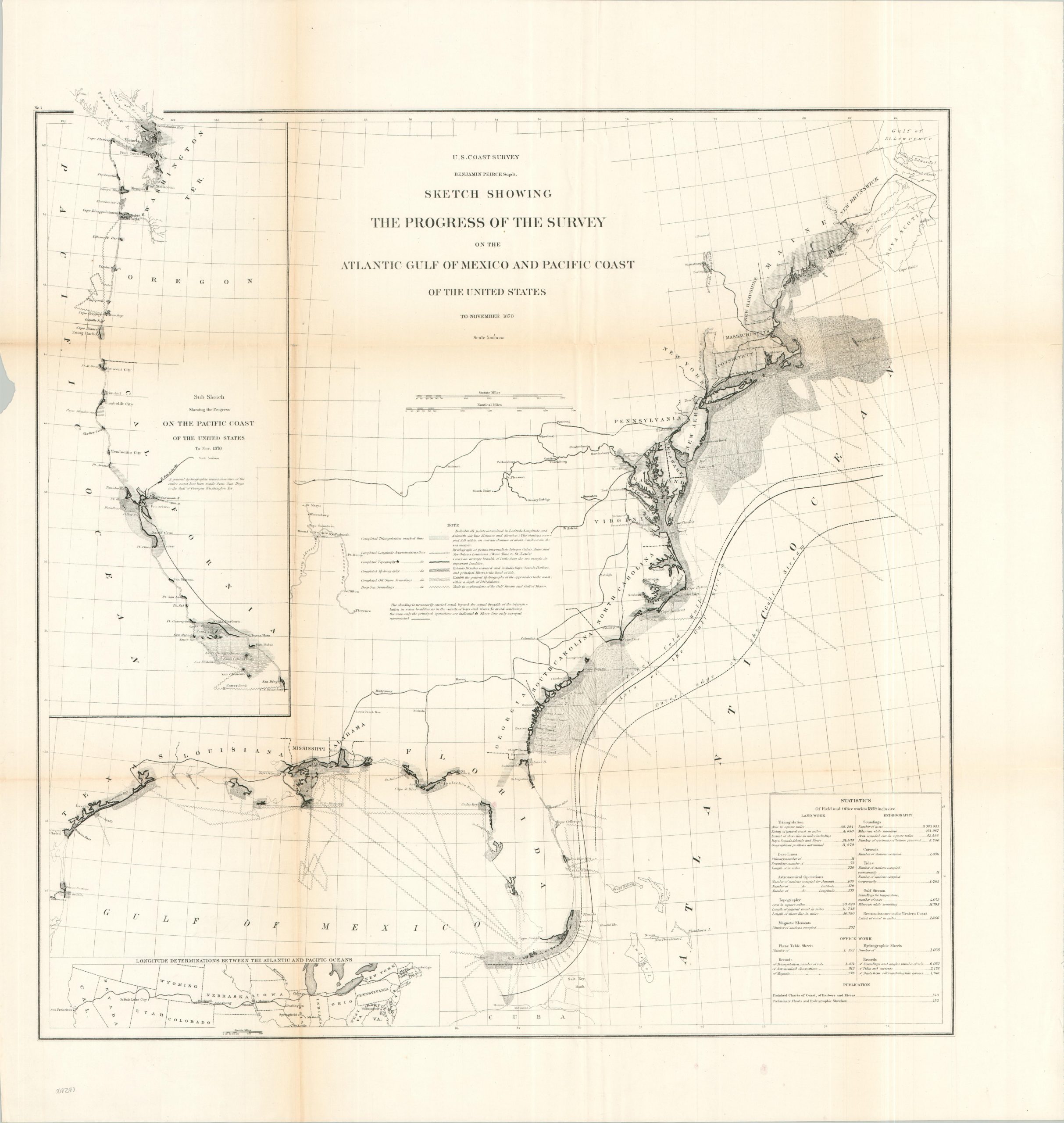
Sketch Showing the Progress of the Survey on the Atlantic Gulf of Mexico and Pacific Coast of the United States
$95.00
Charting America’s coasts in the years following the Civil War.
1 in stock
Description
Following the conclusion of the Civil War, the United States turned its full attention toward the mapping of its massive shoreline. This 1870 progress report documents the monumental work of the U.S. Coast Survey – the nation’s oldest scientific agency – as it measured, mapped, and marked the shifting shores of a reunited nation.
Hydrographic data, depth soundings, and topographic measurements are noted along the coast from Maine to the mouth of the Rio Grande. An inset, upper left, shows similar details for the Pacific Coast, with an evident concentration of efforts in the Puget Sound and San Francisco Bay. These various toils are captured in the accompanying statistical chart, which notes nearly 10 million soundings and over 58,000 square miles of triangulation. A second inset, lower left, presents the route of the recently completed Transcontinental Railroad.
The image was created under the watchful authority of U.S. Coast Survey Benjamin Peirce. Published in Washington, D.C. in 1870 as part of a Congressional Report.
Map Details
Publication Date: 1870
Author: Benjamin Peirce
Sheet Width (in): 27.75
Sheet Height (in): 29.00
Condition: B+
Condition Description: Lithographed map on a single-sided sheet. Moderate wear and toning along original folds, including about 8" of separation (upper left) repaired on the verso with archival tape. Marginal wear on the left side, including a small chip. Good condition overall.
$95.00
1 in stock