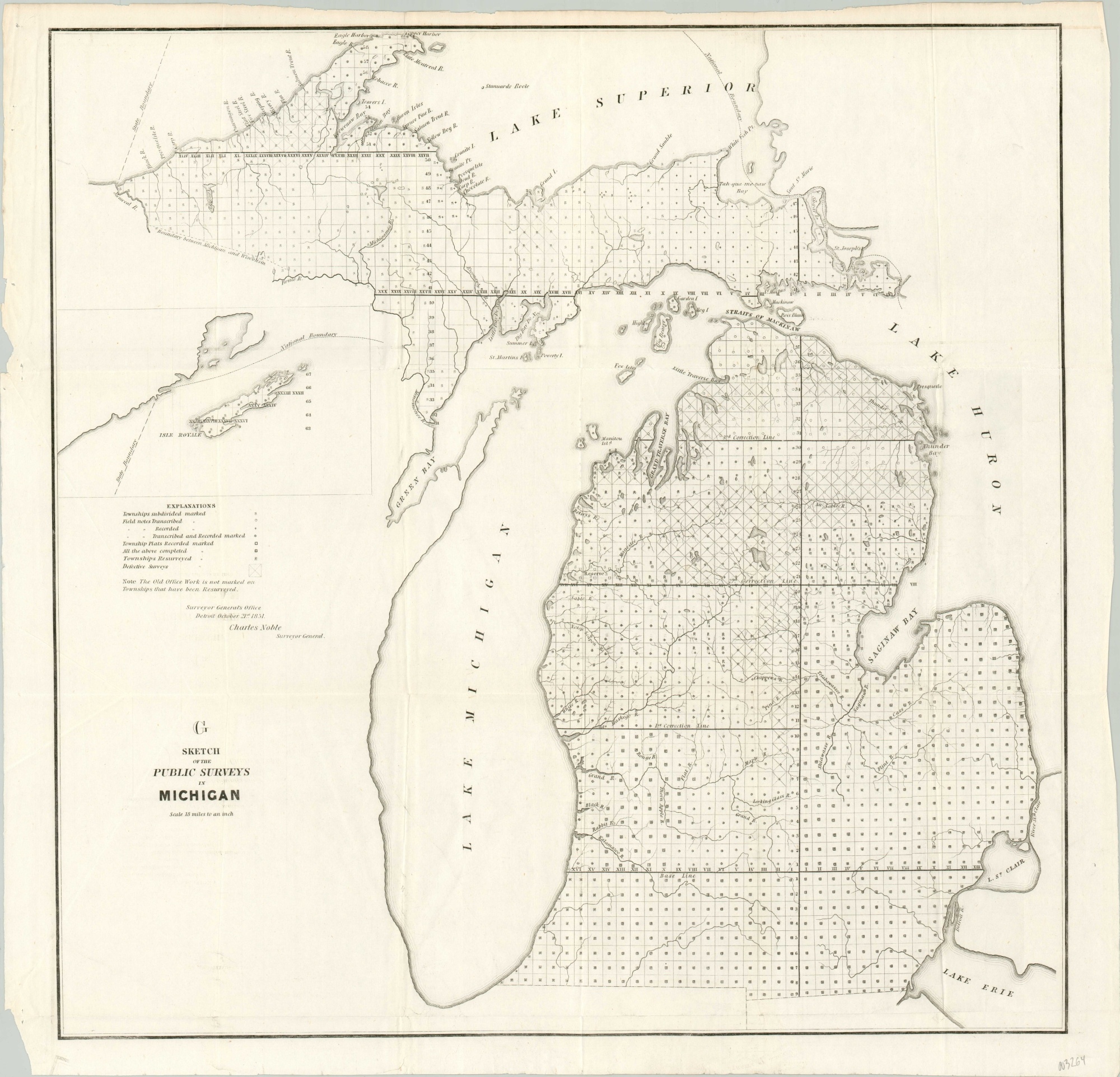
Sketch of the Public Surveys in Michigan
$150.00
Michigan’s surveyed townships about fifteen years after statehood.
1 in stock
Description
This mid-19th century survey of Michigan was issued by the General Land Office in 1851 and reflects the latest efforts of the Surveyor General’s Office under the authority of Charles Noble. The status of each surveyed township is shown with letters and symbols, explained in further detail by a legend above the title block. An ‘X’ through a particular township indicates the survey was defective – much of the center of the state would apparently require redoing.
Few details are noted elsewhere, apart from national and state boundaries, relevant geographic features, and survey correction lines.
Map Details
Publication Date: 1851
Author: Charles Noble
Sheet Width (in): 23.25
Sheet Height (in): 22.25
Condition: A
Condition Description: Creasing along former fold lines and some extraneous wrinkling visible in the corners and margins. Very good to near fine overall - a crisp impression on a bright sheet.
$150.00
1 in stock

