
Sea Island and Saint Simons
$185.00
Welcome to Georgia’s All-Year Playground!
1 in stock
Description
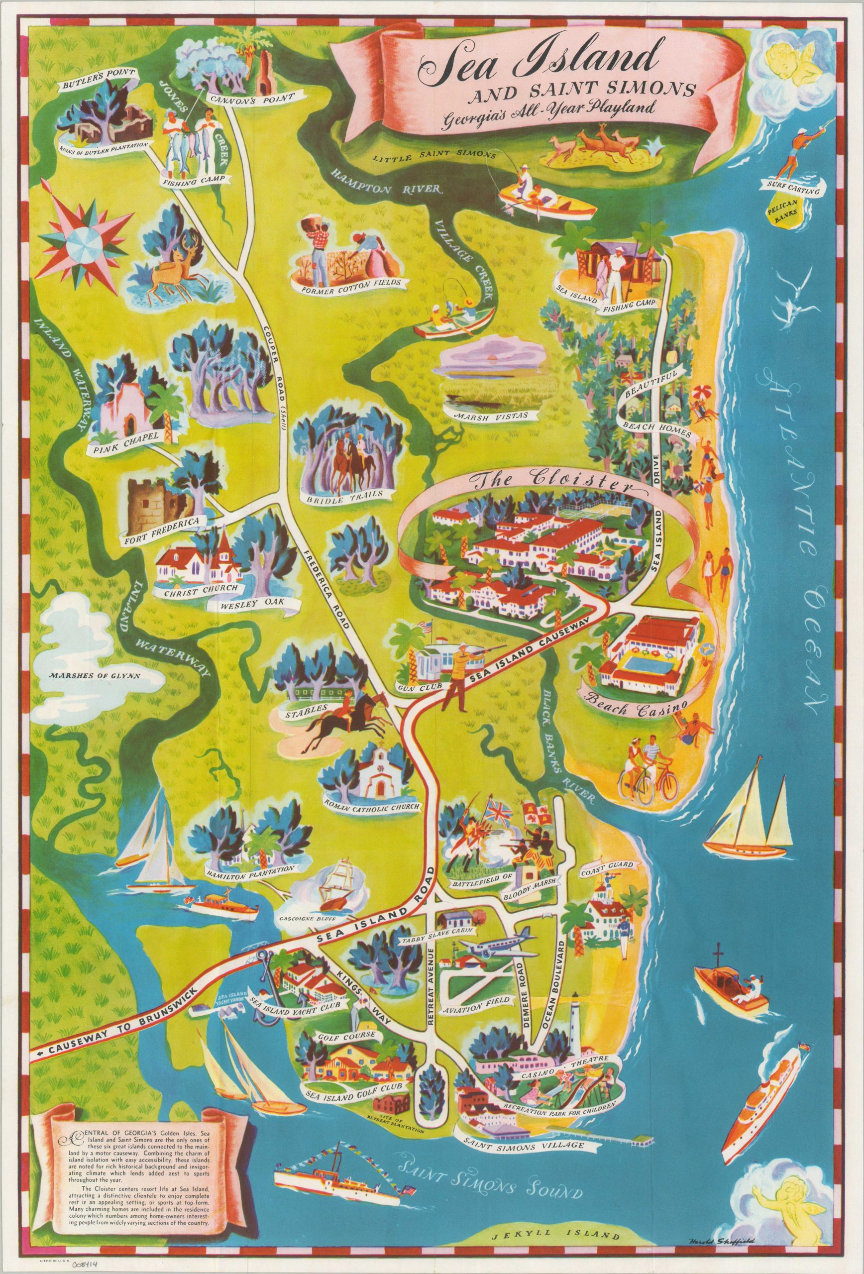
“Combining the charm of island isolation with easy accessibility, these islands are noted for a rich historical background and invigorating climate which lends added zest to sports throughout the year.” — Text, lower left.
This rare pictorial map captures the verdant coastal allure of Georgia’s Golden Isles during the mid-20th century. While the title encompasses the region, the composition focuses primarily on St. Simons and Sea Island, the latter separated from its larger neighbor by Village Creek and the Black Banks River. Centered on The Cloister, the map highlights the amenities of the privately owned resort, including the casino, fishing camps, and expansive beachfront estates. Nearby, “old plantations,” golf courses, and horse stables are rendered with a characteristic mid-century whimsical charm.
The map was drawn by Harold Sheffield (signed lower right) and published c. 1950, likely commissioned by the resort owners or a local Chamber of Commerce. At the time of publication, Sea Island operated as a strictly segregated enclave; notably, the only Black figures depicted within the map’s “historical” vignettes are those shown picking cotton – a sanitized and regressive representation of the region’s labor history. As of April 2026, this map remains unlisted in WorldCat, though a physical example has been identified in the permanent collection of the Georgia Historical Society.
Map Details
Publication Date: c. 1950
Author: Harold Sheffield
Sheet Width (in): 14.75
Sheet Height (in): 21.90
Condition: A
Condition Description: Single-sided color printed map, creased along old folds. Near fine overall.
$185.00
1 in stock