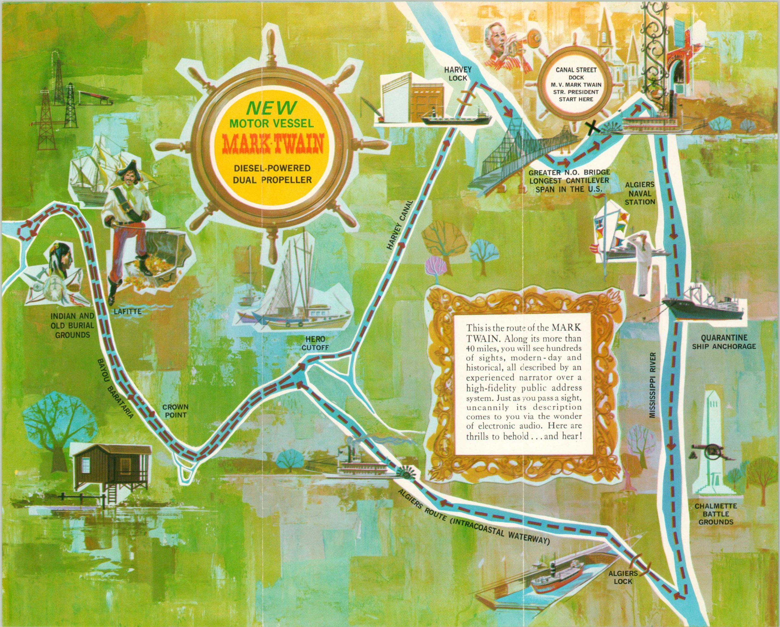
[Route Map of the Mark Twain]
$35.00
Take a tour of the New Orleans bayou aboard the Mark Twain!
1 in stock
Description
This simple stylized map shows the approximately forty-mile circuit undertaken by the paddle-wheeler Mark Twain during its New Orleans Bayou Tour. Guests can marvel at the stomping grounds of the pirate Jean Lafitte, ogle at the longest cantilever span in the U.S. (now superseded by the Commodore Barry Bridge), and travel through the Algiers Lock. According to the accompanying text,
“This is the route of the Mark Twain. Along its more than 40 miles, you will see hundreds of sights, modern-day and historical, all described by an experienced narrator over a high-fidelity public address system. Just as you pass a sight, uncannily its description comes to you via the wonder of electronic audio. Hear are thrills to behold…and hear!”
The Mark Twain was laid down in 1963, hence the estimated date, and remains in operation today in Louisville as The Spirit of Jefferson.
Map Details
Publication Date: c. 1964
Author: Anonymous
Sheet Width (in): 11.10
Sheet Height (in): 8.90
Condition: A
Condition Description: Three panel folding brochure with light wear along fold lines.
$35.00
1 in stock

