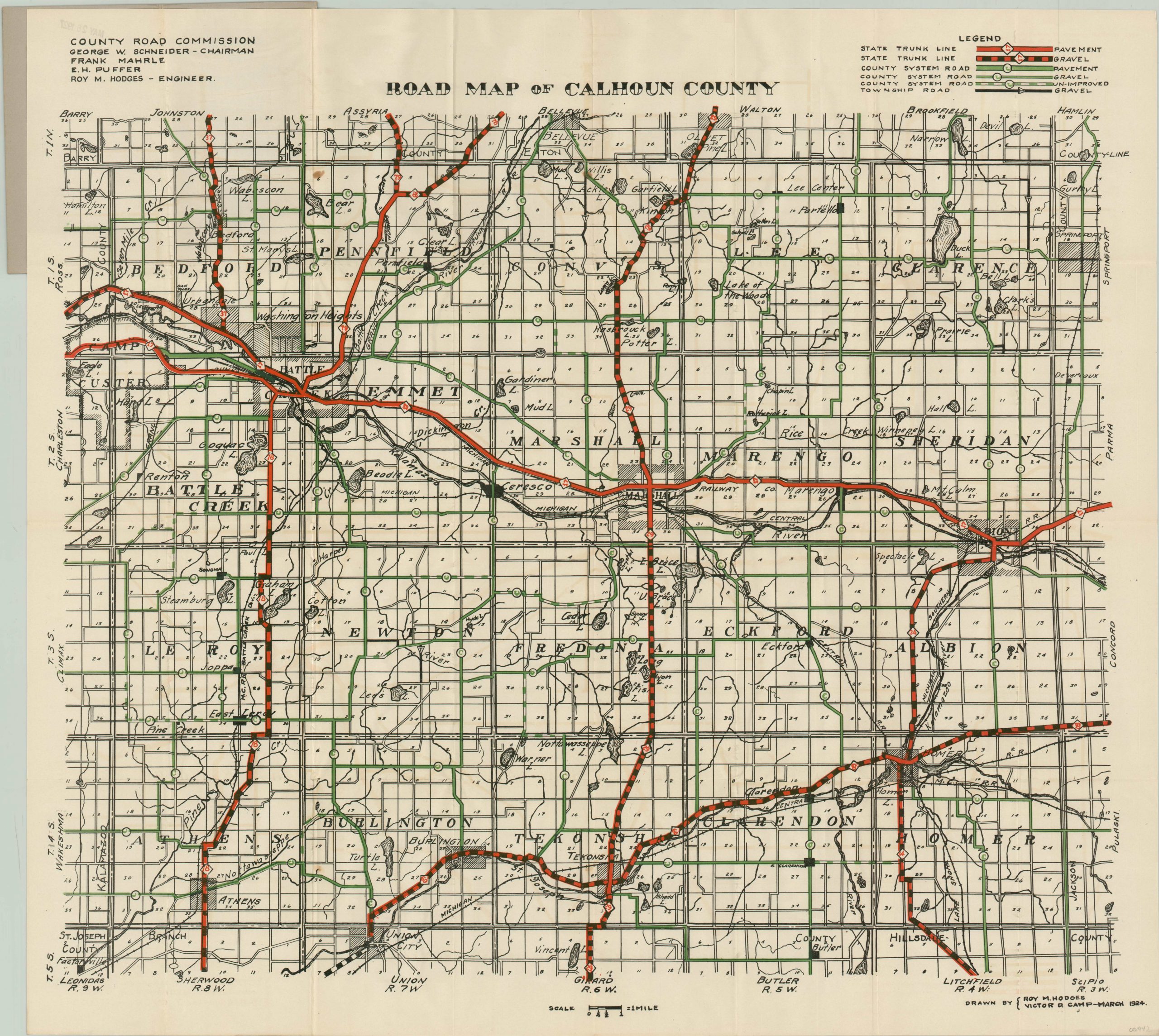
Road Map of Calhoun County
$110.00
An in-depth look at the road system around Battle Creek, Michigan.
1 in stock
Description
This detailed road map of Calhoun County, Michigan captures the local transportation network at a pivotal point in it’s history. Issued the year prior to the implementation of the United States Numbered Highway System, the map shows an interesting mix of paved, gravel, and dirt roads connecting the various urban centers and small towns. Of particular interest are Battle Creek, home of John Harvey Kellogg’s famed sanitarium and recently renamed Kellogg Company, and Marshall, the county seat and home to a variety of renowned architecture.
Trunk lines and county roads are highlighted in red and green, respectively. The map was drawn in March 1924 by Roy Hodges and Victor Camp and issued by the County Road Commission.
Map Details
Publication Date: 1924
Author: Roy Hodges and Victor Camp
Sheet Width (in): 26.5
Sheet Height (in): 24
Condition: A-
Condition Description: Folding pocket map with several faint spots of discoloration scattered throughout the image. Old rubber stamp dated 1927 and manuscript ink on front cover (attached and in excellent condition).
$110.00
1 in stock

