Rand McNally Official Auto Trails Map Maine Vermont New Hampshire
“Maine’s Best Highways Lead to Lewiston – The Industrial Heart of Maine – the Home of the Haskell Implement & Seed Co.” [Front Cover]
Out of stock
Description
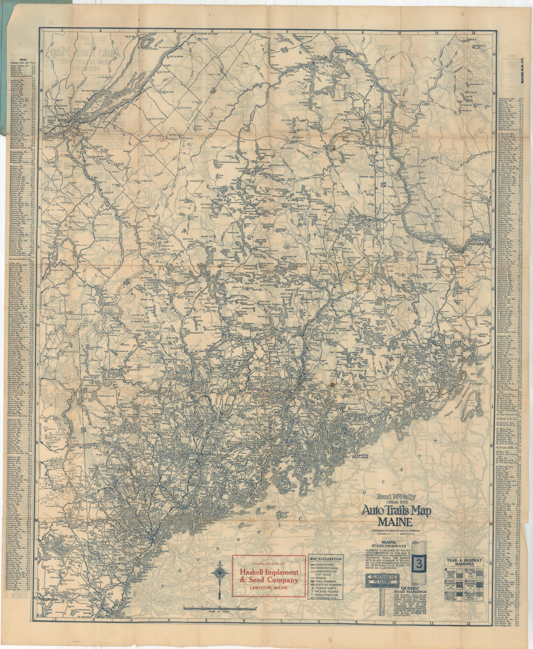
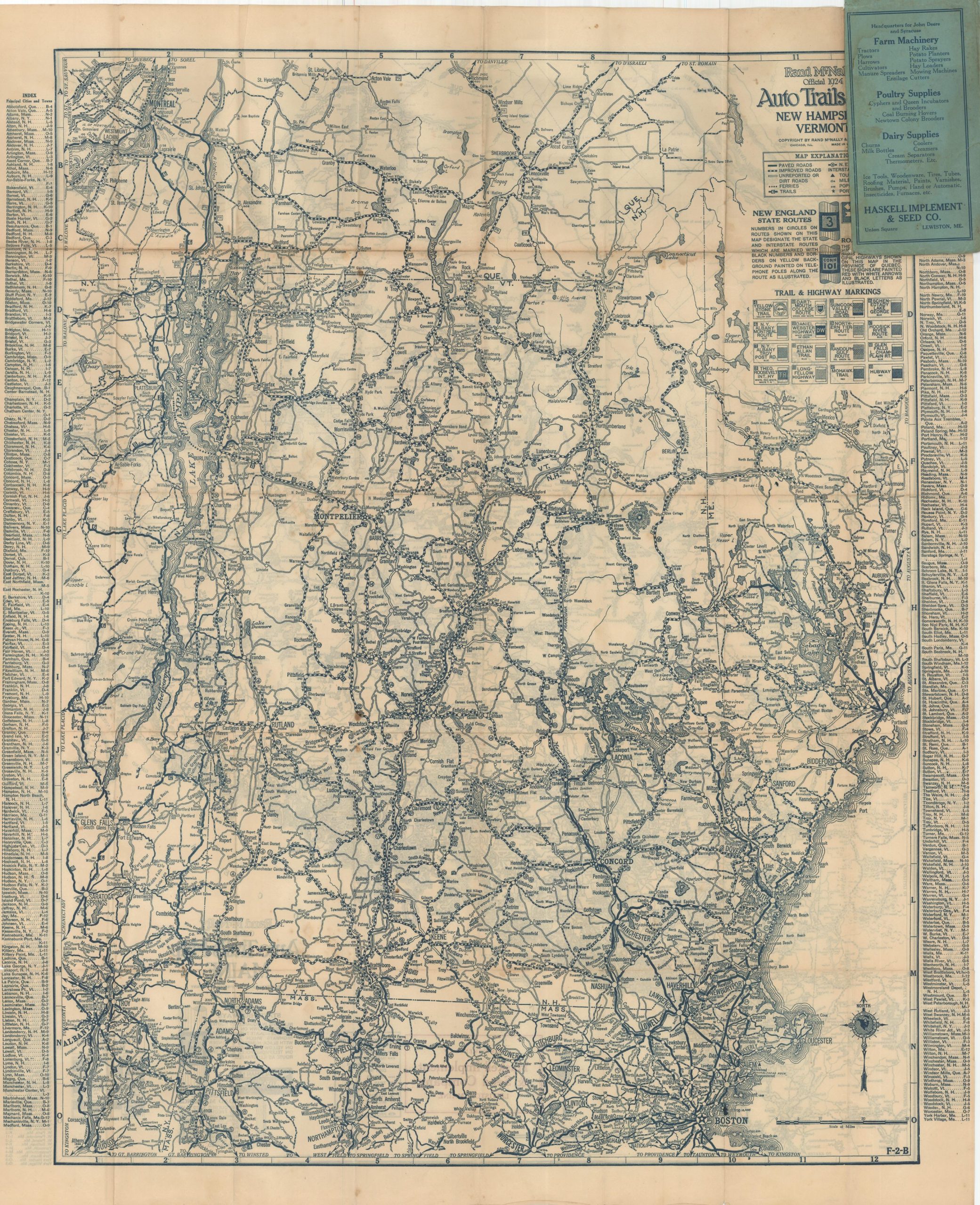
This double-sided pocket map was published in Chicago in 1924 by Rand McNally and distributed by the Haskell Implement and Seed Company of Lewiston, Maine.
One side presents the automobile trail markings, numbered state highways across the states of New Hampshire and Vermont, while the verso depicts the same for Maine. Ferry routes, distances between points, the location of tourist camps, and population statistics are also noted. An interesting and ephemeral map that highlights the transition from haphazard trail markings to more structured, numbered routes.
Map Details
Publication Date: 1924
Author: Rand McNally
Sheet Width (in): 28
Sheet Height (in): 34
Condition: B
Condition Description: Double-sided pocket map folded into 40 segments and affixed to original blue paper wraps. Moderate discoloration and wear along fold lines, including bits of separation at fold intersections and tears along the outer edges of the sheet, some of which have been repaired with archival materials. Between good and very good overall.
Out of stock