Rand McNally Official Auto Trails Map District No. 1
$245.00
A WWI-era motorist’s guide to Illinois and its immediate surroundings.
1 in stock

Description
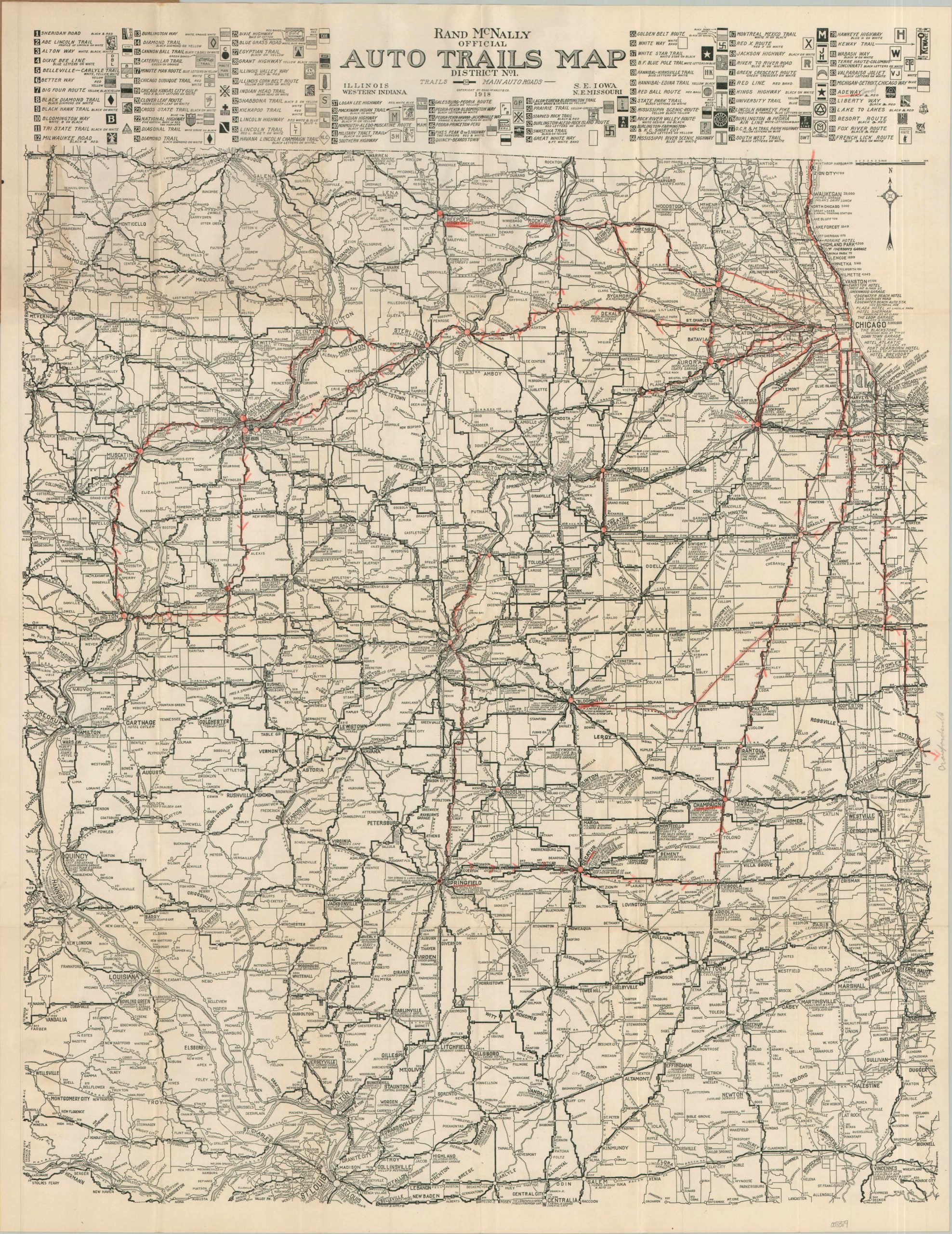
This fascinating road map of Illinois and the surrounding area was published in 1918 by the Rand McNally company of Chicago. Issued before the introduction of a cohesive national highway numbering system, the image reflects a disjointed network of privately sponsored and promoted auto trails. These routes often overlapped and were inconsistent in terms of surfacing, signage, traveler’s amenities, etc. Though Illinois adopted a framework of State Bond Issue Highways (numbered 1-46) in 1918, they have not yet been incorporated into the work.
The map shows the robust network of regional roads near the end of the 1910s, after the development of the Model-T brought the automobile to an all-time level of affordability. The aforementioned trails are shown with thick black lines, while other roads are relegated to their thinner counterparts. A list across the top of the sheet lists ninety of these different auto trails, each accompanied by its respective marker (which would have been posted on utility poles or special signs). Distances range from relatively local affairs, like the Egyptian Trail, to major transcontinental routes such as the Pikes Peak Ocean to Ocean Highway. Dozens of towns, large and small, are served by this growing and ever-improving network linking Chicago and St. Louis. Many of the bigger settlements are accompanied by recommended tourist amenities – garages, restaurants, hotels, etc – offering an interesting snapshot of the local economy of early automobile tourism.
Advertisements on the front cover indicate this copy of the map was distributed courtesy of Chapin Electric Garage in Springfield, Illinois. A second image, inside the front, places the Hein Tire and Rubber Company (also of Springfield) at the center of seven different auto trails.
Map Details
Publication Date: 1918
Author: Rand McNally
Sheet Width (in): 21.75
Sheet Height (in): 28.25
Condition: A-
Condition Description: Printed map on a single-sided sheet, folded and affixed to original stiff brown wraps (as issued). Light wear along folds and some tiny splits at the joints. Old handwriting in red and gray pencil. Good to very good condition overall.
$245.00
1 in stock