Rand McNally Official 1929 Auto Road Map Kentucky Tennessee
$125.00
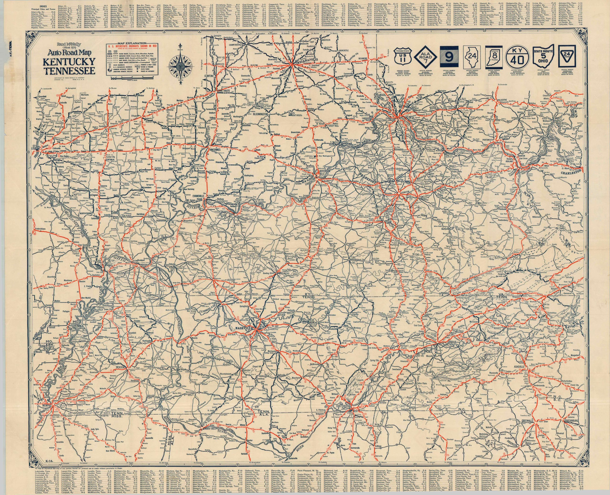
The roads of Trans-Appalachia near the end of the 1920s.
1 in stock
Description
This detailed road map of Kentucky and Tennessee was published in Chicago by the prominent mapmaking firm of Rand McNally in 1929. The image is extended to include nearby urban centers like Indianapolis, St. Louis, Charleston (W.V.) and Cincinnati. Road signs for the eight covered states are noted in the upper right corner. Interstate Highways (the name given to the U.S. Numbered Highway System) are shown in bright red, while five styles of lines indicate different road surfaces from paved to theoretical (or under construction). Distances between points are noted and small hachures give a general impression of topographic features. Numerous ferries are labeled at river crossings.
Map Details
Publication Date: 1929
Author: Rand McNally
Sheet Width (in): 34.25
Sheet Height (in): 28.50
Condition: B+
Condition Description: Single-sided pocket map roughly extracted from original wraps (lost), with a small chip in the upper left margin as a result. Light wear along original folds, including a 5" split (lower left) repaired on the verso with archival tape. Good to very good condition overall.
$125.00
1 in stock