
Rand McNally & Co.’s Handy Map of Chicago and the World’s Fair
A most useful map to Chicago and the World’s Fair.
Out of stock

Description
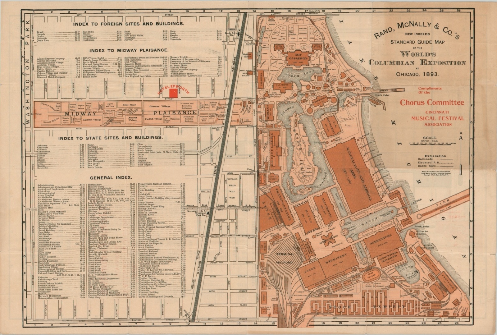
Go everywhere and see everything at the Columbian Exposition with this detailed map of the city and fairgrounds, published in 1893 by Rand McNally. One side presents Chicago between River North and Jackson Park, the site of the World’s Fair, with an emphasis on transportation routes, lodging, and theaters. Other notable buildings like the courthouse, Art Institute, library, and the University of Chicago are also labeled.
The city’s park and boulevard system, colloquially known as its Emerald Necklace, is depicted in bright green. The verso shows a detailed plan of the grounds of the White City and adjacent Midway Plaisance. Exhibits and attractions are outlined and accompanied by a comprehensive index. Both sides of the map note the location of Hotel Epworth, which, according to a contemporary guide to the fair, was the headquarters for the General Board of Control and ‘Methodists generally.’
The map is overprinted in red, indicating it was distributed by the Chorus Committee of the Cincinnati Music Festival Association. This was a clever marketing technique by the publishing juggernaut of Rand McNally, who licensed the same maps for use by a wide variety of organizations during the fair. See here for an example by the Union News Company.
Map Details
Publication Date: 1893
Author: Rand McNally
Sheet Width (in): 13.5
Sheet Height (in): 19.9
Condition: B+
Condition Description: Issued folded into 16 panels, with moderate creasing and wear along fold lines. Small holes and paper separation at fold intersections and a few tiny tears around the outer edges (confined to the margins). The front two panels (upper right of the fairgrounds plan) have discolored from age. Remains in good condition overall.
Out of stock