
R.L. Polk & Co’s Map of Jackson and Vicinity
$110.00
Vivid Depression-era broadsheet promoting the home of the Coney Island Hot Dog.
1 in stock
Description
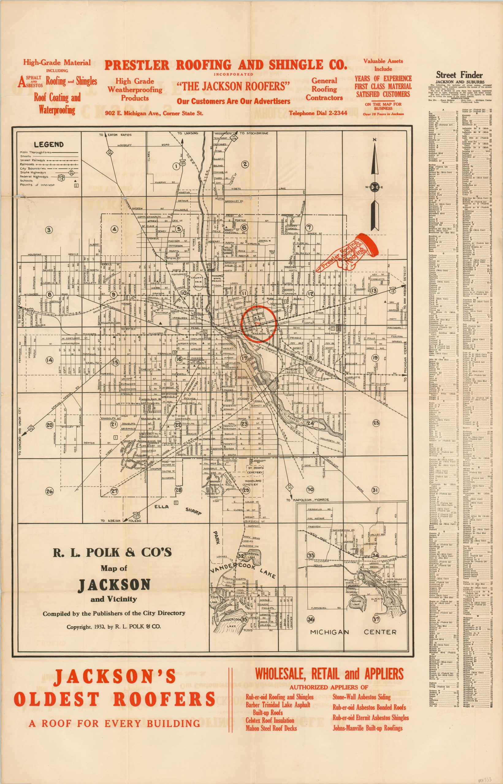
This bold broadsheet map presents a detailed street plan of Jackson, Michigan, divided into thirty seven separate squares. These numbers correspond to an index on the right side of the sheet, which lists all streets in alphabetical order.
This particular copy of the map features bold red advertisements for Prestler Roofing and Shingle Company, “Jackson’s Oldest Roofers” and wholesale, retail, and applier of numerous asbestos products! The headquarters on the corner of State Street and Michigan Avenue is helpful identified with a distinctive hand pointer. Published in 1932 by R.L. Polk and Company.
Map Details
Publication Date: 1932
Author: R.L. Polk & Co.
Sheet Width (in): 21.90
Sheet Height (in): 32.90
Condition: B
Condition Description: Originally folded into sixteen panels, with moderate discoloration, creasing, and some separation along the fold lines. The worst has been repaired on the verso with archival tape. One quarter sized dark spot in the center of the image, and minor offsetting and toning present. An interesting piece of ephemera that remains in good, presentable condition.
$110.00
1 in stock