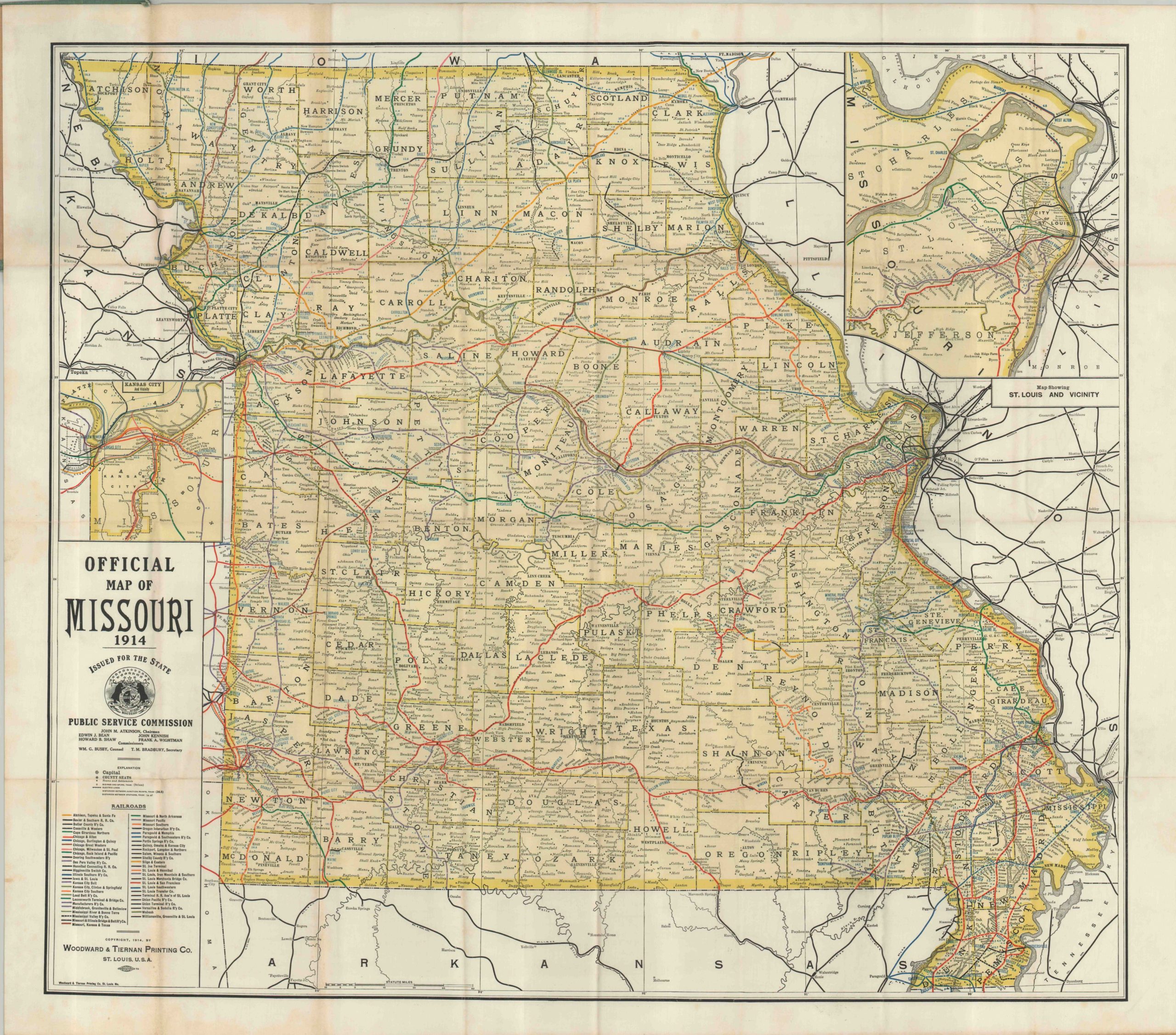
Public Service Commission Map of Missouri
$125.00
Nice fold out map of Missouri published during the first quarter of the 20th century.
Description
This map shows the transportation system in Missouri prior to the automobile revolution. The National Highway System wouldn’t have significant federal support until the 1920’s, and rails ruled the day. This map is evidence to that fact, showing the routes of over fifty separate railroads that operated within the boundaries of the state of Missouri in 1914.
Junctions in Kansas City and St. Louis are depicted via inset maps, showing more detail than could otherwise fit on the map. These hubs contrast sharply with rural locations, which were still only accessible by the new (and unproven) automobile or a stagecoach, even in the second decade of the 20th century! Of additional interest is the rapid consolidation among railroad companies that took place, shrinking the 50+ operators listed here to only a handful within a few decades.
Map Details
Publication Date: 1914
Author: Woodward & Tiernan
Sheet Width (in): 31.00
Sheet Height (in): 27.50
Condition: A-
Condition Description: The map is in excellent condition, mounted on linen with original cloth covers. Some discoloration along fold lines, but otherwise very fine.
$125.00

