
Provisional Map Rabun Hills
$350.00
Real estate development in Atlanta’s suburbs on the brink of the Great Depression.
1 in stock
Description
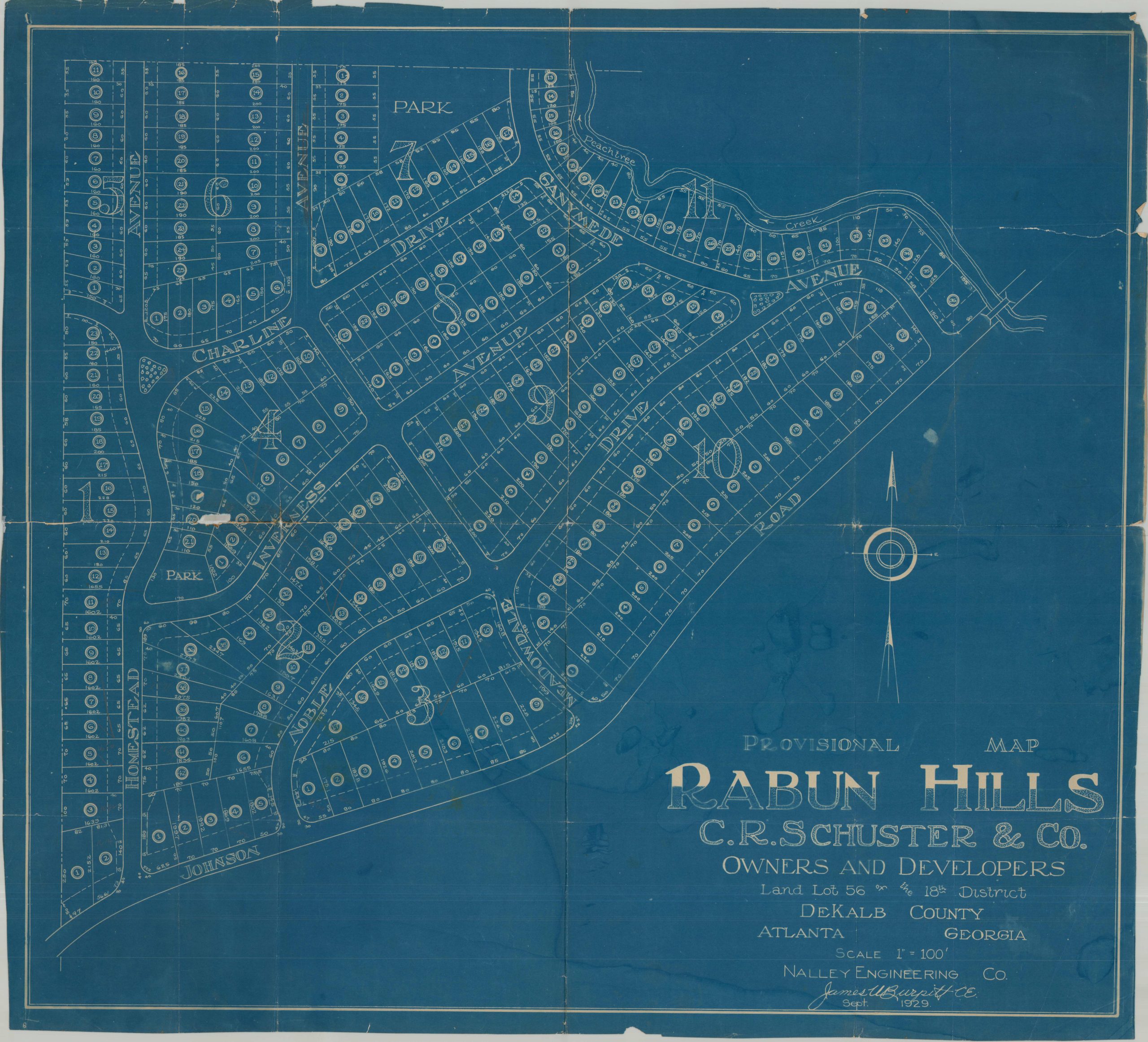
This large-scale real estate map presents the planned subdivision of Rabun Hills, located in Atlanta’s Morningside-Lenox Park neighborhood. The detailed plan numbers individual lots for sale across ten separate sections, noting parcel dimensions, streets, parks, and other improvements. Peachtree Creek is shown in the upper right, crossed by a bridge along Johnson Road.
The map was drawn by civil engineer James Burpitt in 1929 and issued by the Nalley Engineering Company on behalf of local real estate developers C.R. Shuster & Company. Although the area had been annexed by the city of Atlanta just four years earlier, much of northern Atlanta remained only lightly developed at the time. Rabun Hills reflects the city’s steady suburban expansion during the interwar period, preceding the explosive residential growth that transformed the area in the decades following World War II.
Map Details
Publication Date: 1929
Author: James Burpitt
Sheet Width (in): 29.1
Sheet Height (in): 26.1
Condition: B
Condition Description: Cyanotyped map on a single-sided sheet of somewhat brittle paper, heavily worn along old folds. A small chip in the center left, plus several other places of wear, toning, and splitting (repaired on the verso). Chipped margins and a damp stain visible in the lower right. About good conditionn overall.
$350.00
1 in stock