
Pony Express Route April 3, 1860 – October 24, 1861
$75.00
Pictorial overview of the short lived Pony Express Route, an icon of the American West.
1 in stock
Description
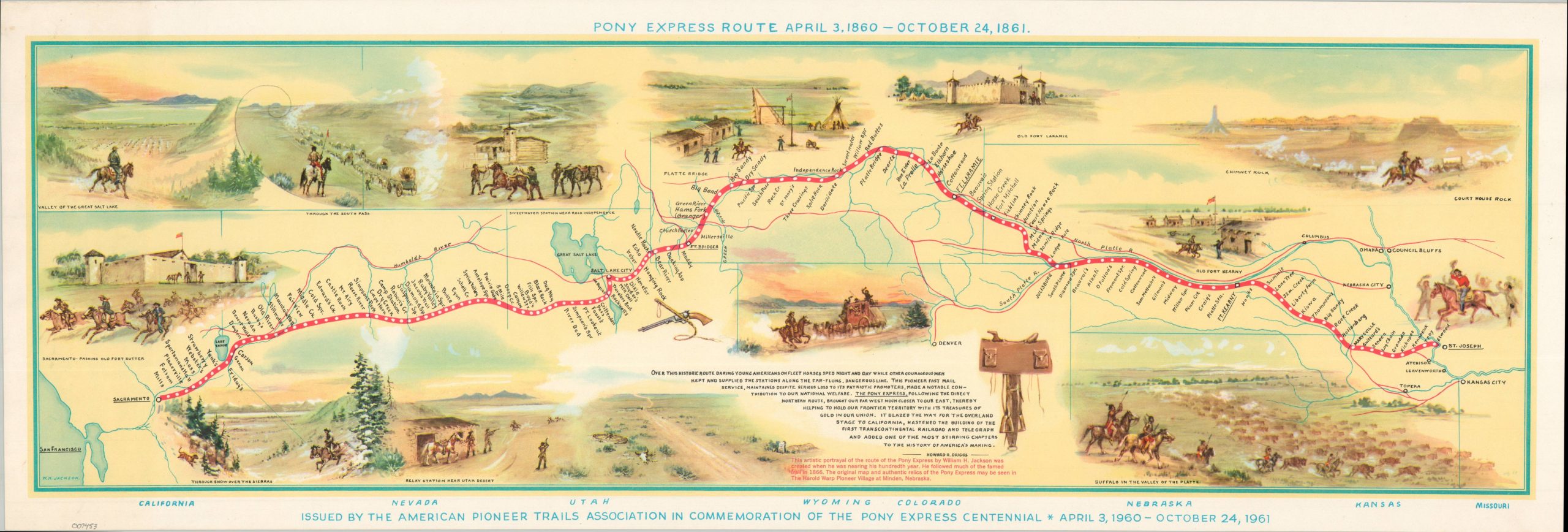
This beautiful map of the western United States boldly presents the route taken by the riders of the Pony Express while it was in operation between April 1860 and October 1861. Numerous landmarks of the American West can be found along the path, several of which are vividly illustrated in scenes filled with cowboys, Native Americans, wagon trains, and buffalo herds.
According to text in the lower center, the Pony Express “blazed the way for the overland stage to California, hastened the building of the First Transcontinental Railroad and telegraph, and added one of the most stirring chapters to the history of America’s making.”
The map was published in New York in 1961 by the Pioneer Trails Association to celebrate the Pony Express Centennial. Artwork was provided by William Henry Jackson and the accompanying text by Howard Driggs.
References: Rumsey List No: 8246.000.
Map Details
Publication Date: 1961
Author: William Jackson
Sheet Width (in): 29.75
Sheet Height (in): 10
Condition: A
Condition Description: Color lithographed map on a single-sided sheet with light wear and a bit of soiling in the margins. Very good to near fine condition overall.
$75.00
1 in stock