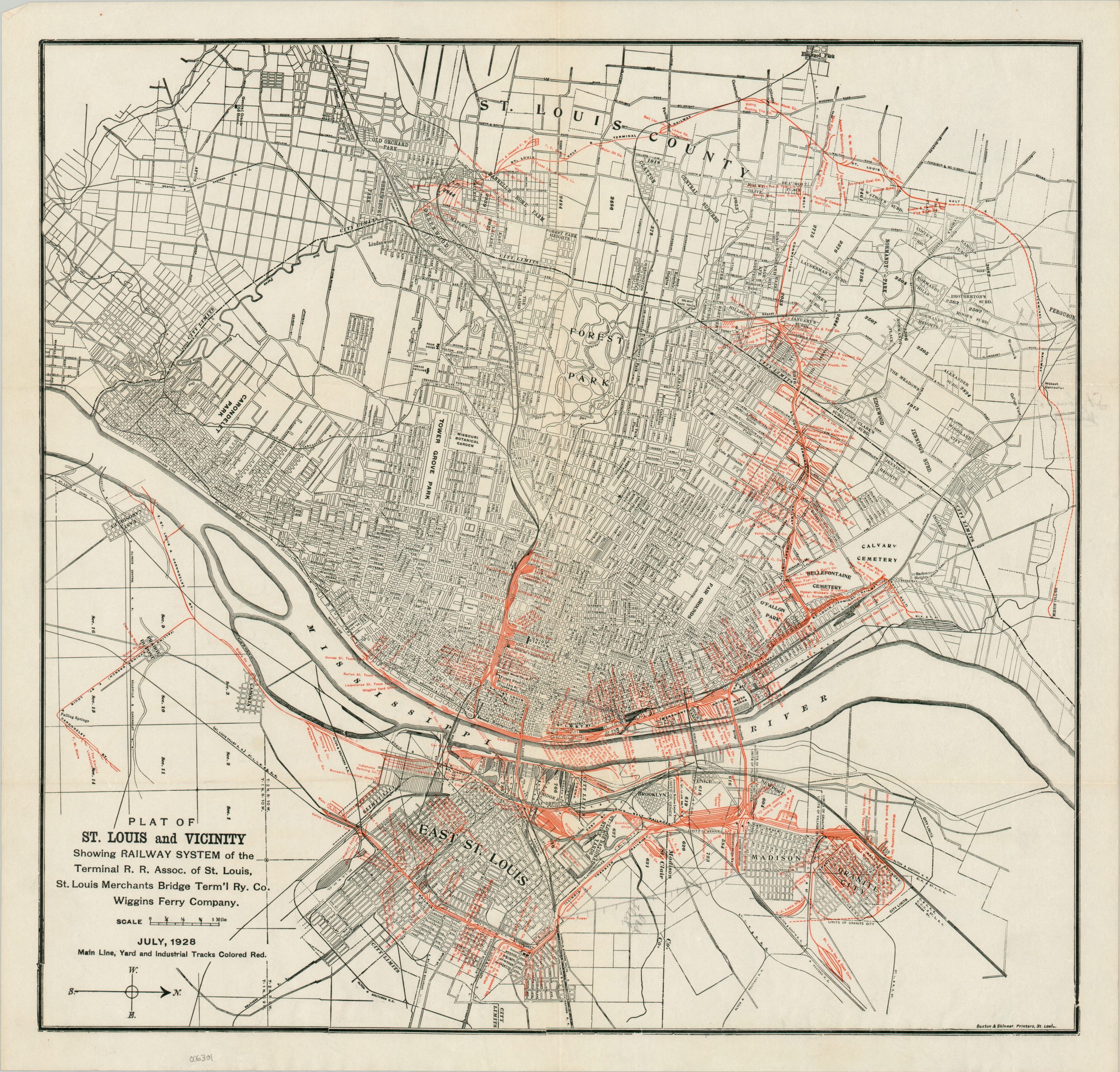
Plat of St. Louis and Vicinity Showing Railway System of the Terminal R.R. Assoc. of St. Louis, St. Louis Merchants Bridge Term’ Ry. Co. Wiggins Ferry Company.
$225.00
Rail connections across St. Louis during the Roaring 20s.
1 in stock
Description
This detailed street plan of St. Louis and East St. Louis was printed locally in 2918 by the firm of Buxton & Skinner. Red overprinting identifies the operational railway tracks of the Terminal Railroad Association of St. Louis and its subsidiary companies. Miniscule text labels relevant infrastructure like yards, observation towers, depots, and local businesses – particularly those with access to sidings.
The Terminal Railroad Association of St. Louis (TRRA) remains in operation today as a crucial switching railroad in the St. Louis area, co-owned by five major rail companies. Founded in 1889 to optimize freight movement across the Mississippi River, the TRRA now serves over 70 industrial clients and connects with all six Class I railroads reaching St. Louis. Notably, it owns and maintains the two vital rail crossings over the Mississippi River – MacArthur and Merchants bridges.
The map is uncommon, with only one example noted in WorldCat at the Wisconsin Veterans Museum Research Center. Sources: OCLC# 770677089; 1908 edition at James Arsenault here.
Map Details
Publication Date: 1928
Author: Buxton & Skinner
Sheet Width (in): 21.5
Sheet Height (in): 20.6
Condition: A
Condition Description: Printed on thin watermarked paper with soft creasing along old fold lines. Scattered annotations in pencil. Very good condition overall. Blank on verso.
$225.00
1 in stock