Plan of New Orleans
Hand colored map of New Orleans published shortly after the end of the Civil War.
Out of stock
Description
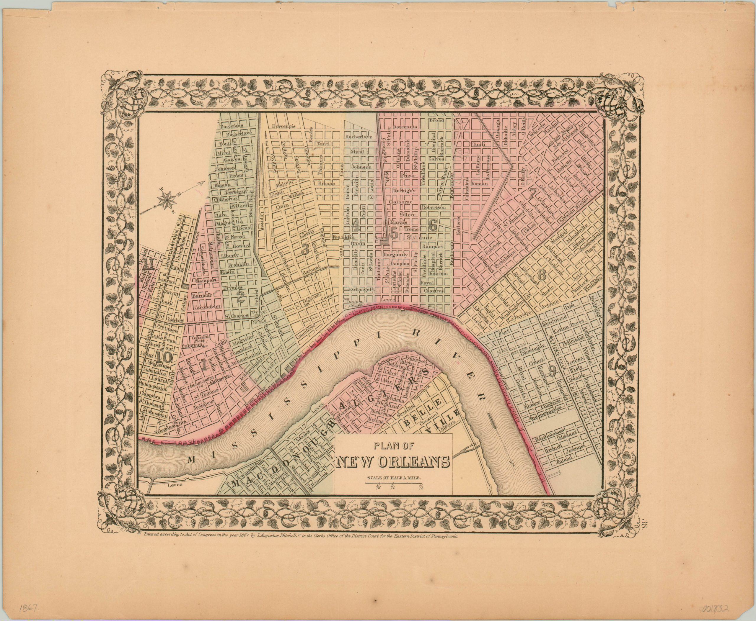
This beautiful map of New Orleans was published in Philadelphia by Samuel Augustus Mitchell in 1867. A compass in the upper left indicates the city is oriented with west at the top, hence the Mississippi River flowing at the bottom of the page.
Bright hand color identifies eleven wards, first established in 1852 and which remain largely the same, with the exception of later additions. Streets and important buildings are individually labeled and several different railroads are noted. The numerous canals, basins, and levees reflect the perennial struggle against the waters of the gulf.
Map Details
Publication Date: 1867
Author: Samuel Augustus Mitchell
Sheet Width (in): 15.25
Sheet Height (in): 12.50
Condition: A-
Condition Description: Moderately toned sheet with a few small spots of foxing in the lower margin, well away from the image. Very good overall.
Out of stock