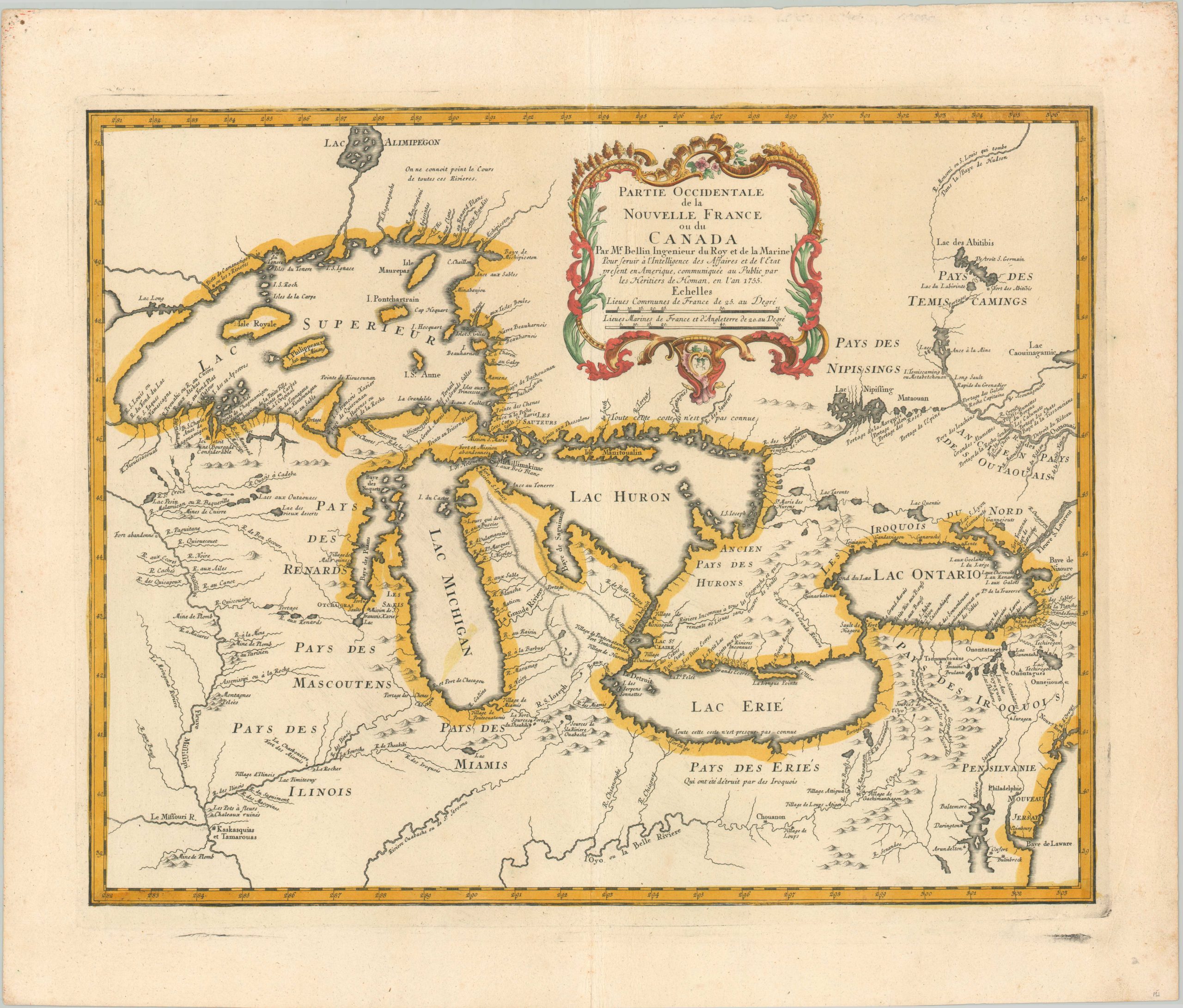
Partie Occidentale de la Nouvelle France ou du Canada
An important map in the history of colonial America and the cartography of the Great Lakes.
Out of stock
Description
This copperplate engraved map purporting to show the western portions of New France and Canada was published in Nuremberg by the Homann Heirs in 1755. At the time of publication, France was engaged in a bitter dispute with England over their North American territories known as the French and Indian War. As a result, the map is representative of French political motivations to limit English territorial claims along the Atlantic coast.
The image includes portions of Pennsylvania and New Jersey, both labeled, but the absence of a clear border between New France and New England reflects the opportunity for new lands. Military outposts and forts, Native American villages (sources of vital allied soldiers), and the river system and its portages (primary avenues for transporting troops) are also emphasized throughout.
Apart from functioning as a propaganda tool, the map also provides one of the most accurate geographic overviews of the region from the 18th century. Bellin is credited with provided the first substantive cartographic updates to the Great Lakes since Delisle’s landmark 1718 map. Notably, he incorporated details from the explorations of Father Pierre de Charlevoix and one of the last French voyageurs, Sieur de la Vérendrye. Though Bellin made every attempt to present verified information, the phantom islands found in Lake Superior would persist on maps into the early 19th century.
Sources: Schwartz & Ehrenberg pl. 97, Heidenreich & Dahl, ‘The French Mapping of North America’, The Map Collector, issue 19, Karpinski p. 138
Map Details
Publication Date: 1755
Author: Homann Heirs
Sheet Width (in): 24.6
Sheet Height (in): 20.8
Condition: A-
Condition Description: Copperplate engraved map with a dark impression on a strong sheet. Nice modern color, though some paint has smudged in Lake Michigan. The sheet has been flattened, with the centerfold reinforced on the verso with archival tape. Some darkening from the plate strike visible in the margins. Some faint smudging also visible in Lake Michigan and Lake Ontario. Overall in very good condition. Blank on verso.
Out of stock