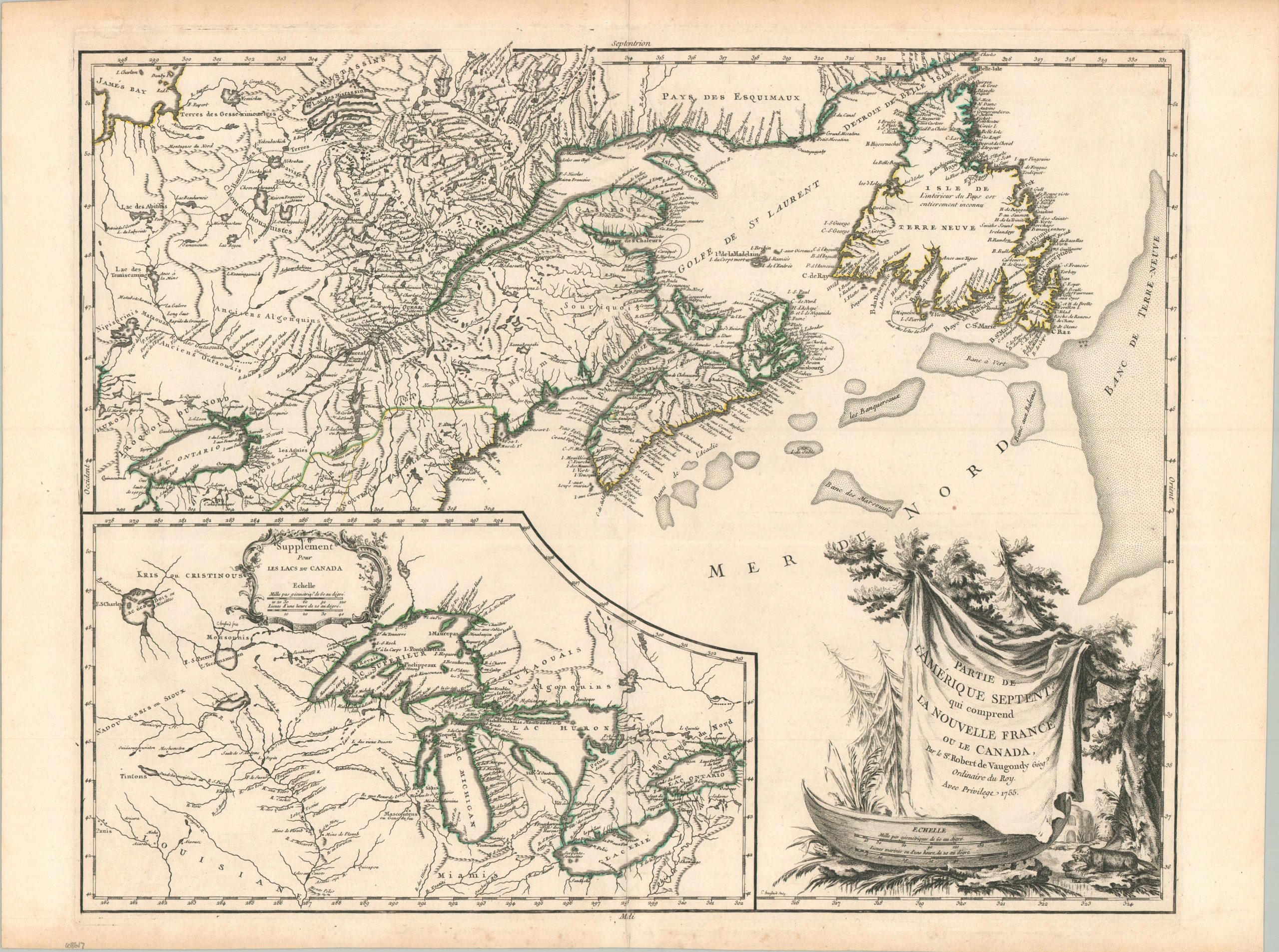
Partie De L’Amerique Septent. Qui comprend La Nouvelle France ou Le Canada
$650.00
Mid-18th century look at France’s colonial possessions in the New World.
1 in stock
Description
Based on the earlier regional cartography by Jacques Nicholas Bellin, this map is an important milestone in the cartography of French territorial claims in colonial America. The primary image is focused on the St. Lawrence River and northeastern Canada, including Newfoundland and the Grand Banks, but a large inset map of the Great Lakes has also been provided in the lower left. This latter map extends east to the Lake of the Woods and includes the mythical River of the West, flowing off the left side of the page – presumably to link up with the Pacific via a Northwest Passage. The sheet also features a large decorative cartouche with an interesting depiction of a beaver and what appears to be indigenous huts.
The image was originally engraved by Catherine Haussard, one of the handful of female 18th-century engravers active in Paris, and published in 1755 by Robert de Vaugondy. This is the second state, featuring a dotted border along the 45th parallel separating adjacent English claims and a labeled James Bay at the extreme upper left. Three further editions would be published by Vaugondy’s successor, Delamarche, until 1784 – reflecting the importance of the image and its lasting impact on the region’s cartography in the 18th century.
Source: Bel et Utile by Mary Sponberg Pedley # 459.
Map Details
Publication Date: 1755
Author: Robert de Vaugondy
Sheet Width (in): 27.00
Sheet Height (in): 20.10
Condition: A-
Condition Description: Crisp impression on a strong sheet of watermarked paper. Original outline color. Minor toning in the margins, two tiny spots in the upper right, with faint foxing along the lower edge of the sheet. Very good condition overall.
$650.00
1 in stock