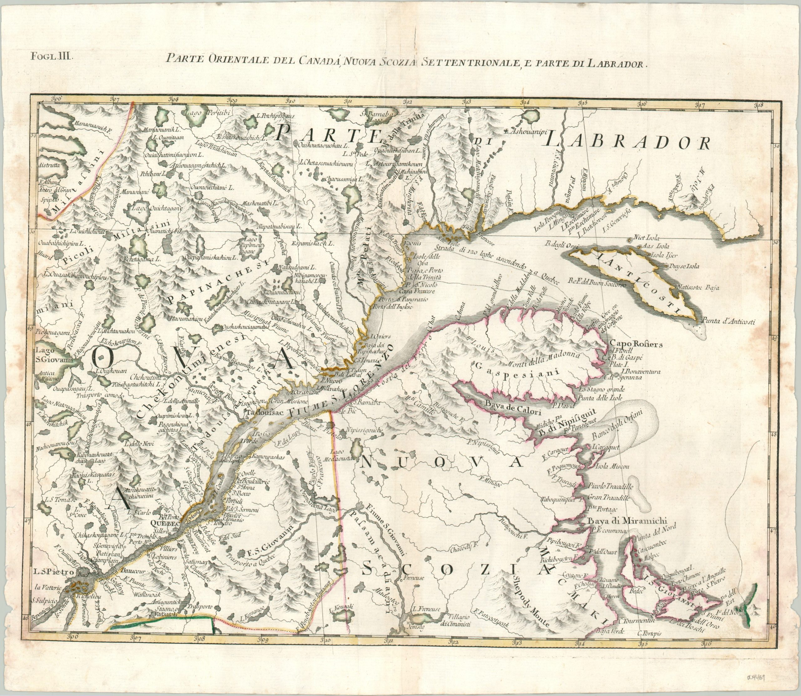
Parte Orientale del Canada, Nuova Scozia Settentrionale, e Parte di Labrador
$275.00
The entrance to the St. Lawrence River during the American Revolutionary War.
1 in stock
Description
This eye-catching copperplate engraved map shows a large territory on either side of the mouth of the St. Lawrence River. The waterway was one of the key entrances into the North American continent during its colonial period and the region was hotly contested between the future ambitions of France and Britain.
A fascinating variety of place names and locations of interest are labeled using a mix of indigenous and European toponyms; including frontier forts, Native American villages, geographic features, and Jesuit missions. Quebec City is featured prominently in the lower left, and the course of the river continues to modern-day Trois-Rivieres. Topography is depicted pictorially – the named mountains were likely more helpful as coastal references than as landmarks for terrestrial navigation.
The map was issued in Venice in 1779 by Antonio Zatta for his Atlante Novissimo. Included in the atlas were twelve sheets covering the United States, based on Mitchell’s Map of North America, but featuring many geographical updates by Zatta.
Map Details
Publication Date: c. 1779
Author: Antonio Zatta
Sheet Width (in): 17.3
Sheet Height (in): 14.9
Condition: B
Condition Description: Moderate to heavy wear visible along the edges of the sheet, including several areas of discoloration, small chips in the right margin, and a few tears in the title block that have been repaired on the verso with archival tape. Some faint discoloration and small tears (repaired on verso) along the vertical centerfold. About good condition, with original outline color.
$275.00
1 in stock

