Official National Highway 20 Association Map
$100.00
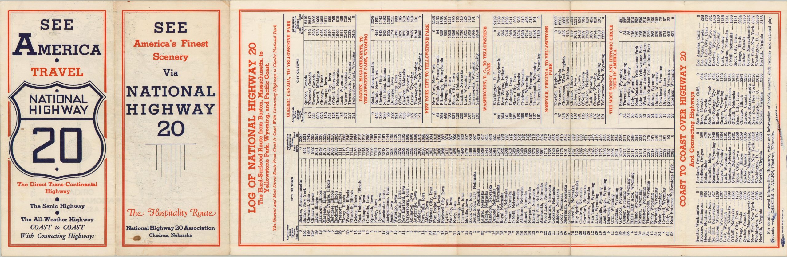
“SEE America’s Finest Scenery via National Highway 20”
1 in stock
Description
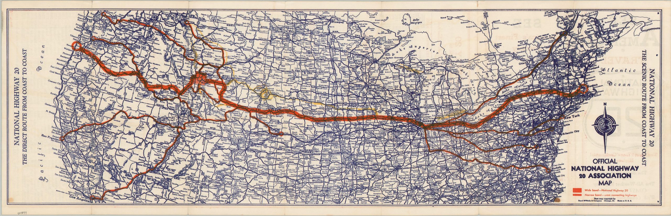
This interesting map brochure was issued in the early 1940s, before the advent of the National Interstate System, but during a period when motorists had increasingly diverse options for long transcontinental trips. U.S. Highway 20 was one of several available routes connecting coast to coast (Boston to Newport, in this case), with the added bonus of going through Chicago and Yellowstone National Park. Favorable weather, scenery, and hospitality are also mentioned as beneficial factors. The promoted route is shown in bold red on the map, with several important connecting highways noted with smaller red lines. An additional path, colored in yellow, was presumably applied by a previous owner.
The base map was copyrighted by Rand McNally of Chicago. Published around 1941 by the Prairie Publishing Company. Issued by the National Highway 20 Association of Chadron, Nebraska.
Map Details
Publication Date: c. 1940
Author: Rand McNally & Company
Sheet Width (in): 28.00
Sheet Height (in): 9.10
Condition: B+
Condition Description: Double-sided brochure with minor wear along original folds. Spotting on the front cover shows through in the lower corners. Yellow pencil marks, applied by hand, note an alternate route. Good condition overall.
$100.00
1 in stock