
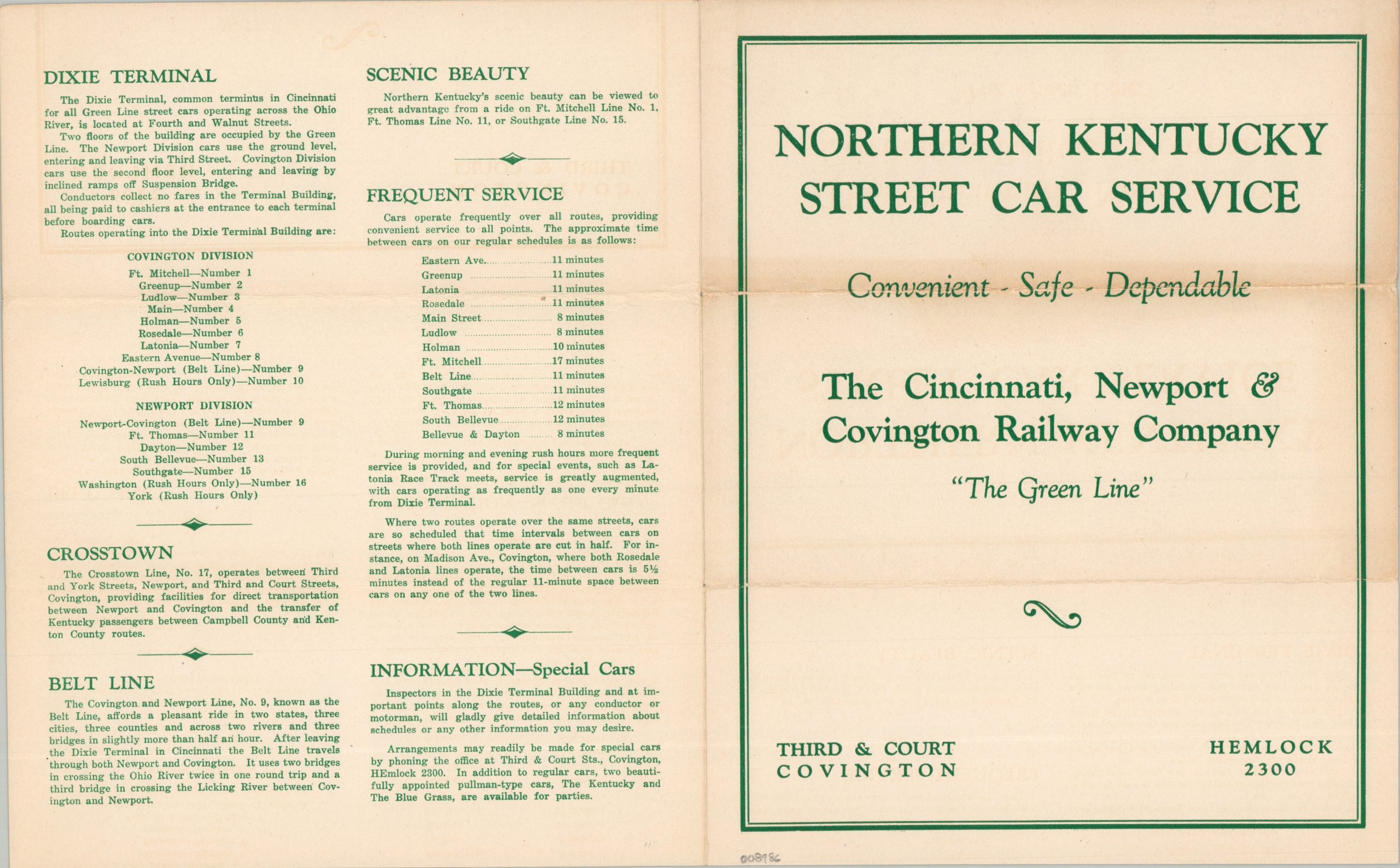
Northern Kentucky Street Car Service
$225.00
The Green Line’ – Convenient – Safe – Dependable
1 in stock
Description
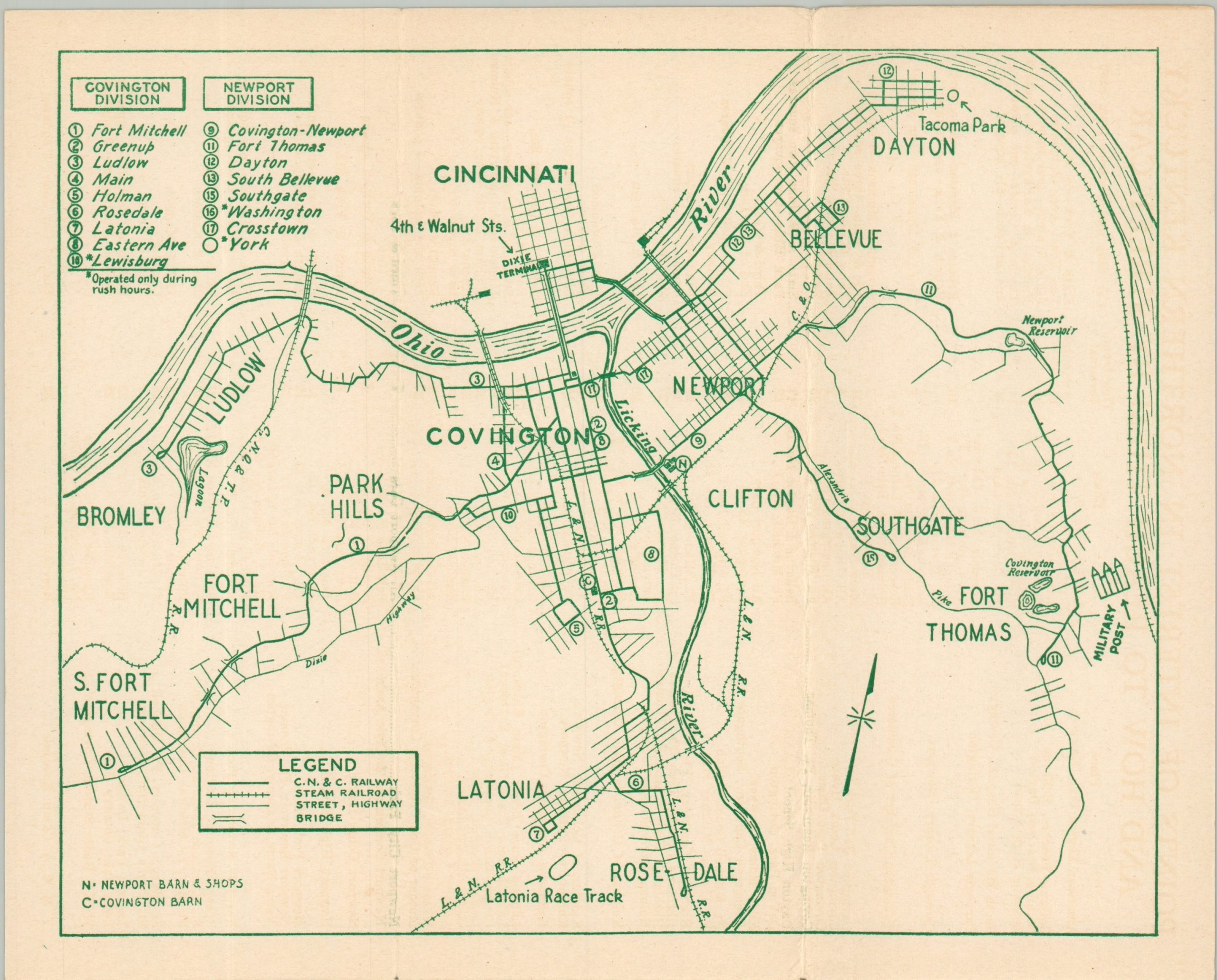
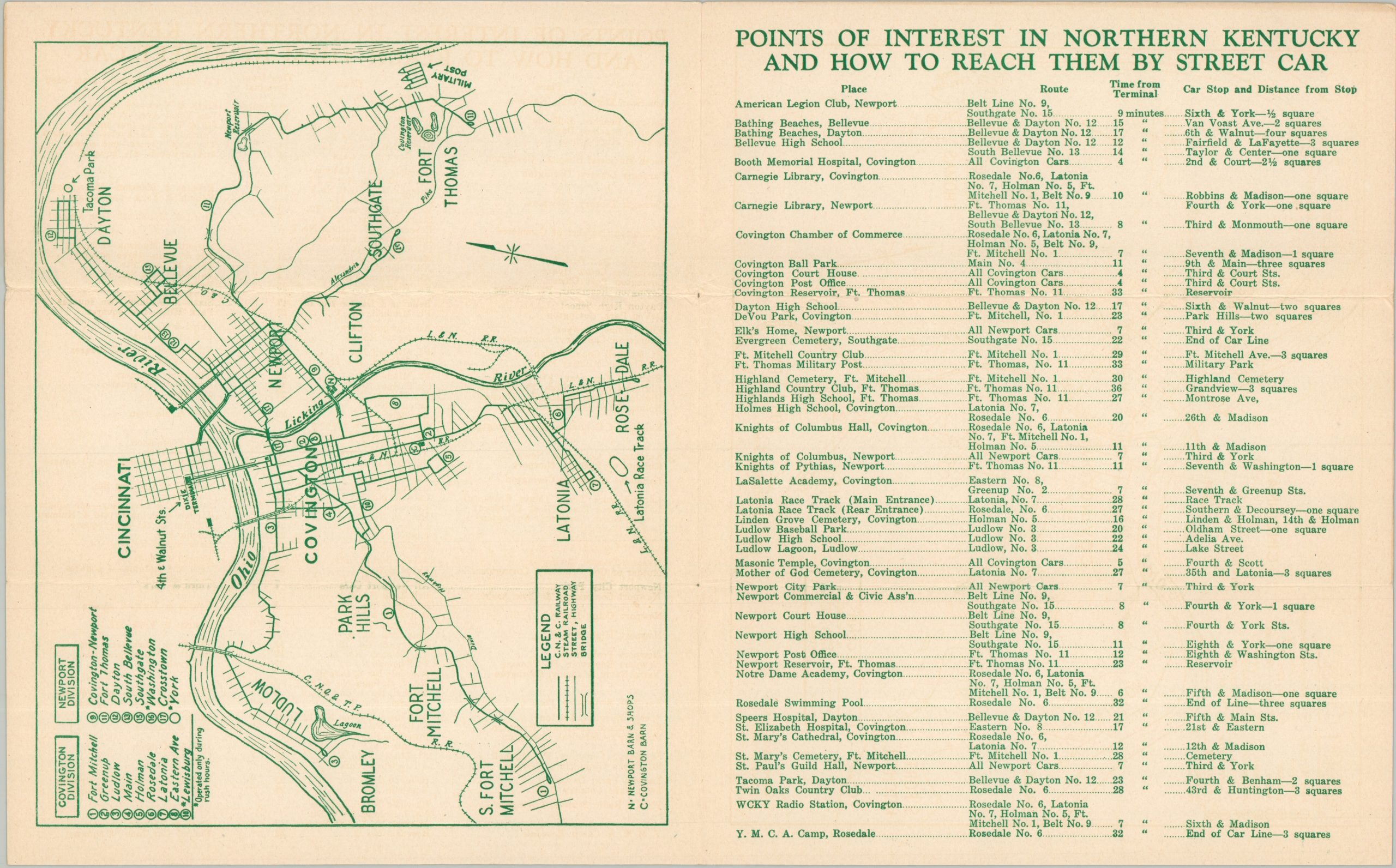
This ephemeral guide to the Cincinnati, Newport & Covington Railway Company shows the ‘Green Line’ network near its operational zenith. The leaflet opens to show a straightforward map of the entire system, connecting various northern Kentucky suburbs to downtown Cincinnati after crossing the Ohio River. Lines are broken into the Covington and Newport Divisions, with various numbered routes ending at the Dixie Terminal at 4th & Walnut. Over two dozen points of interest and their respective streetcar numbers are listed on the opposite page. Further information on special cars, service frequency, the Belt Line, etc. can be found on the back page.
The Cincinnati, Newport & Covington Railway Company was organized in 1892 through the consolidation of several smaller street railway companies. It served as the principal streetcar and local transit operator serving Northern Kentucky and its connections to Cincinnati until the mid-20th century. The Dixie Terminal was completed in 1921 and buses were first introduced in 1936, providing a publication window for the otherwise undated piece.
Map Details
Publication Date: c. 1930
Author: The Cincinnati, Newport & Covington Railway Company
Sheet Width (in): 8.00
Sheet Height (in): 10.00
Condition: B+
Condition Description: Four page circular with a single-page map, folded into thirds. Moderate wear along folds, including some toning present on the front page. Good condition overall.
$225.00
1 in stock