North America: Sheet IX Parts of Missouri, Illinois and Indiana
$75.00
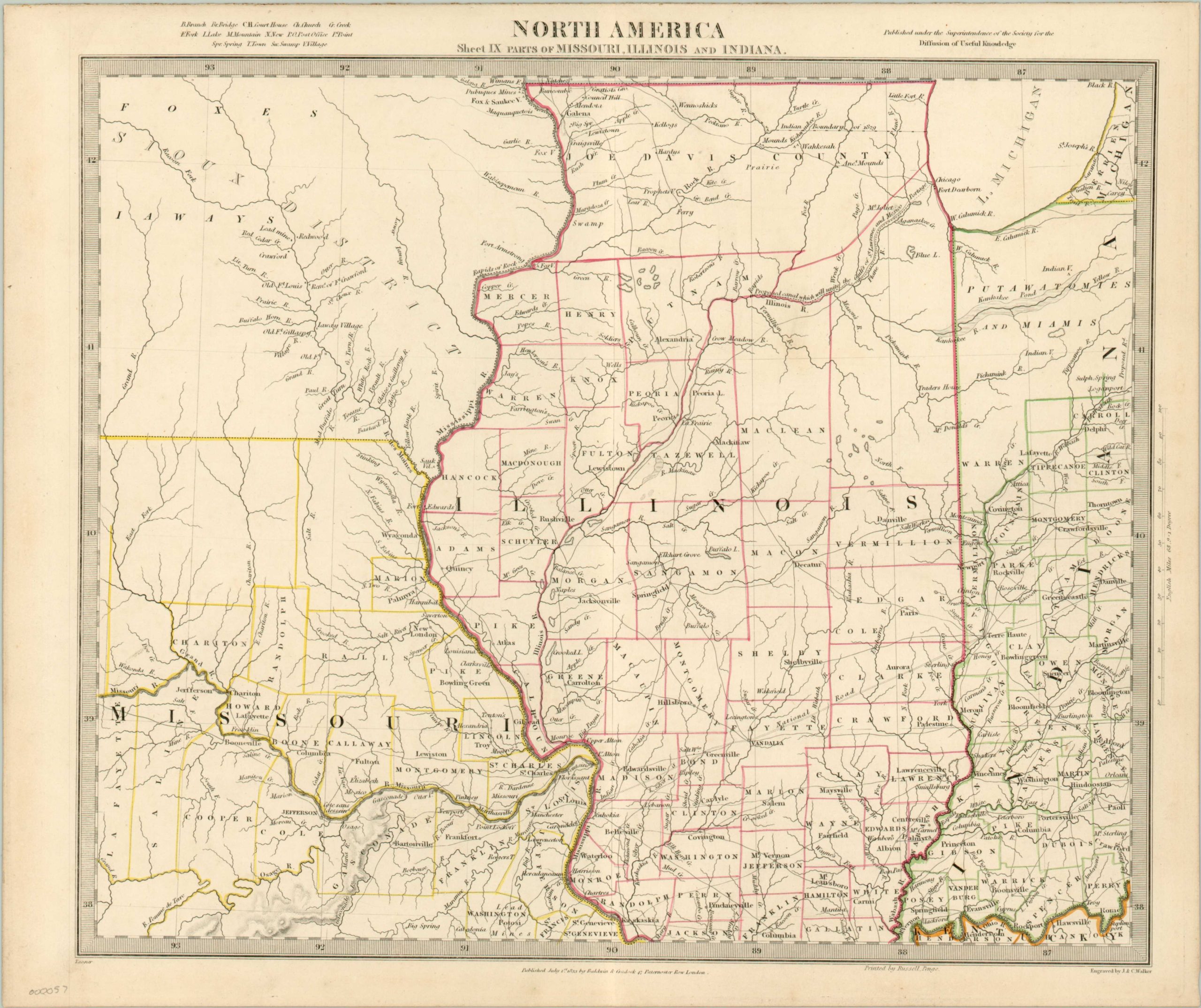
A beautiful 1833 map of the Midwest (then considered the Western states), issued by the Society for the Diffusion of Useful Knowledge.
Description
This map covers parts of modern day Iowa (labeled as the Sioux District), Illinois, Missouri and Indiana from Lake Michigan to the Kentucky Border. Depicts a very early county configuration, including an enormous Joe Davis County in northern Illinois. Topographical details such as swamps, creeks and mountains are listed in the legend alongside labels for towns, court houses, churches and post offices. The map is particularly interesting and important due to its portrayal of the rapidly changing American Indian situation. Several Indian tribes are identified, including the Sioux, Foxes, and others.
Published in 1833 by Baldwin and Cradock of Paternoster Row for the S.D.U.K., which was an organization founded the previous decade and dedicated to inexpensive publications for the general, self-educated public. Although the Society formally closed its doors in 1848, subsequent reissues of the S.D.U.K. atlas were printed well into the 1870’s by Chapman and Hall, who acquired the original plates. Also of note is the proposed canal joining the Great Lakes to the Gulf of Mexico, which was completed in 1848 as the Illinois and Michigan Canal.
Map Details
Publication Date: c. 1833
Author: J & C Walker
Sheet Width (in): 16
Sheet Height (in): 13.3
Condition: A
Condition Description: The map is in great condition, with strong original outline color and a clean sheet. A ragged upper edge is the only visible defect.
$75.00