[Mt. Gauro, Italy]
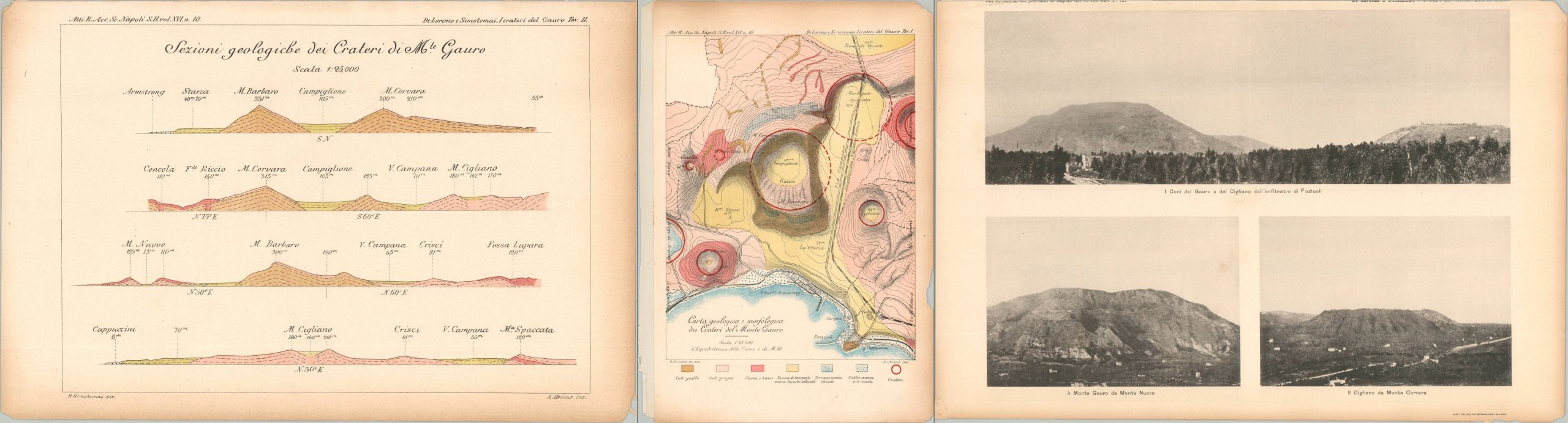
“The only report regarding the Fossa Lupara activity is by De Lorenzo and Simotomai” – Lirer, Petrosino, & Alberico (2001).
Out of stock
![[Mt. Gauro, Italy] - Image 2](https://curtiswrightmaps.com/wp-content/uploads/map_8.59x12.91_08-19-25_inv007438c-scaled.jpg)
![[Mt. Gauro, Italy] - Image 3](https://curtiswrightmaps.com/wp-content/uploads/map_8.87x13.04_08-19-25_inv007438c-scaled.jpg)
![[Mt. Gauro, Italy] - Image 4](https://curtiswrightmaps.com/wp-content/uploads/map_9.03x12.91_08-19-25_inv007438c-scaled.jpg)
Description
This trio of plates represents early 20th century research performed by G. DeLorenzo and H. Simotomai on the geology of Italy’s Mt. Gauro (also called Mt. Barbaro). The volcanic peak overlooks the Gulf of Naples, west of the city, and its distinctive crater was caused by an ancient eruption of unknown date. A cross section, topographic map, and photographic views offer a detailed visual overview of the landmark and its geography.
Map Details
Publication Date: c. 1914
Author: G. DeLorenzo and H. Simotomai
Sheet Width (in): 8.5
Sheet Height (in): 12.6
Condition: B
Condition Description: Three printed plates extracted from a report by the Italian Academy of Royal Sciences. Brittle and toned pages, thick cardstock, are heavily worn and chipped in the margins. Binding strip along one edge. About good condition overall.
Out of stock