Mountains & Rivers
$150.00
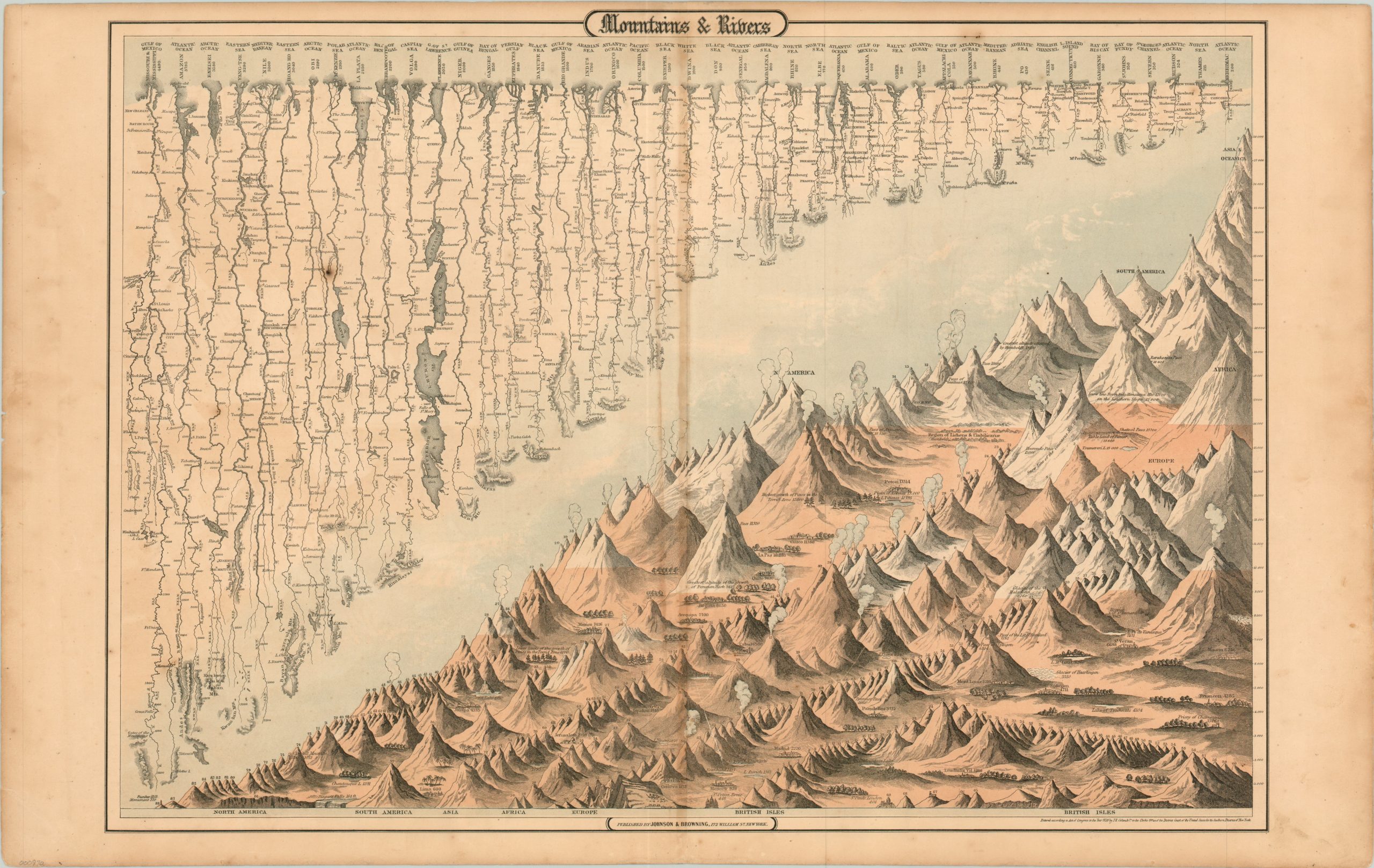
Excellent chart of comparative global geography.
Description
Simply titled “Mountains & Rivers,” this detailed double folio diagram is an early attempt at comparative geography – showing the relationships between natural features across the globe. Along the top of the sheet are 43 charts of the longest rivers in the world; the course of each is shown from source to mouth.
The bottom and right hand side of the sheet are dedicated to depicting the relative height of mountain peaks, cities, and landmarks from across the world. These range in statue from the 220 foot Bunker Hill monument in Boston to the massive summit of Mt. Everest rising to over 28,000 feet. Various points between the two are illustrated, labeled, and organized by general region.
The chart was designed by Joseph Hutchins Colton for inclusion in the Colton firm’s General Atlas. This particular version from the 1859 edition is attributed to the publishing firm of Johnson & Browning.
Map Details
Publication Date: 1859
Author: J.H. Colton
Sheet Width (in): 27.60
Sheet Height (in): 17.40
Condition: B
Condition Description: Moderate soiling in the margins and discoloration along the centerfold. A few small spots of foxing within the image, but overall the sheet is in very good shape.
$150.00