Mount Hope Bridge Bristol, Rhode Island
$250.00
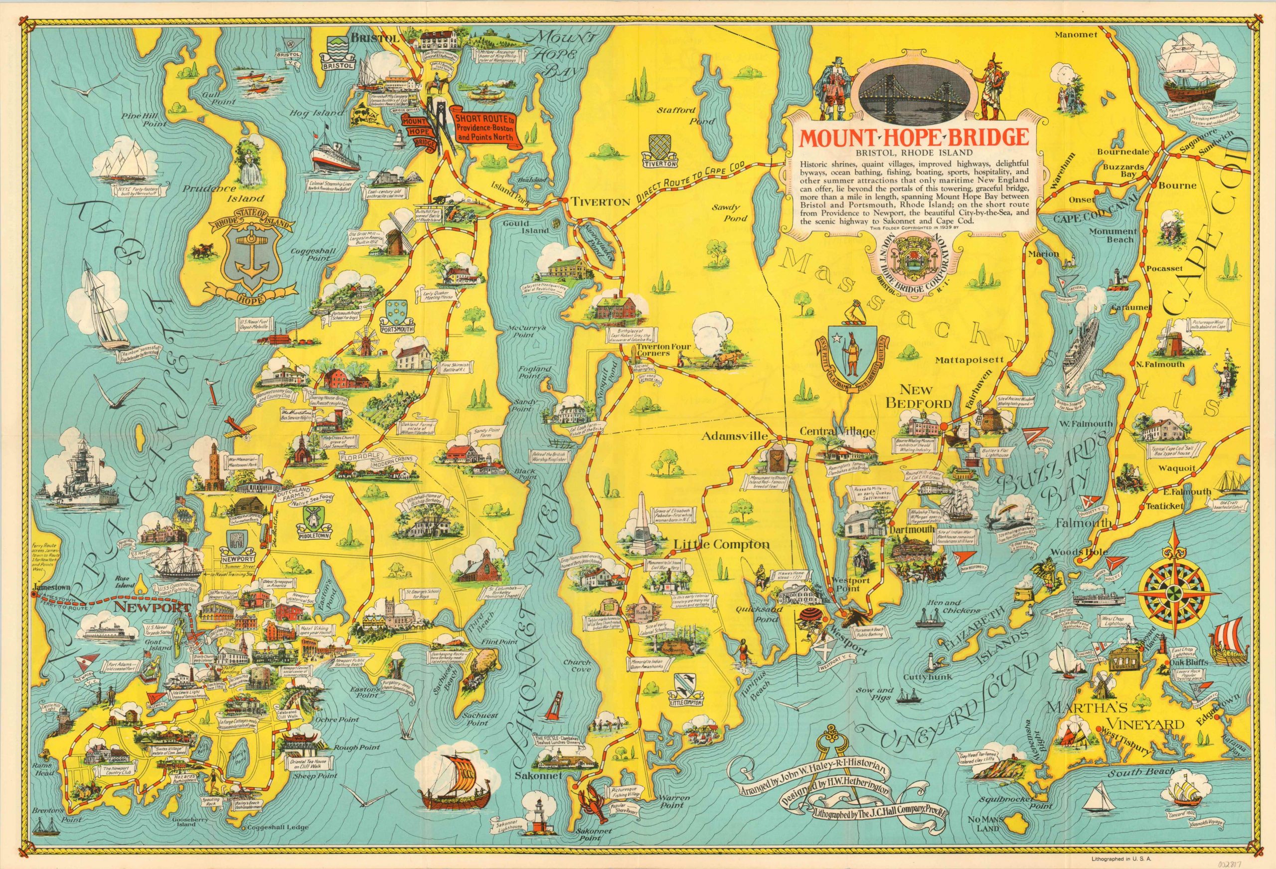
Charming pictorial map of the coastline of Rhode Island and Massachusetts.
1 in stock
Description
This eye-catching pictorial map covers a broad region along the Atlantic seaboard between Newport, Rhode Island and Cape Cod, Massachusetts. The area is known for its rich history and maritime associations; both of which are boldly highlighted with a variety of vignettes and quaint illustrations. Longships to destroyers are shown cruising in the waters of the Atlantic while a variety of notable historic sites and events are labeled within the image.
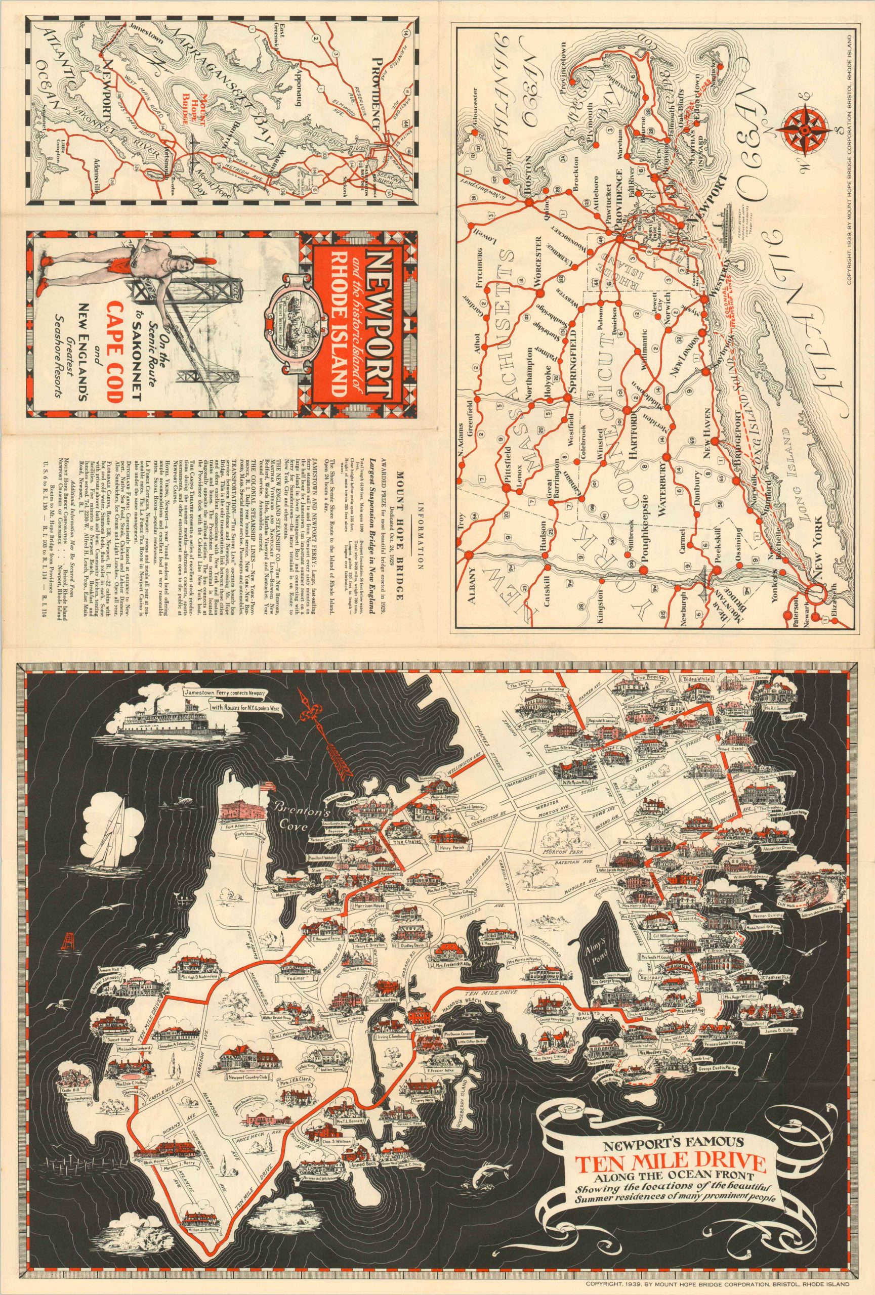
The image was arranged by John Haley, designed by H.W. Hetherington, and lithographed by the J.R. Hall Company on behalf of the Mount Hope Bridge Corporation in 1939. The verso features a lovely pictorial map of Newport’s famous Ten Mile Drive, along with a simplified road map of New England from New York City to Boston.
Map Details
Publication Date: 1939
Author: Mount Hope Bridge Corporation
Sheet Width (in): 26.00
Sheet Height (in): 17.50
Condition: A
Condition Description: Creasing and faint wear along originally issued fold lines. Near fine overall.
$250.00
1 in stock


