Motoring in the Canadian Rockies
$150.00
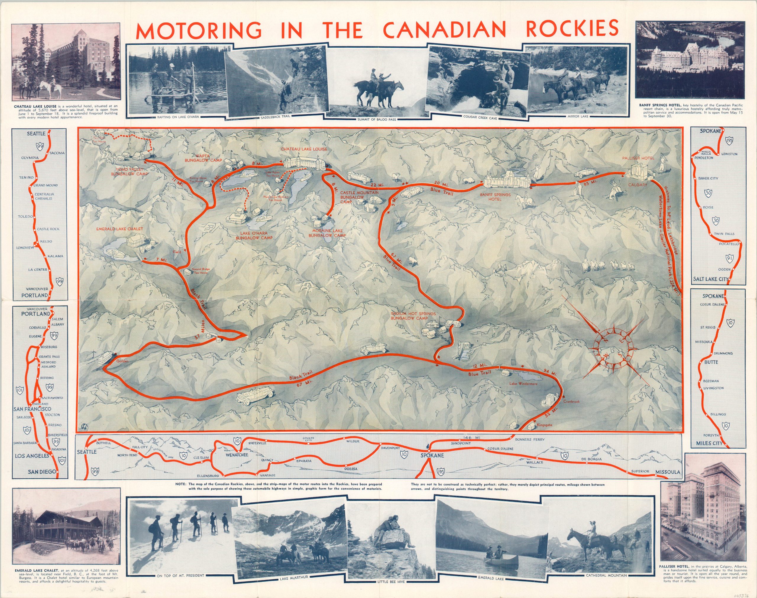
Depression-era driving guide to accommodations across the Canadian Rockies.
1 in stock
Description
This fabulous promotional map provides an eye-catching, if somewhat inaccurate, overview of the various motorist amenities available to travelers across the Canadian Rockies during the Great Depression. The image is oriented with northeast at the top and does not include any scale, allowing for flexibility in distances between points that best fit the limitations of space.
Lavish hotels, bungalow camps, and tea houses, all primarily operated by Canadian Pacific, are represented by charming vignettes. Bright red auto trails connecting each accommodation snake through ambiguous mountain peaks, largely devoid of any defined features apart from a few lakes and small towns. Strip maps surround the primary image, showing primary connections to major cities, primarily in the United States. A second border of photographs showcases the natural beauty, contrasting with the ultra-modern hotels.
Designed and printed by an American firm with the acronym DA, as seen in the lower left and on the verso. Published in 1931 by Canadian Pacific.
Map Details
Publication Date: 1931
Author: DA
Sheet Width (in): 24.25
Sheet Height (in): 19
Condition: A-
Condition Description: Creasing and light wear along originally issued fold lines, including tiny holes at fold intersections. Wear along the outer edges of the sheet and some minor soiling in the lower left, confined to the margin. Very good overall.
$150.00
1 in stock