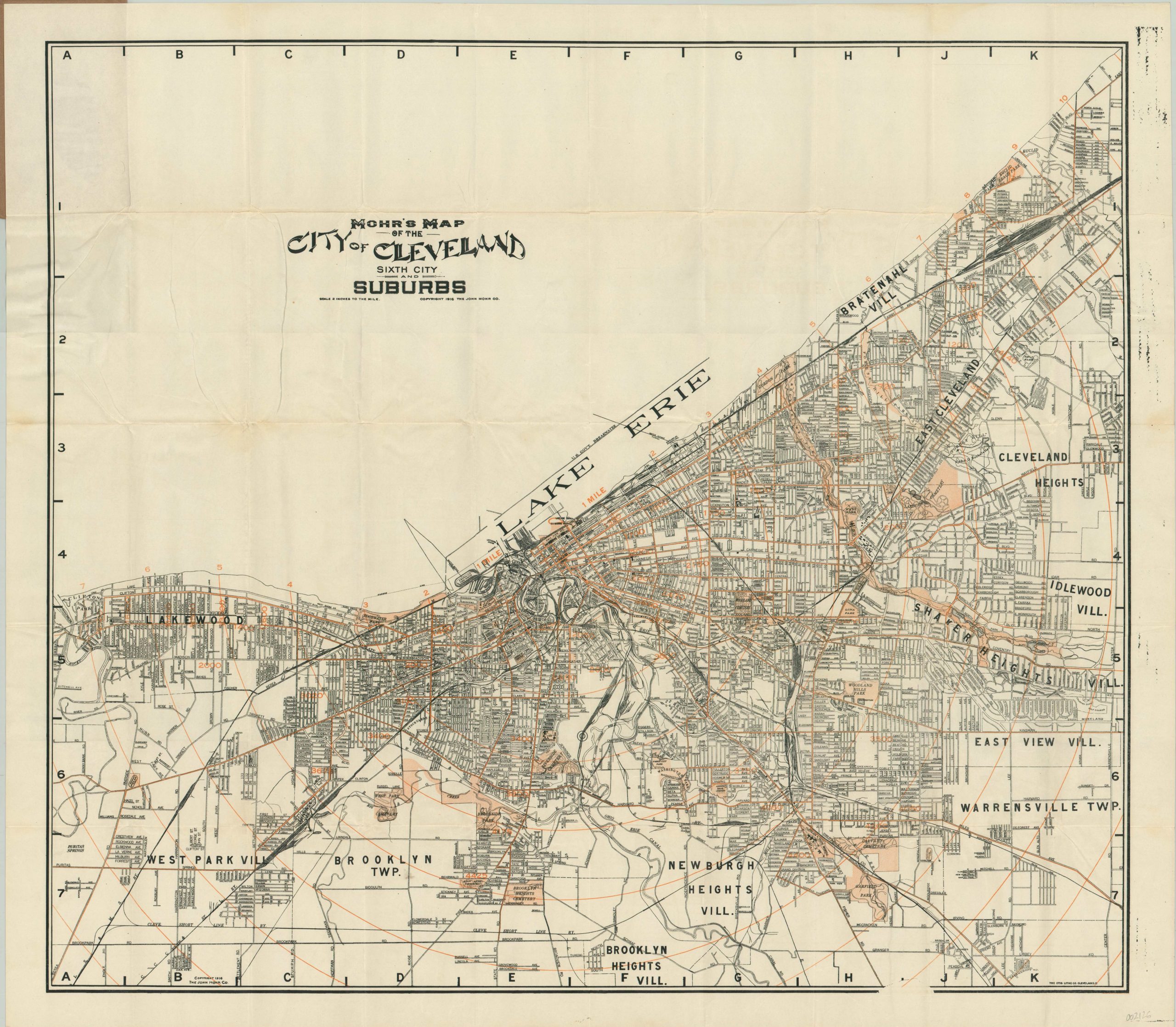
Mohr’s Map of the City of Cleveland Sixth City and Suburbs
$110.00
Detailed pocket map of Cleveland published locally in 1916.
1 in stock
Description
This tremendous pocket map of Cleveland, Ohio was created in 1916 by John Mohr and published by the Otis Lithograph Company. It shows the ‘Sixth City’ (an antiquated nickname based on the city’s population) along the shores of Lake Erie with clarity and legibility. Streets, villages, neighborhoods, and important buildings are individually labeled; while parks, cemeteries, block numbers, and mile-wide concentric circles are highlighted in orange (an interesting side note – all other examples I’ve found use green).
The concentration of rail lines (including inter-urban) is immediately apparent, especially along the lakefront. The map was published during a period of tremendous industrial and cultural growth for the city and reflects new parks (the Cleveland Mall), institutions (Museum of Art), and other attempts at urban beautification.
Map Details
Publication Date: 1916
Author: The John Mohr Co.
Sheet Width (in): 33.50
Sheet Height (in): 30.00
Condition: A-
Condition Description: Pocket map formerly folded into 50 panels. Creasing and faint wear along fold lines, but no image loss and overall the map and original paper covers are in very good shape. The street index affixed to the inside front cover is torn, but present.
$110.00
1 in stock

