
Mohawk-Hobbs Grade and Surface Guide – Pacific Highway Redwood Highway
$175.00
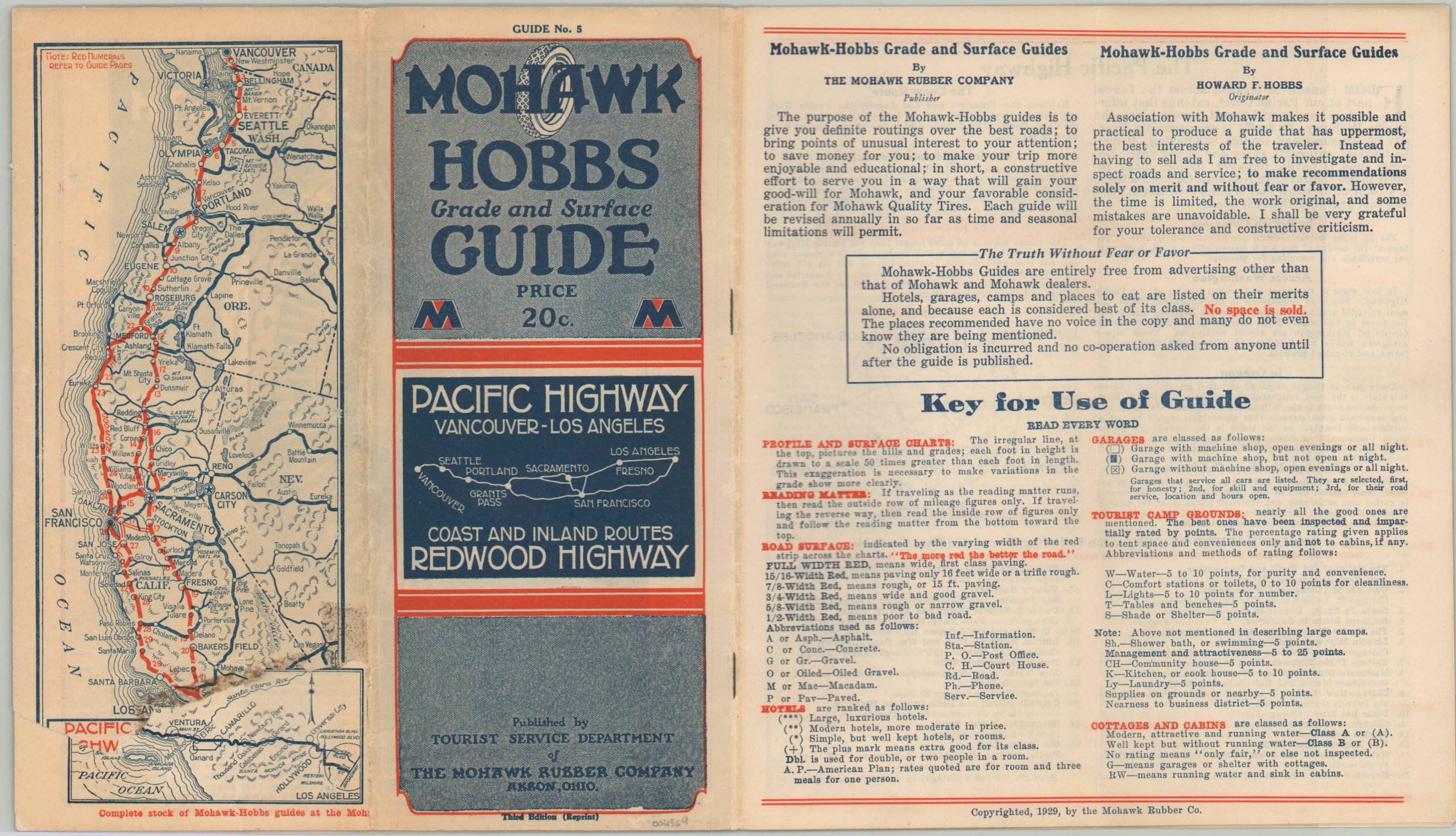
Cruise the West Coast of the U.S. with this innovative road guide from 1929.
1 in stock
Description
“The purpose of the Mohawk-Hobbs guides is to give you definite routings over the best roads; to bring points of unusual interest to your attention; to save money for you; to make your trip more enjoyable and educational; in short, a constructive effort to serve you in a way that will gain your good-will for Mohawk, and your favorable consideration for Mohawk Quality Tires.” [foreword].
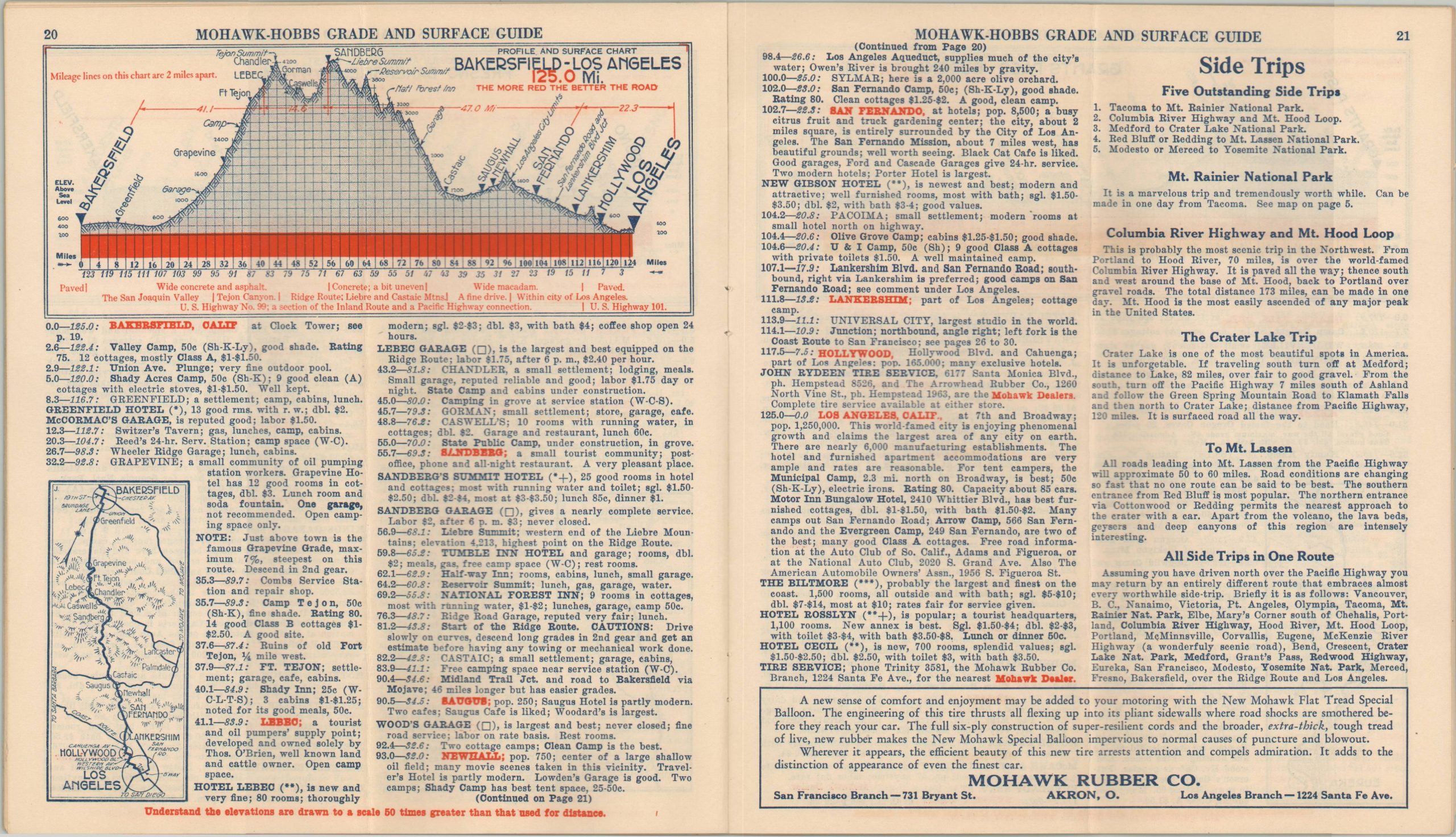
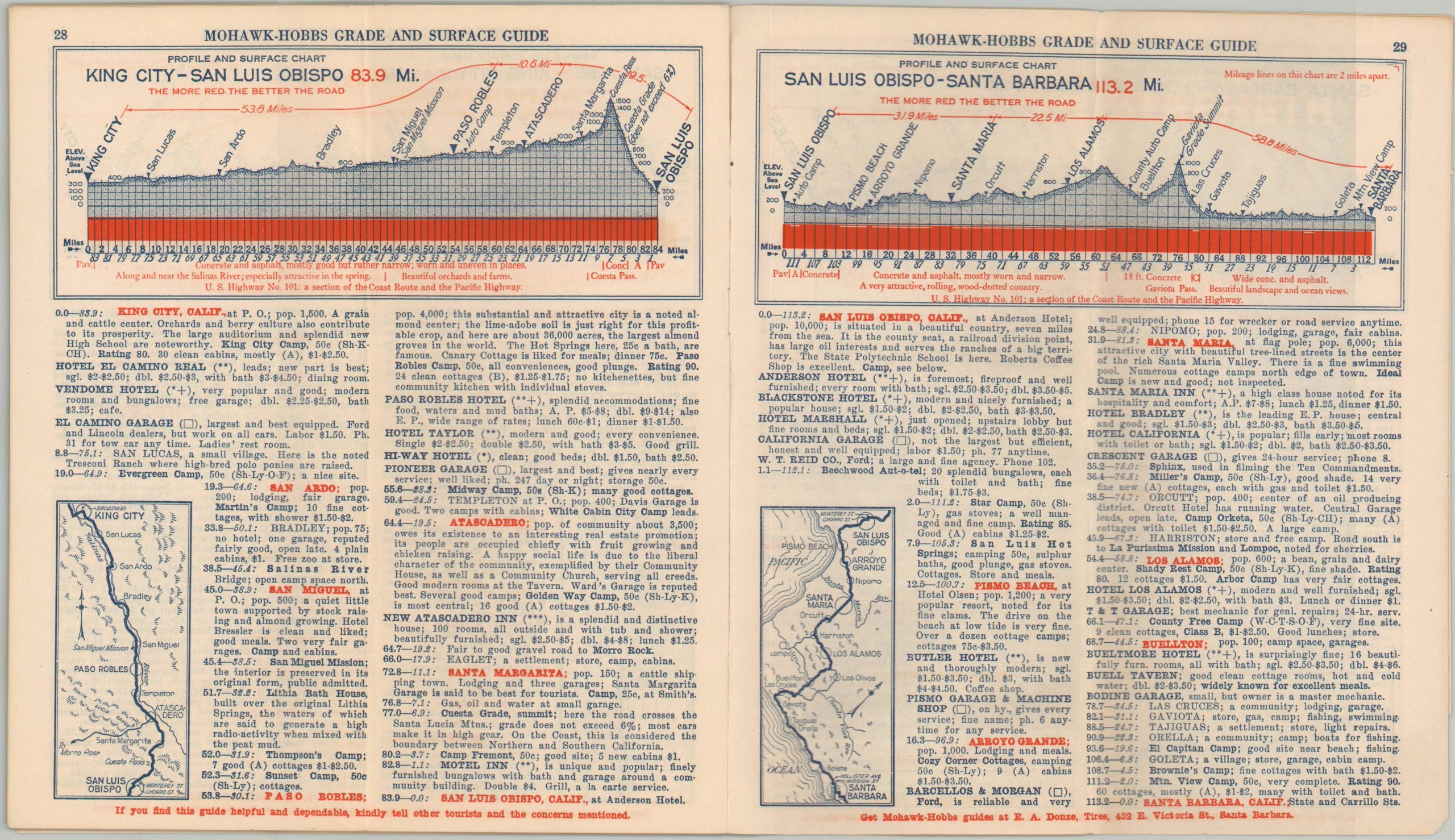
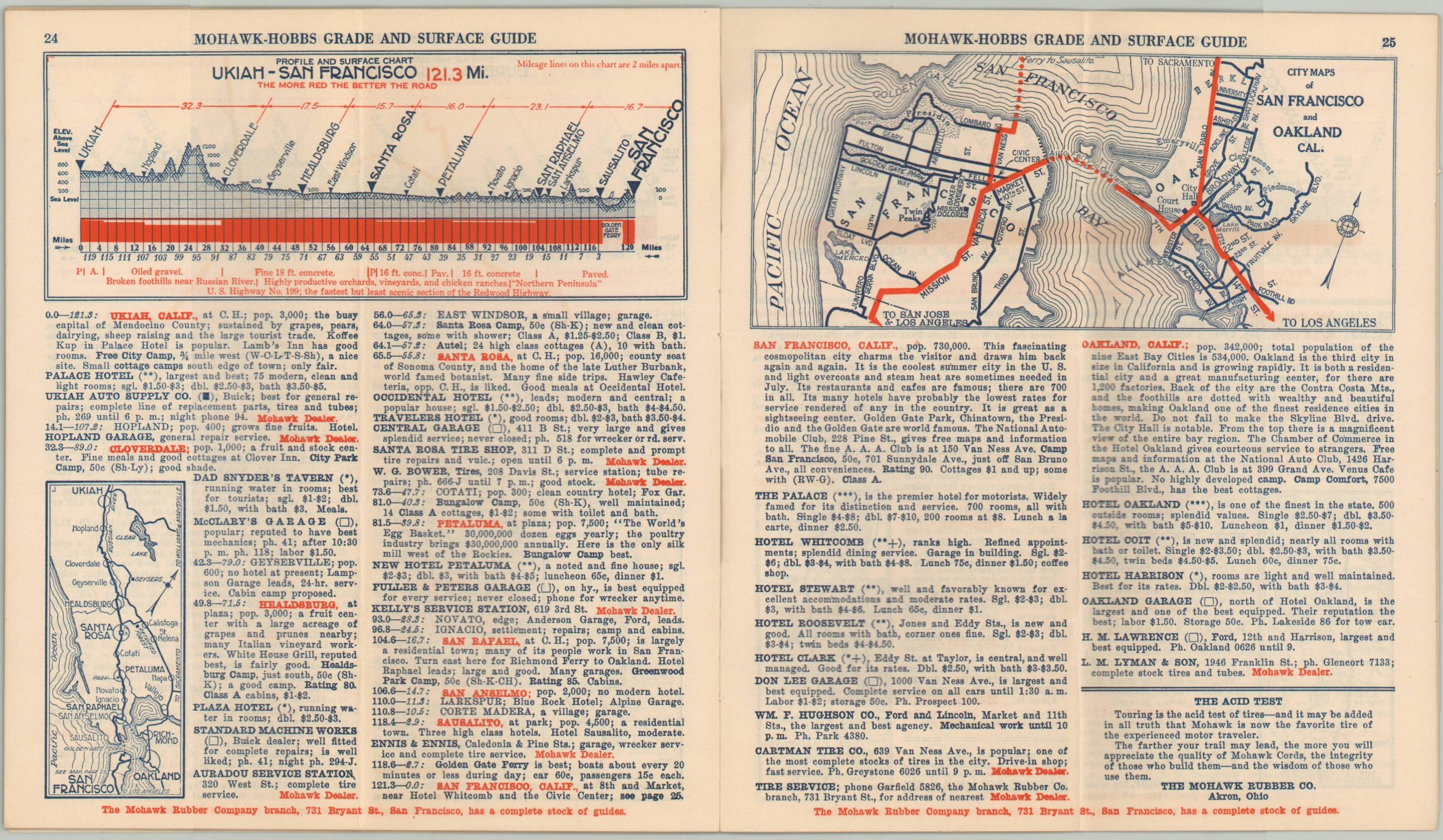
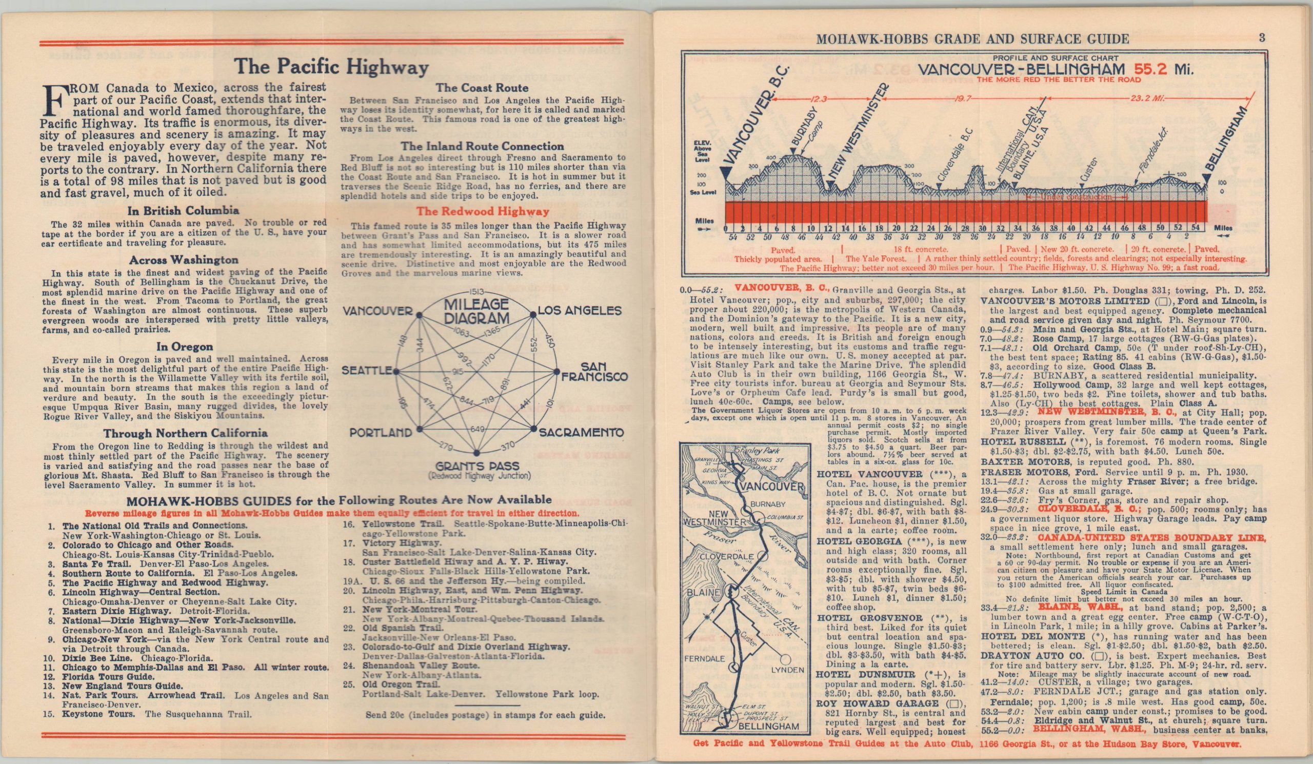
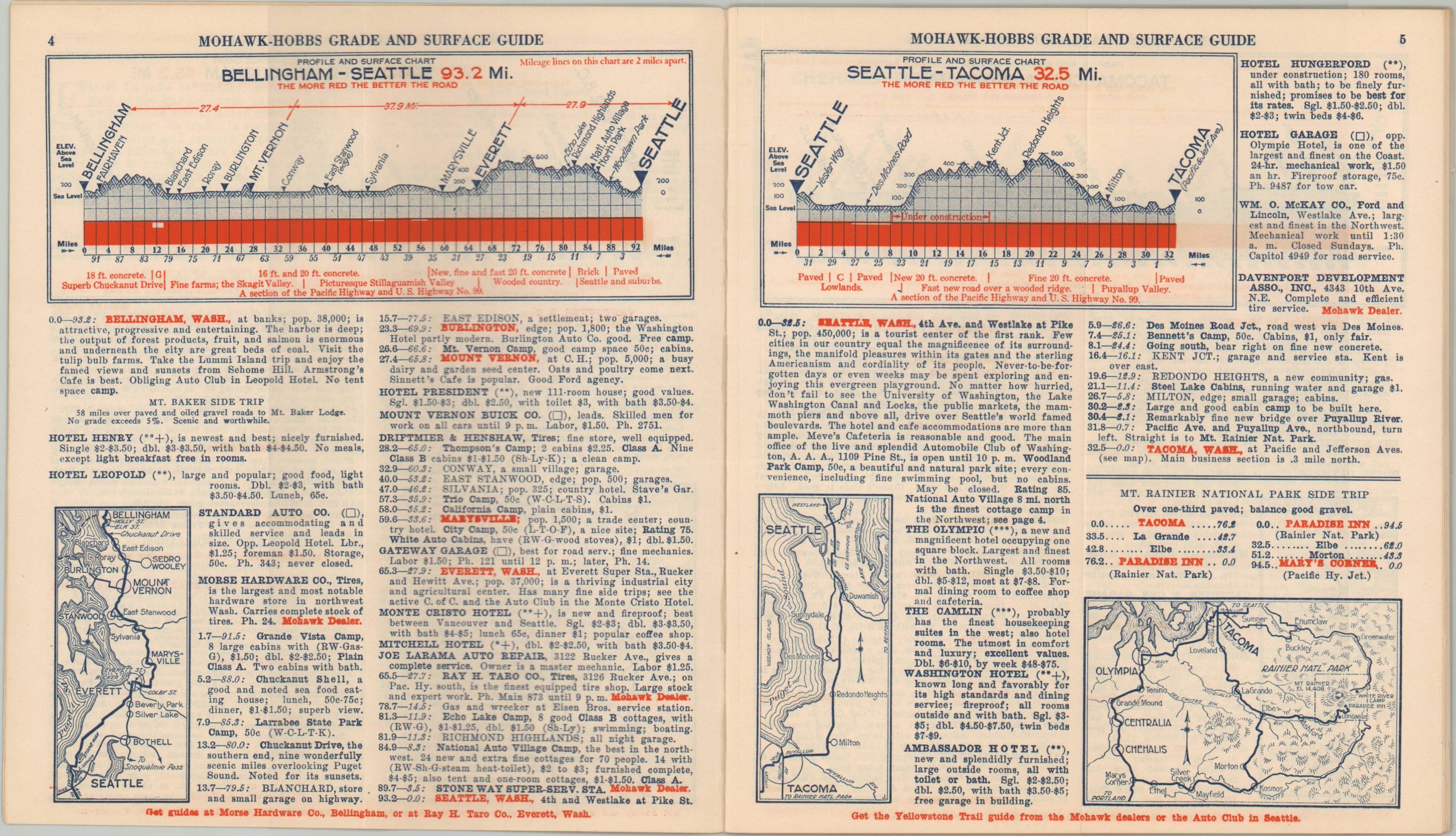
In 1921, Howard Hobbs created his first innovative Hobbs Grade and Surface Guide. Issued on an annual basis until the early 1930s, the booklets were sponsored by the Mohawk Rubber Company of Akron, Ohio and covered one of America’s primary highways. At least 25 different routes were covered in tremendous detail. Each page of the guide presents a detailed diagram of the route’s elevation and surface composition, a small strip map, list of motorist’s amenities (lodging, garages, restaurants, etc.) and ‘intimate notes’ that provide a fascinating contemporary snapshot into automobile tourism of the early 20th century. This example was published in 1929 and shows recommended routes between Los Angeles and Vancouver along the Pacific Coast Highway and Redwood Highway.
In addition to the aforementioned information present on each page, the guide also includes key for use, recommended side trips, street plans of Oakland and San Francisco, a list of published routes, advertisements for Mohawk rubber products, an innovative mileage diagram, and a map of the route on the back panel. Interesting descriptions include that for the Canadian Border (all liquor confiscated), Seattle (Never-to-be-forgotten days or even weeks may be spent exploring), and Salem (the most All-American city), among many others.
More information on the Mohawk-Hobbs Guides can be found at my blog post here.
Map Details
Publication Date: 1929
Author: Howard F. Hobbs
Sheet Width (in): See Description
Sheet Height (in): See Description
Condition: B+
Condition Description: 30 pp. printed brochure with stapled binding and illustrated wraps. Folds over once to a size of approximately 4" x 9". A large tear on the back panel results in the loss of the lower 20% of the route map. Light soiling and wear throughout. Good to very good overall.
$175.00
1 in stock