
Missouri’s Great Lake of the Ozarks
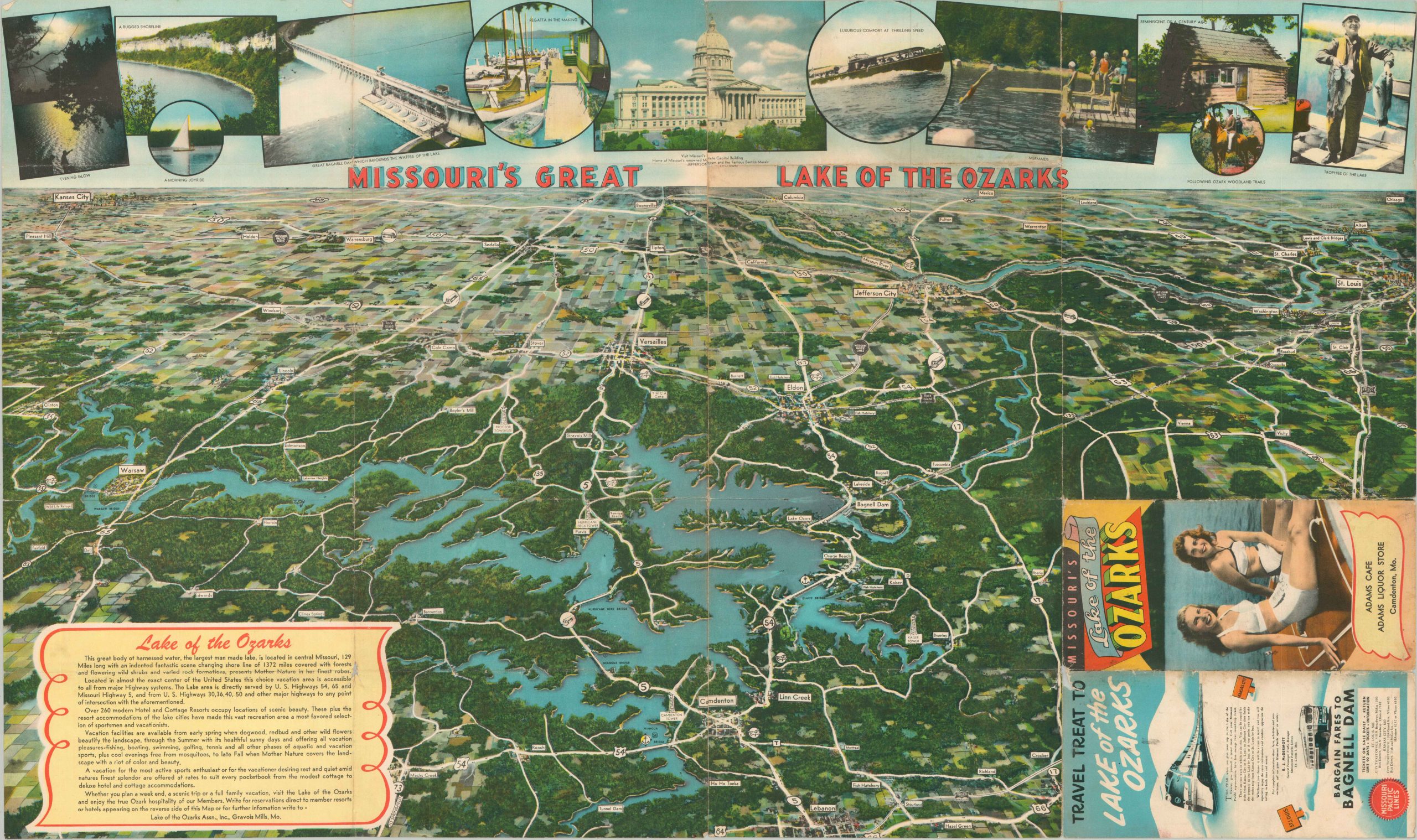
“Mother Nature in her finest robes.” – text, lower left.
Out of stock
Description
Slap on a swimsuit and get ‘made in the shade’ with this fun mid-century map of the Lake of the Ozarks. A beautiful view of the huge man-made lake in central Missouri stretches to the nearby urban centers of St. Louis and Kansas City. Vibrantly colored images at the top of the sheet showcase local attractions and recreational opportunities.
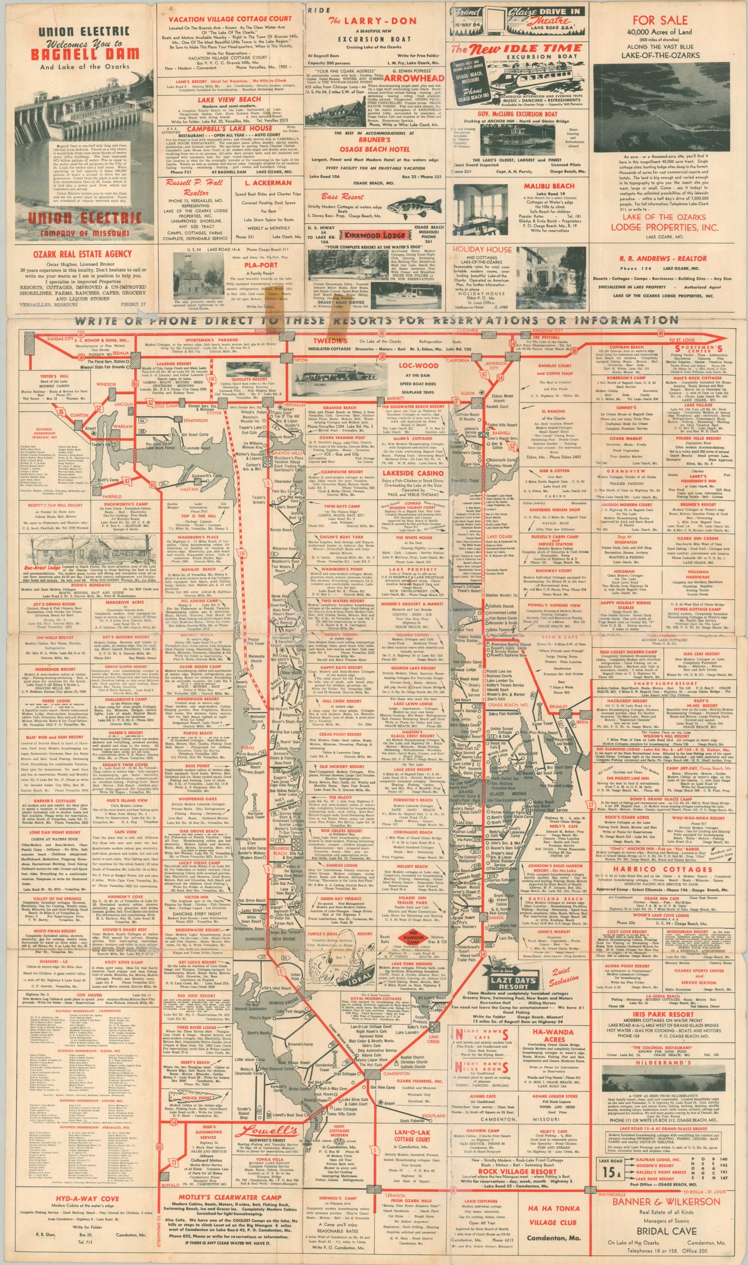
The verso provides a fascinating diagrammatic road map that distills the entire view into a network that’s reminiscent of mass transit. Dozens of advertisements correspond approximately to the business location throughout. The map was issued around 1950 by the Lake of the Ozarks Association, Inc. According to the State Historical Society of Missouri (which dates the map to the late 1940s);
“The Lake of the Ozarks Association worked with local chambers of commerce, resort associations, and individual businesses to promote tourism and trade in the area surrounding the Lake of the Ozarks, including the cities of Camdenton, Versailles, and Eldon.”
Map Details
Publication Date: c. 1950
Author: Lake of the Ozarks Association, Inc.
Sheet Width (in): 34
Sheet Height (in): 20
Condition: B
Condition Description: Double sided brochure, now flattened. Formerly split in half along the centerfold, with numerous other spots of separation along the originally issued fold lines. Heavy archival tape repairs on the verso, but very minimal image loss (see lower left, next to the front panel). Between fair and good condition.
Out of stock