Missouri
$60.00
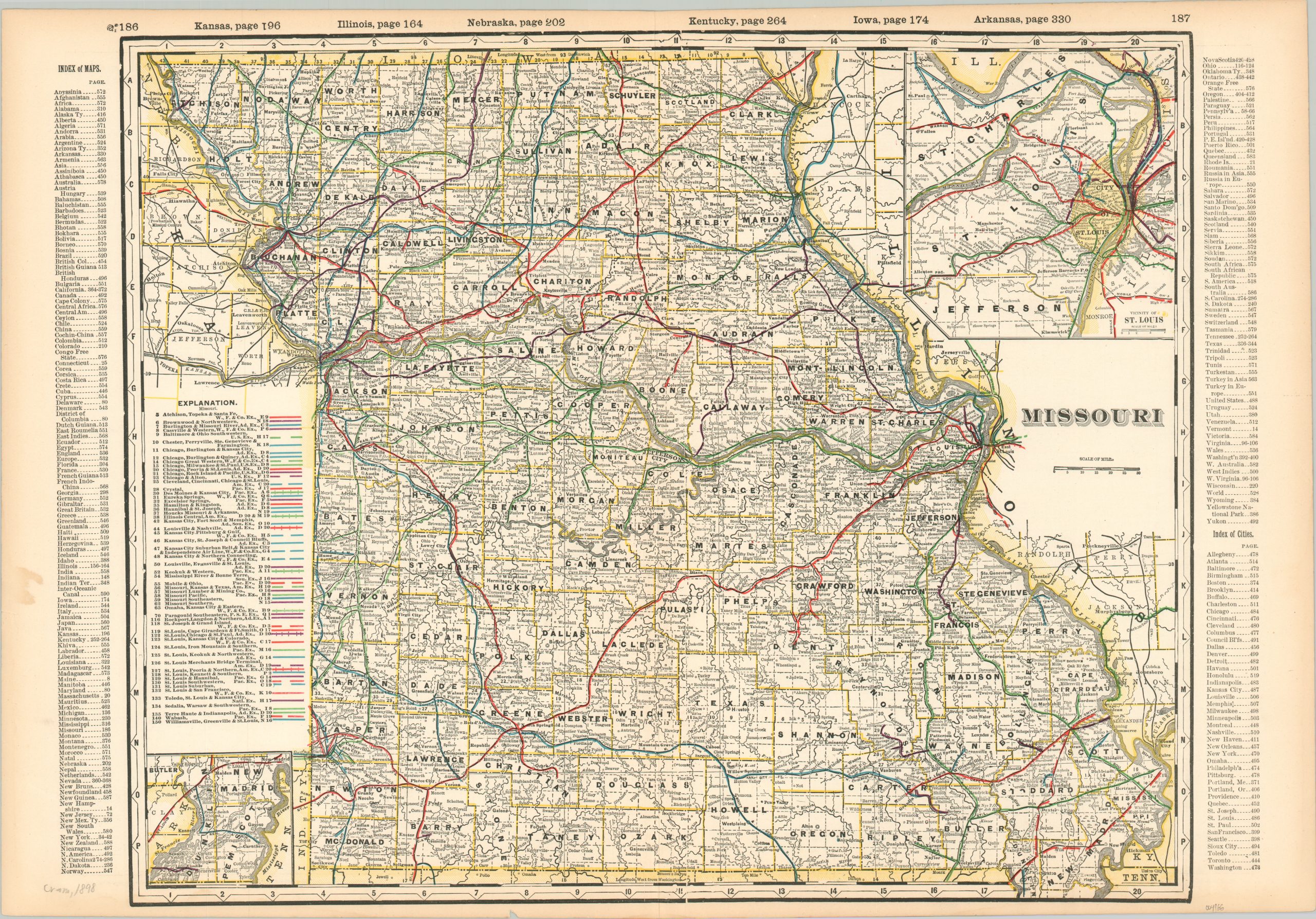
The railroads of Missouri in the late 19th century.
1 in stock
Description
This vibrant celebration of Missouri’s railroad building bonanza was published in Chicago in 1898 by George Cram. The double-page map presents a detailed overview of The Show-Me State’s network of iron rails, stretching from the Mississippi to the Missouri River. Fifty-eight different routes are shown in operation, each noted with a different color and labeled according to the legend on the left-hand side.
The discrepancy in numbering is likely due to the rapid process by which railroad consolidation occurred in the last quarter of the 19th century – having to re-number each line for every printing was too labor-intensive to be cost-effective.
Inset maps show details around the vicinity of St. Louis (upper right) and the southeastern tip of the state (lower left). A comprehensive index of place names from across the state can be found on the verso.
Map Details
Publication Date: 1898
Author: George Cram
Sheet Width (in): 25.5
Sheet Height (in): 17.5
Condition: A-
Condition Description: Quarter sized damp stain in the left margin, away from the image, and some light toning elsewhere in the margins. Very good overall.
$60.00
1 in stock