Michigan State University Campus
Interesting campus plan of Michigan State University in East Lansing.
Out of stock
Description
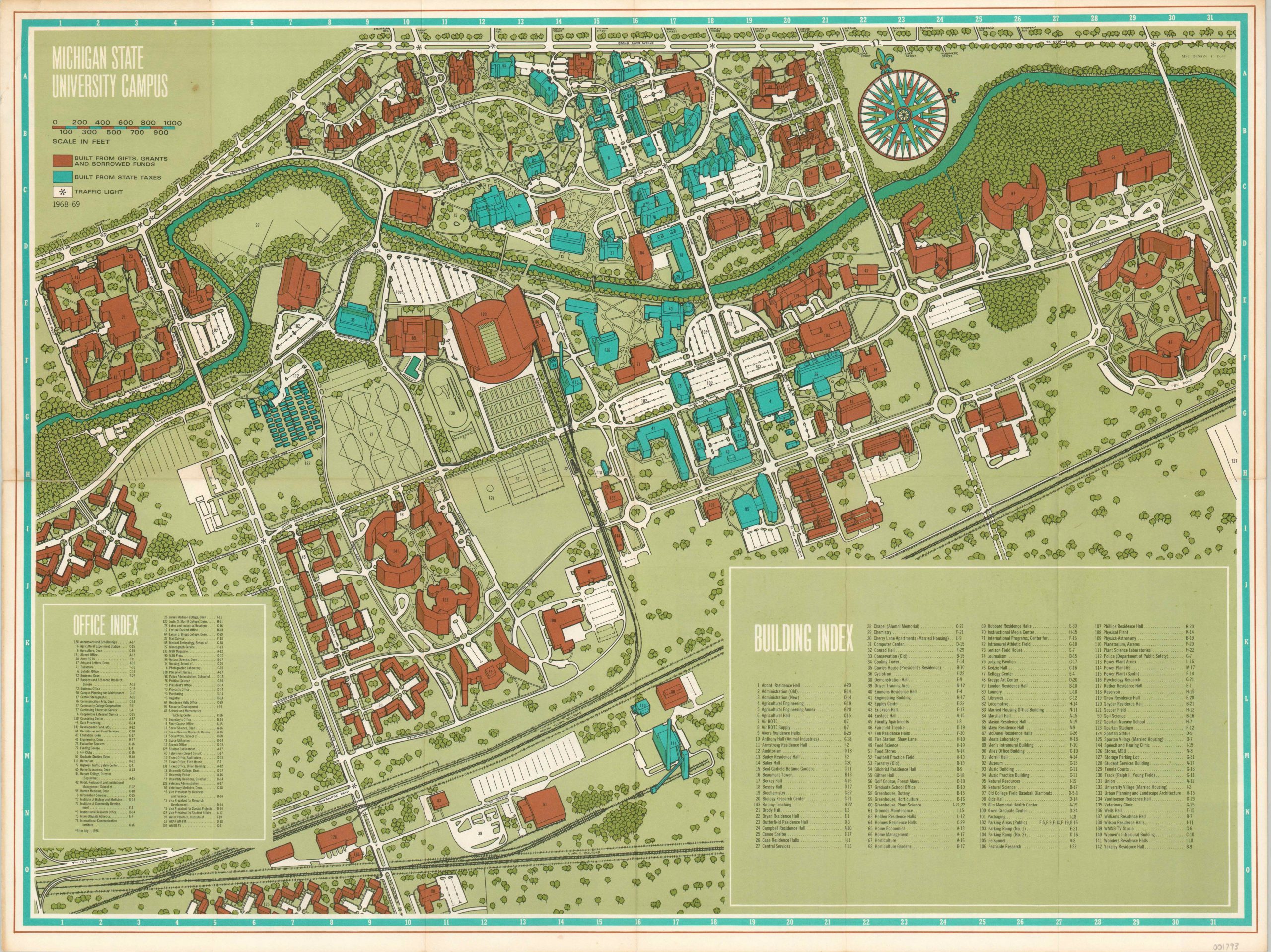
Funding is a perennial challenge for state universities, and this map is a public expression of Michigan State’s pride in their diversified sourcing. Blue buildings are constructed from state taxes, and the vastly more numerous brown buildings were built ‘from gifts, grants and borrowed funds.’
Nearly 300 separate locations are identified within the two indices, each corresponding to a coordinate on the grid system within the map’s border. The Big House dominates the center of the image, and a decorative compass rose can be found in the upper right. The verso features photographs, activities for campus visitors, and a map of the agricultural campus and its farms.
Published for the 1968/1969 school year by Michigan State University.
Map Details
Publication Date: 1968
Author: Michigan State University
Sheet Width (in): 23.50
Sheet Height (in): 17.90
Condition: A-
Condition Description: Originally issued folded into 12 panels, with minor wear and creasing along fold lines. A small spot of separation along the horizontal centerfold, repaired on verso. Some discoloration is visible on the verso, but it does not affect the image.
Out of stock