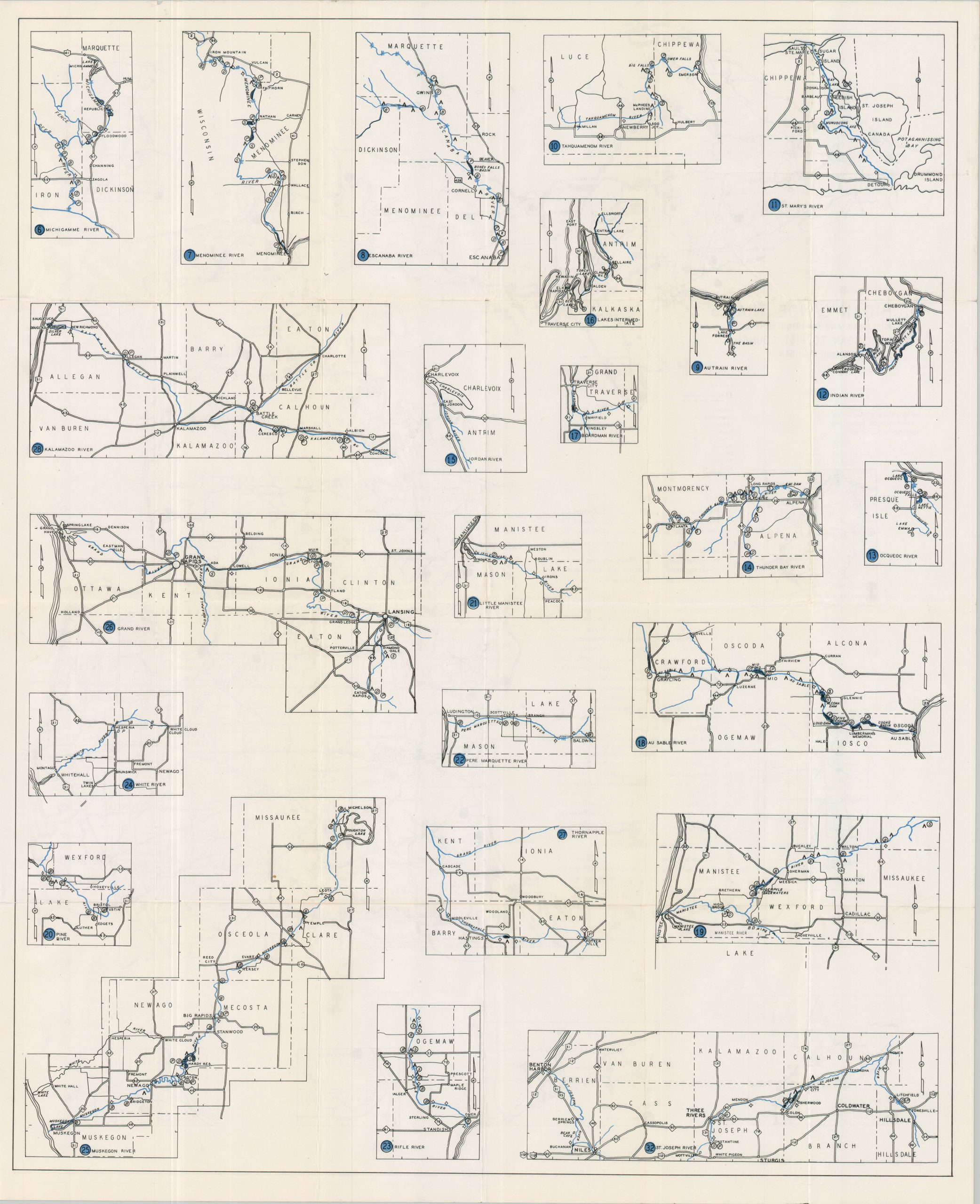
Michigan Canoe Trails
$110.00
Uncommon postwar map of Michigan’s many navigable waterways.
1 in stock

Description
This straightforward map of Michigan highlights a mode of transportation often overlooked in 20th-century cartography – canoe trails. Three dozen different navigable rivers are numbered and colored in bright blue, offering a wide variety for the outdoor enthusiast. Accompanying small-scale insets provide additional details about the recommended routes, ranging from the waters around Sault St. Marie to the shores of Lake Michigan and Lake Erie.
The map was published in Lansing in 1946 by the Michigan Tourist Council. The years following World War II saw a surge in outdoor recreation and motor tourism, as the American economy far outpaced that of devastated Europe. National parks, lakes/reservoirs, and resort areas saw record visitation as returning G.I.’s and their families embraced leisure travel, camping, and road trips as hallmarks of the postwar good life.
Map Details
Publication Date: 1948
Author: Michigan Tourist Council
Sheet Width (in): 28
Sheet Height (in): 34.25
Condition: B
Condition Description: Double-sided sheet, moderately worn, toned, and creased along old folds. Scattered surface soiling affects several areas (see lower center), but overall in good condition.
$110.00
1 in stock