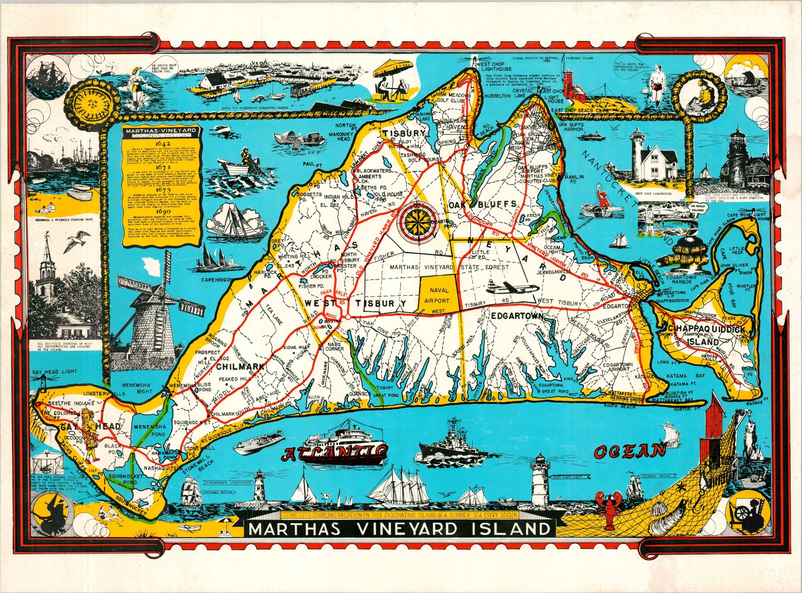
Martha’s Vineyard Island
Come Get a Sparkling Vacation on this Fascinating Island in a Summer Sea Every Season – Text, bottom
Out of stock
Description
This is a vibrant updated version of Larry Parker’s attractive (though originally black & white) pictorial map of Martha’s Vineyard, first published around 1940. This later example was issued probably during the 1970s, based on the jumbo jet pictured.
Numerous vignettes highlight the recreational opportunities, maritime culture, and rich history of the island that sits in the Atlantic just south of Cape Cod. Decorative elements add to the East Coast theme, including opposing pictures of a witch and a spinster in the lower corners!
Map Details
Publication Date: c. 1970?
Author: Larry Parker
Sheet Width (in): 23
Sheet Height (in): 16.75
Condition: B
Condition Description: Color printed map on a single-sided sheet of glossy paper. Moderate marginal wear and light wrinkling, consistent with age. A bit of scattered surface soiling and foxing (see scan), most evident along the lower edge. About good condition overall.
Out of stock