[Maps of the Ohio Boundary Question – The Toledo War]
Mapping the conclusion to The Toledo War.
Out of stock
Description
The Toledo War was a (nearly) bloodless boundary dispute that took place between the state of Ohio and the Michigan Territory, culminating in the summer of 1835 with a violent bar brawl and the calling out of local militias. The conflict originated decades earlier. Ohio’s 1802 admission to the Union was predicated on state borders that varied slightly from those outlined in the 1787 Northwest Ordnance, legislation that dictated the organization of the Northwest Territory (of which Ohio and Michigan were both a part). The boundaries of the Michigan Territory (established in 1805) followed the text of the Northwest Ordinance and the resulting discrepancy in Ohio and Michigan’s respective surveys was a 468 square mile area of land known as the Toledo Strip.
The issue was more than state pride – serious economic consequences were at stake for the local communities involved. The contested territory was a rich agricultural region and included property on which a proposed canal would eventually connect Lake Erie to the Ohio River. Michigan’s application for statehood in 1833 was denied by Congress as a result of the border uncertainty, escalating the issue. A surveying party led by U.S. Army Captain Andrew Talcott was ordered into the contentious situation in the spring of 1835 to help with a resolution. Among the group were Lieutenants Washington Hood, William Smith, and Robert E. Lee (of Civil War fame).
Their efforts can be seen in this group of four maps, published in a report to Congress that would eventually form the basis of the compromise that ended the ‘war.’ Ultimately, Michigan would cede claims to the Toledo Strip in exchange for the entirety of the Upper Peninsula. At the time, the UP was considered a desolate and hostile region but its subsequent mineral, timber, and other natural resources would more than make up for the loss.
Map Exhibiting the Position of the several lines connected with the settlement of the Ohio Boundary Question – 51.75″ x 24.5″.Three separate sheets affixed along vertical seams, with the middle sheet moderately toned. Minor to moderate creasing, toning and wear along former fold lines and a diagonal closed tear in the upper left corner. Several areas affected by spotting and light offsetting. This large map shows the entirety of the Toledo Strip between Lake Erie and the Indiana border, just south of Lake Michigan. The boundaries claimed by Ohio and Michigan are noted, along with the international line between the U.S. and Canada. The various points of observation taken by the surveying party are listed in the upper left, helping to provide a conclusive answer to the ‘Ohio Boundary Question.’ Compiled on a scale of five miles to one inch by Washington Hood and engraved by W.J. Stone.
Ohio Boundary No. 1 South bend of Lake Michigan Map, exhibiting the position occupied in the determination of the Latitude on the extreme South bend of Lake Michigan. – 30.75″ x 14″. Moderate discoloration in the upper left where previously bound and a nickel sized spot below the title block. Light offsetting, some discoloration and creasing along former fold lines. This interesting map shows the origin of the Toledo War, at the southern tip of Lake Michigan where the diverging language between the Northwest Ordinance and the Ohio Constitution is visualized. Various points of reference, including a large poplar tree used as a trailblazing marker, are described in the upper right. Created at a scale of 1,000 ft. to 1 inch by Washington Hood.
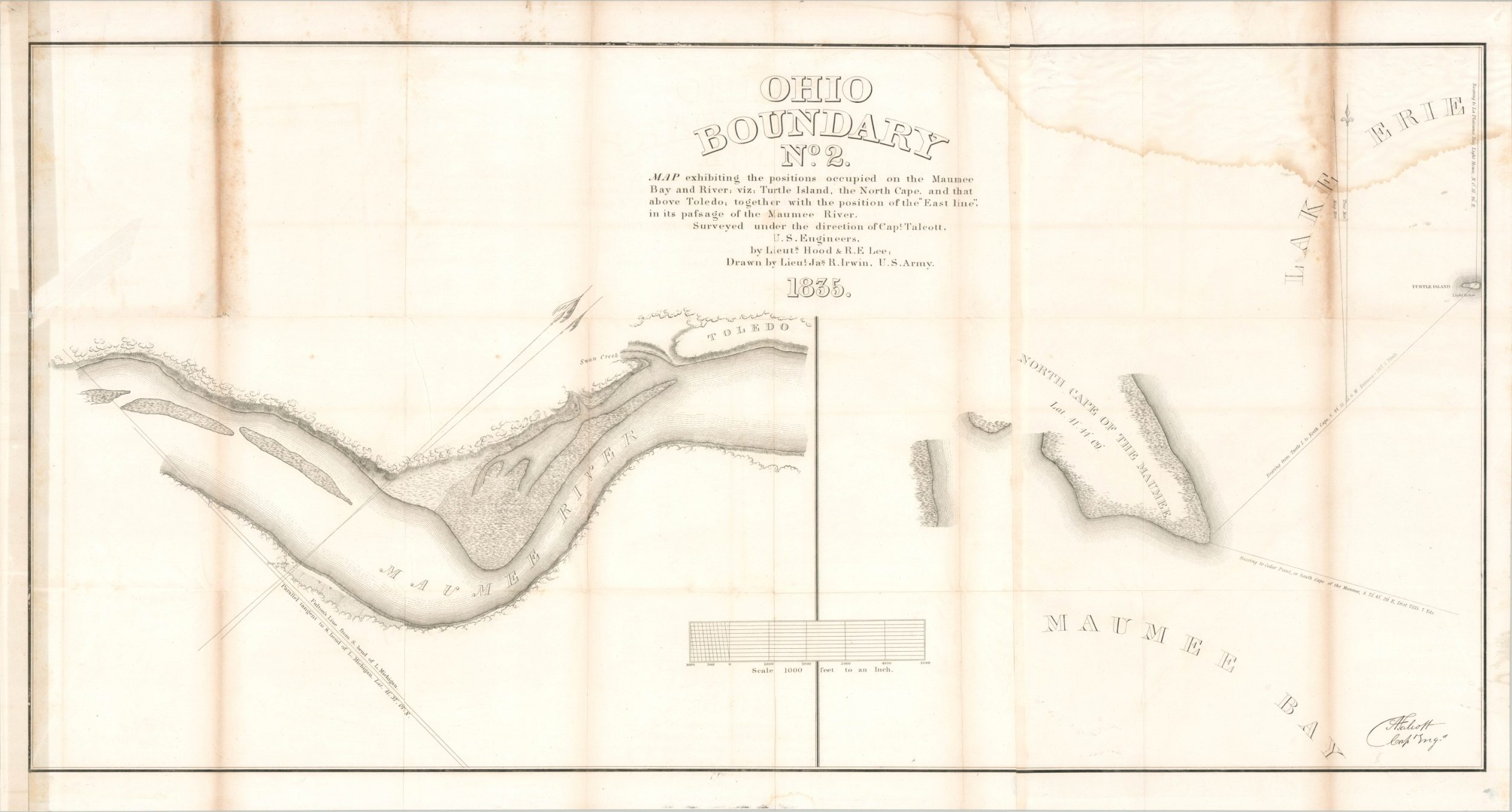
Ohio Boundary No. 2 Map exhibiting the positions occupied on the Maumee Bay and River, viz: Turtle Island, the North Cape, and that above Toledo; together with the position of the “East line”, in its passage of the Maumee River. – 37.75″ x 20.25″. Diagonal 3″ closed tear on the left edge of the sheet and a large damp stain in the upper right corner. Moderate discoloration and wear along former fold lines and scattered spotting visible in several areas of the margins. The second map in the series that shows observation stations and measurement bearings along the Maumee River. Drawn by Lieutenant James R. Irwin at a scale of 1000 feet to an inch using surveys performed by Washington Hood and Robert E. Lee.
Ohio Boundary No. 111 South Bend of Lake Erie: Map exhibiting the position occupied in the determination of the most southwardly point of the Boundary line between the United States & Canada. – 47″ x 20.25″. Two sheets joined along a vertical seam that has become discolored. Large damp stain in the lower left and minor offsetting throughout. This map shows the various points of measurement and observations taken along the southern shoreline of Lake Erie, between Huron and Schoolhouse Point (Vermillion). An inset in the upper left shows Point Pele, the southernmost part of mainland Canada. Drawn at a scale of 1,000 feet to 1 inch by Washington Hood using surveys performed by him and Robert E. Lee.
Sources; Friis 109-112; Karpinski 685; Michigan Tech University; Robert E. Lee and the Lake Erie Survey
Map Details
Publication Date: c. 1835
Author: Washington Hood
Sheet Width (in): See Description
Sheet Height (in): See Description
Condition: B
Condition Description: Group of four separate maps originally issued in a Congressional report published in late 1835 or early 1836. Each shows moderate wear, creasing along originally issued fold lines, and offsetting. Additional details are provided in the product description.
Out of stock


