Maps and Information of Michigan State College and Vicinity
$80.00
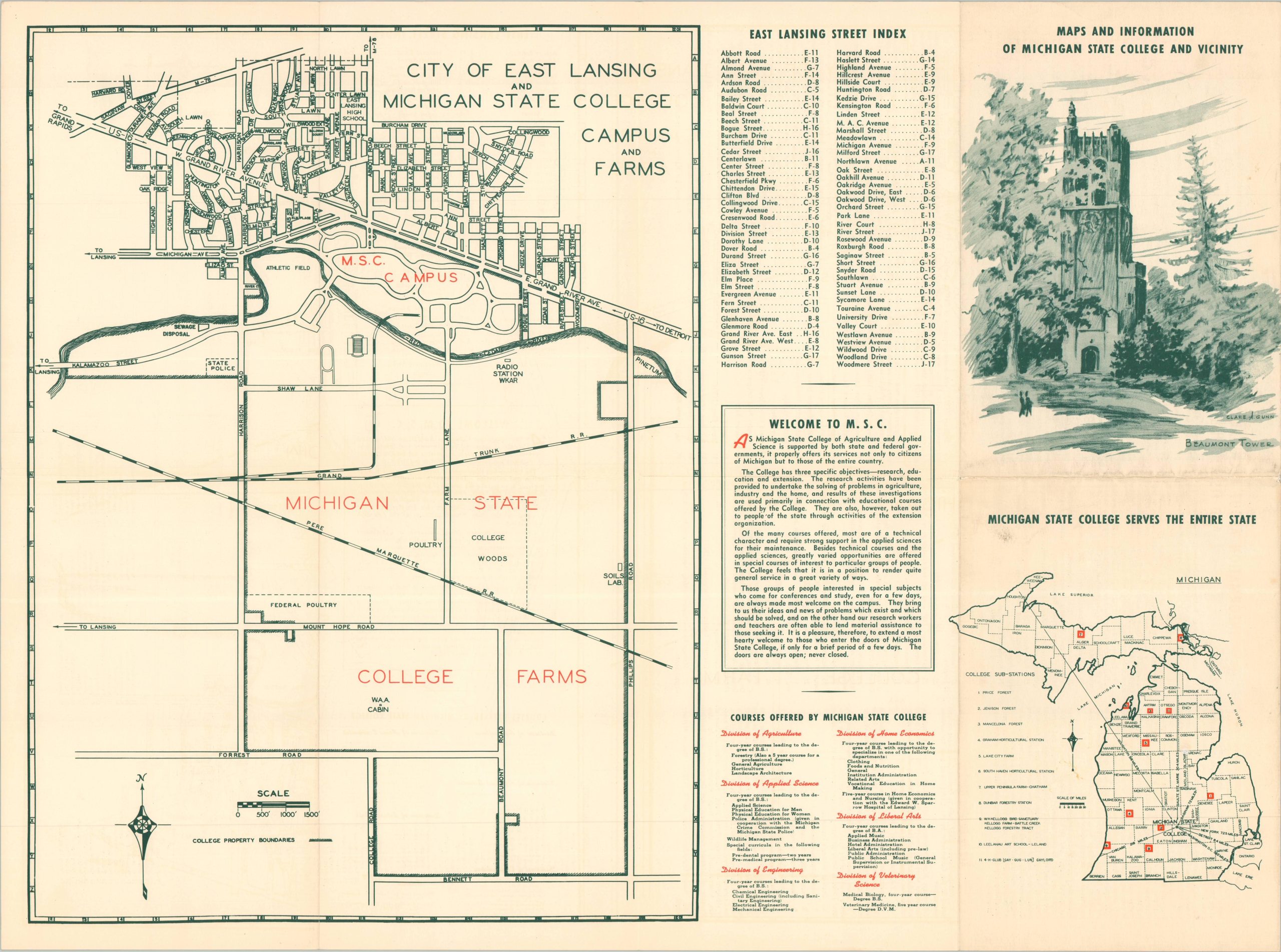
WWII-era campus plan for Michigan State University.
1 in stock

Description
This interesting brochure offers a wealth of information about Michigan State College during the early 1940s (the school was renamed on its centennial in 1955). A simple campus guide identifies 135 different buildings, plus sporting facilities and transportation routes. The verso presents a city plan of East Lansing, noting the large MSC farming lands in the surrounding area. A list of courses and a small map of Michigan pinpointing 11 college ‘sub-stations’ highlights how “Michigan State College Serves the Entire State.”
Though the original date and author are credited to the National Youth Administration in 1941, the presence of the proposed Natural Science Building (completed in 1949) and the handwritten addition of ‘Shaw Hall’ (completed in 1950) indicates a possible later date of issue.
Source: Michigan State University
Map Details
Publication Date: c. 1941
Author: National Youth Administration
Sheet Width (in): 17.9
Sheet Height (in): 24
Condition: B+
Condition Description: Double-sided brochure with light wear and creasing along folds, plus a bit of edge wear. Old penciled annotations (Shaw Hall) and some faint toning, consistent with age. Good condition overall.
$80.00
1 in stock