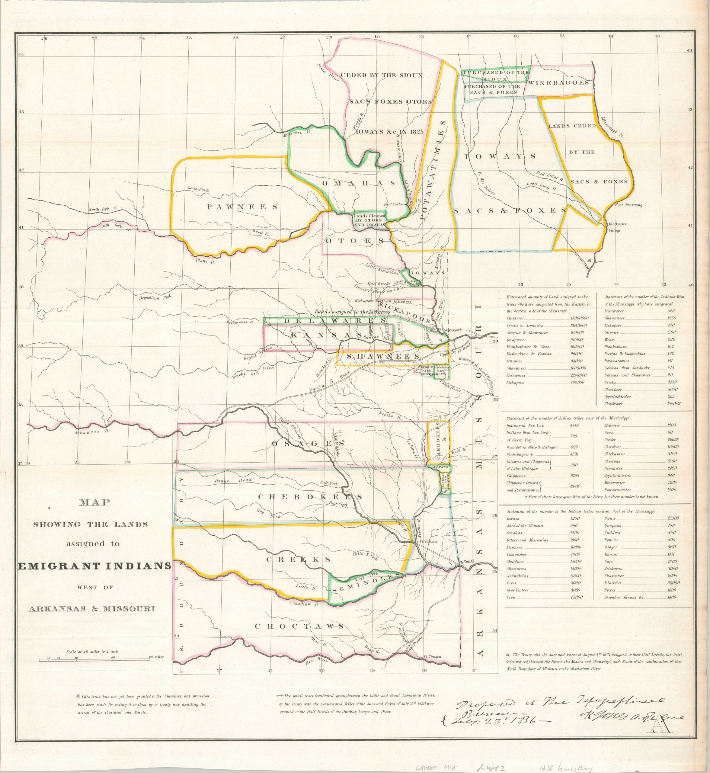
Map Showing the Lands Assigned to Emigrant Indians West of Arkansas & Missouri
$500.00
Mapping the results of the Dodge-Leavenworth Expedition.
1 in stock
Description
This interesting map was published in 1836 to accompany the Congressional report on the results of the Dodge-Leavenworth Expedition (1834). The image covers much of the Great Plains, including portions of the future states of Nebraska, Oklahoma, Iowa, and Kansas. Parcels of land allocated to various ’emigrant’ (i.e. recently relocated) Native American tribes are brightly outlined in original hand color. Treaty details are provided, where applicable. Several forts are labeled throughout the image, including Leavenworth, Towson, Gibson, Smith, Armstrong, and Calhoun. Tables of statistics in the center-right reflect the total acreage, respective populations, and more.
The Dodge-Leavenworth Expedition, also known as the First Dragoon Expedition, was one of the earliest U.S. Military operations to make official contact with the southern tribes of the Great Plains. Diplomatic efforts were necessary to pacify the local indigenous people, whose lands west of Arkansas and Missouri were being forcibly settled by eastern tribes forcibly relocated through The Indian Removal Act of 1830. Notable members of the party included Stephen Kearney, George Caitlin, Jefferson Davis, and Nathan Boone (youngest son of Daniel Boone). Oddly, the expedition’s route is omitted from the map.
Sources: Wagner-Camp #63; Wheat (TMW) #412; Library of Congress;
Map Details
Publication Date: 1836
Author: Washington Hood
Sheet Width (in): 18.5
Sheet Height (in): 21
Condition: A
Condition Description: Soft creasing along originally issued fold lines and some moderate toning visible on the far right side of the sheet. Original outline hand color. Very good condition overall. Blank on verso.
$500.00
1 in stock

