Map Showing the Burlington Cedar Rapids and Minnesota Railway
$295.00
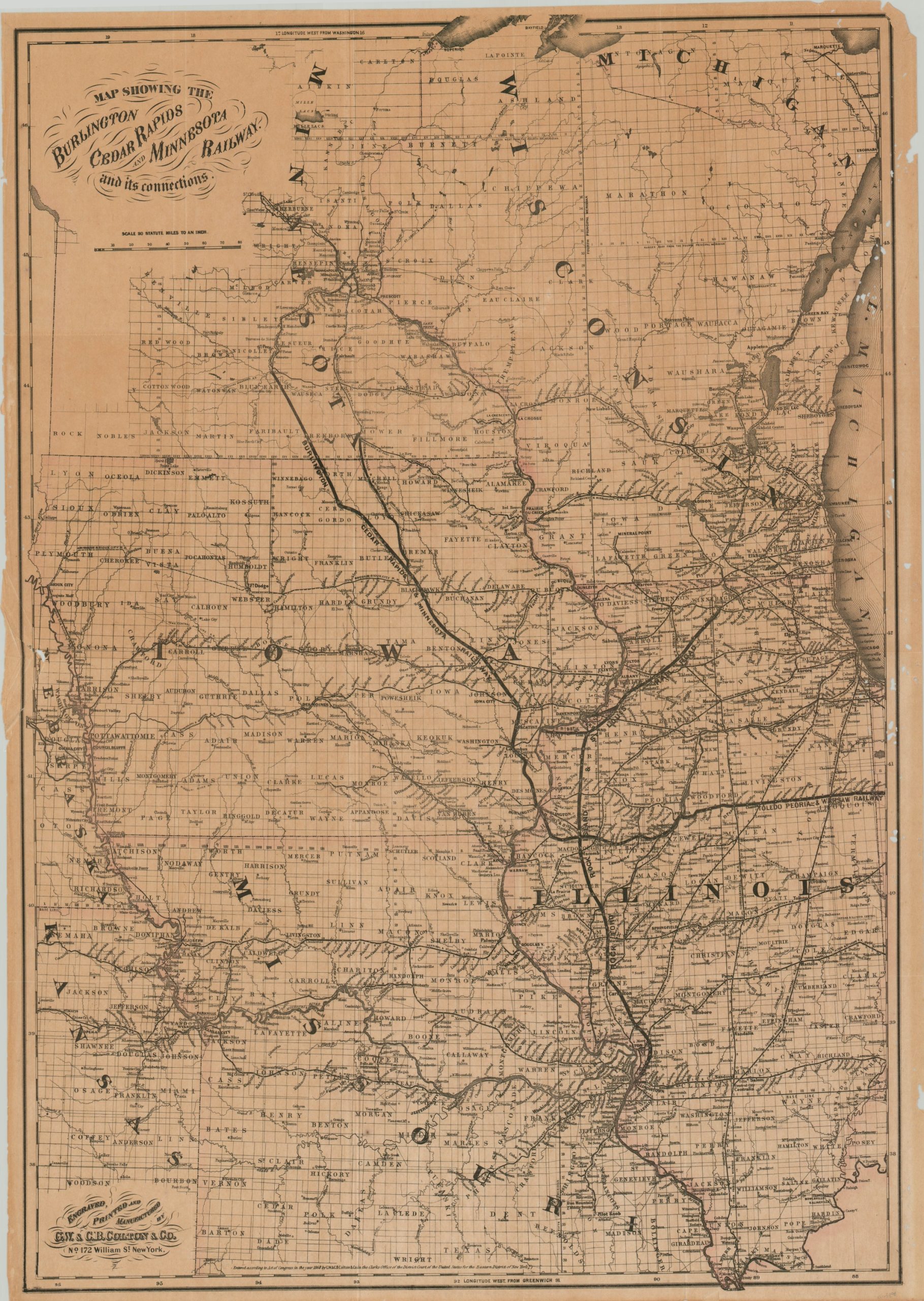
The inception of the short-lived Burlington, Cedar Rapids, & Minnesota Railroad.
1 in stock
Description
This detailed railroad map of the Upper Midwestern states of Illinois, Missouri, Iowa, Minnesota, and Wisconsin was published in New York by G.W. & C.B. Colton in 1868 to highlight the route of the Burlington, Cedar Rapids, and Minnesota Railroad, organized that same year. The company was a consolidation of smaller predecessor railways and its network can be seen running from Burlington, Iowa to Mankato, Minnesota. Connecting lines of the Rockford Rock Island & St. Louis Railroad and Toledo Peoria & Warsaw Railway are also shown in bold, while other competitors’ lines are relegated to smaller markings.
The map also shows township and county outlines, geographic features, and survey points. Less than ten years after the map’s publication, the Burlington, Cedar Rapids, and Minnesota Railroad would file for bankruptcy and be re-organized as the Burlington, Cedar Rapids and Northern Railway.
Source. Library of Congress.
Map Details
Publication Date: 1868
Author: G.W. & C.B. Colton
Sheet Width (in): 24
Sheet Height (in): 34
Condition: B
Condition Description: Printed on thin, brittle paper that's moderately toned. Numerous small spots of worming visible on the right side of the sheet and a small closed tear on the left side, near the 'N' in Nebraska.
$295.00
1 in stock